Once again, I find that there are way too many of these types of items to include them in any of my existing articles. There just isn’t room. So, I have created this article to keep you informed on current extreme weather and or disaster type warnings. That way you won’t be as likely to miss them mixed in with other news. The dam, river and flooding items will still be found here:It’s a DAM Shame.
Update 3/29/21
I received the following link in an email from someone who reads my posts. It is a great place to check the weather. Very easy to read and very informative. It includes weather quality and has no ads.
BREAKING NEWS FROM TEXAS NEWS STUDIO BREAKING FLASH ALERTS AND SPECIAL REPORTS LIVE BREAKING NEWS AND INTERNATIONAL NEWS COVERAGE BREAKING MILITARY UPDATES
BREAKING NEWS FROM TEXAS NEWS STUDIO BREAKING FLASH ALERTS AND SPECIAL REPORTS LIVE BREAKING NEWS AND INTERNATIONAL NEWS COVERAGE BREAKING MILITARY UPDATES
BREAKING NEWS FROM TEXAS NEWS STUDIO BREAKING FLASH ALERTS AND SPECIAL REPORTS LIVE BREAKING NEWS AND INTERNATIONAL NEWS COVERAGE BREAKING MILITARY UPDATES
SO MANY VOICES CONCUR, GET OUT OF THE OROVILLE/GOLDEN GATE AREA!!! NOW WHILE YOU CAN. EVACUATION TAKES A MINIMUM OF 72 HOURS UNDER THE BEST CONDITIONS. DON’T WAIT FOR THE PANIC. GET OUT WHILE IT IS SAFE TO BE ON THE ROAD. THE DAM IS GOING TO FAIL. DON’T RISK YOUR LIFE.
All the areas showing severe weather for the next few days already have flooding and/or near flooding conditions. Please stay on top of what is happening with the flood gauges in your area. Be ALERT, Be READY, Be SAFE! Visit the NOAA interactive Flooding Map Presently showing 565 guages at flooding or near flooding level. You can zoom into your area on their map and see what guages are showing flooding.
With a moist unstable air mass hovering over the plains and Ohio river valley, severe weather is a large potential. Hail and damaging winds are large threats, with tornadoes as a slightly lower threat, but nonetheless there.
Proof of Spalling in the Walls and Gate House, It’s cracking apart, they can’t use the Main Spillway, so that means it’s going to go over the Emergency Spillway, you can’t risk that! All that dirt and trees below will go into the river and clog it! Get out people! Go somewhere safe! This is not the only problem, there are too many! Leaks, broken parts, Spalling, gatehouse sinking, and more! Watch the video linked below:
These clips have information regarding the Dam and what’s happening right now. Paul Preston visited our chat and these are his words, you have to watch this. Leaving the valley and going to higher ground is a good idea after hearing from Paul, I have no doubt. Watch the video linked below:
OKLAHOMA EVACUATION INFORMATION IN THIS NEXT VIDEO!! PLEASE LISTEN CAREFULLY! Arkansas levee updates, Montana road closings. Illinois Tornados could be SEVERE, Flooding Likely. LISTEN CAREFULLY! To bypass her rant, on this video, start at minute 5:32!
With a lot of daytime heating and an upper-level trough that continues to impact much of the west. The severe threat still continues across the Midwest and the deep South such as Texas as this weather pattern remains in place. The next couple of days the storm prediction center has issued a enhanced risk for severe weather due to plenty of moisture, little bit of wind shear, instability, and Lift. Therefore a threat or isolated tornadoes does remain possible across the enhanced risk area noted from northern panhandle of Texas into southern portion of Kansas. There are a couple of models that do not agree that they derecho will be developing overnight into the Texas Oklahoma area. While the Nam 3 km model is confident that derecho will develop. However based on MLCAPE values 3000 to 4000 J/kg this should be enough energy to withstand a strong derecho. Much more details in the video. 🌪🚨
Live Tulsa, Oklahoma Tornado Warning – The Weather Channel Live – May 22, 2019 WSV3 FREE—- https://wsv3.software.informer.com/3.7/ Download Now & Stay Safe!—-
BREAKING NEWS FROM TEXAS NEWS STUDIO BREAKING FLASH ALERTS AND SPECIAL REPORTS LIVE BREAKING NEWS AND INTERNATIONAL NEWS COVERAGE BREAKING MILITARY UPDATES
…SUMMARY… Severe thunderstorms are forecast this afternoon into the evening from central and northeast Oklahoma into Missouri and central Illinois. Tornadoes, large/damaging hail and severe gusts all are possible. …OK to IL… Given latest model guidance and observational trends, have opted to upgrade to MDT risk along a narrow corridor from northeast OK into central MO. Consensus continues to grow in model guidance that several discrete supercells will develop along this corridor this afternoon and evening, as low-level moisture streams northward and shear profiles rapidly strengthen. The primary negative indicator of a more significant severe weather event involves the large scale pattern, and the large midlevel height rises that are occurring throughout the Plains. However, the latest water vapor loop and model guidance suggest very subtle shortwave troughs embedded in the upper flow, with one currently over southwest OK. This feature would arrive into the risk area around peak heating, potentially helping initiation. Forecast soundings suggest an environment favorable for strong tornadoes and very large hail and if discrete supercells can form. It is unclear how far southwest the development will occur into central OK. Several 12z CAM solutions suggest 1-2 storms near OKC that could be severe if they develop, with a conditional risk of significant tornadoes and hail. However, confidence in persistent thunderstorms that far southwest is lower than farther northeast. Storms that form over central MO will spread eastward into central/northern IL during the evening, with the continued risk of supercells capable of large hail, damaging winds, and a few tornadoes. It is unclear how rich the low-level moisture will be ahead of the storms, but shear profiles will be quite favorable in this area.
…SUMMARY… Thunderstorms capable of damaging wind gusts and a few tornadoes are possible from the middle Mississippi Valley south into the Arklatex today. Additional daytime storms, capable of producing hail, gusty winds, and a couple of tornadoes, will also be possible into parts of the central Plains. …Ozarks/Mid Mississippi Valley/Arklatex/East Texas… A negatively tilted upper-level trough will move northeastward from the southern Plains into the central Plains today. At the surface, a low will move across Kansas as a warm front advances northeastward into the mid Mississippi Valley. A surface trough is forecast from the surface low extending south-south eastward into eastern Oklahoma, along which thunderstorms will be ongoing this morning. This line of storms will move eastward into Missouri and Arkansas by early afternoon. As surface temperatures warm ahead of the line, a corridor of instability will strengthen with the NAM increasing MLCAPE values into the 1000 to 1500 J/kg range. This combined with a north-to-south band of large-scale ascent ahead of the upper-level trough and strong low-level shear will be favorable for squall line development. The squall line will move eastward across Missouri and Arkansas reaching the Mississippi River during the evening. A few QLCS tornadoes and widespread damaging wind gusts will be likely with the stronger parts of the squall line. The southern portion of the squall line is forecast to be located from the Arklatex into east Texas this afternoon. Large-scale ascent is forecast to be considerably less this far south with the much weaker low-level flow. For this reason, the wind-damage threat should be more isolated with southward extent. …Central Plains… An upper-level low will move northward across the central Plains today. At the surface, a cold front will advance southeastward across western Kansas. Along and ahead of this front, thunderstorms are forecast to develop this afternoon. Warming surface temperatures should result in destabilization along a corridor of maximized low-level moisture extending northwestward across southeast and central Kansas. Enhanced lift associated with the exit region of the mid-level jet, strong deep-layer shear and strengthening low-level shear will be sufficient for rotating storms along the instability axis. Isolated large hail, strong gusty winds and a tornado or two will be possible mainly in the late afternoon. IF YOUR A NEW VIEWER and you love my weather content, Please Subscribe to my channel to get daily forecasts on a daily basis and I plan on covering hurricane season with my first forecast expected to get released on May 22nd, 2019. Also make sure to like the video, comment and ring the bell icon, Thanks for Support, it keeps me moving. The link listed below https://www.youtube.com/c/davidschlot…
We are expecting a possible Historical Significant Severe weather once every 2 to 6 years of Large Tornadoes for Western Oklahoma and Northeastern Panhandle of Texas. Latest NAM 3km, NAM, and NAM-NEST models are all agreeing on the significant threat for Discrete cyclonic supercells that look to pose a serious threat for Large Tornadoes across the Moderate to possible High-risk areas. Very strong Low-level winds at 5,000 feet will support tilted updrafts that lead to long track supercell activity and in this case, Long tracked Tornadoes. Very High CAPE values based on the RAP and HRRR have been trending higher with each run are around 4750 to 5500 J/kg enough to support Baseball size hail given the right thunderstorm structure. However, some soundings are starting to indicate there’s weak capping under these high CAPE values. But other models still suggest with strong lifting ascent over the for supercell development that the capping inversion will break by 15z to 16z. IF YOUR A NEW VIEWER and you love my weather content, Please Subscribe to my channel to get daily forecasts on a daily basis and I plan on covering hurricane season with my first forecast expected to get released on May 25th, 2019. Also make sure to like the video, comment and ring the bell icon, Thanks for Support, it keeps me moving. The link listed below https://www.youtube.com/channel/UC5C6…
BrieAnna J Frank, Arizona RepublicPublished 7:50 p.m. MT May 20, 2019 | Updated 7:53 p.m. MT May 20, 2019
Nineteen degrees below normal.
Let’s say it again: Monday’s high temperature in Phoenix was 19 degrees below normal.
On top of that, a storm system that moved across the state brought wind, rain and hail along with temperatures that were perhaps more familiar to folks in the northwest than Arizonans just weeks away from the start of another summer.
The high temperature recorded at Phoenix Sky Harbor Airport was 77 degrees, the National Weather Service said, just five degrees off the lowest-ever high for the day of 72, which was set in 1917.
Much of the storm activity in the Valley was focused in its northern regions. The weather service said a line of showers and thunderstorms moving across the north Valley and Interstate 17 corridor late Monday morning were bringing strong wind gusts, lightning strikes and small hail.
Rainfall totals neared one-quarter of an inch near State Route 51 and Bell Road in Paradise Valley, making it the heaviest-hit area in the Valley, meteorologist Matthew Hirsch said.
Earlier in the day, a significant weather advisory was issued for parts of northern Maricopa County including Anthem, Carefree and Lake Pleasant. The weather service said residents in those areas could expect to see half-inch hail, wind gusts of up to 50 miles per hour and brief heavy rain.
Significant weather was also reported in northern Arizona, with Munds Park receiving three inches of snow and areas near the Apache-Sitgreaves National Forest getting two inches, meteorologist Tim Steffen said.
The area around the Interstate 17 corridor between Munds Park and Stoneman Lake was also expected to see hail and rain through the mid-afternoon, with officials warning residents about slick roads and low visibility.
A severe thunderstorm warning was issued late Monday morning for a storm northwest of Payson that had potential to bring quarter-size hail to areas including Pine and Strawberry, and a wind advisory was still in effect Monday evening.
Strong winds were expected to continue Tuesday in northern Arizona, with the weather service anticipating gusts between 40 and 55 miles per hour.
More winter weather, with possible snow, was expected across Northern Arizona Wednesday and Thursday.
Storms with small hail and rain to affect I-17 from around Munds park to Stoneman Lake through 3 PM. Expect slick roads, and low visbilities.
These storms are moving to the east about 25 mph.
We are expecting a possible Historical Significant Severe weather once every 2 to 6 years of Large Tornadoes for Western Oklahoma and Northeastern Panhandle of Texas. Latest NAM 3km, NAM, and NAM-NEST models are all agreeing on the significant threat for Discrete cyclonic supercells that look to pose a serious threat for Large Tornadoes across the Moderate to possible High-risk areas. Very strong Low-level winds at 5,000 feet will support tilted updrafts that lead to long track supercell activity and in this case, Long tracked Tornadoes. Very High CAPE values based on the RAP and HRRR have been trending higher with each run are around 4750 to 5500 J/kg enough to support Baseball size hail given the right thunderstorm structure. However, some soundings are starting to indicate there’s weak capping under these high CAPE values. But other models still suggest with strong lifting ascent over the for supercell development that the capping inversion will break by 15z to 16z.
MONDAY WEATHER FORECAST FOR USA THE WEATHER CHANNEL LIVE – WARNING 2 LARGE SUPER-CELL STORMS TARGET SOUTH / CENTRAL USA-MAY 20, 2019 https://youtu.be/PRewyCchY_o There is an even bigger Super-storm coming than what we just had. This storm has 2 Super-Cells that are very powerful and very big. Large, multiple tornadoes expected all across Texas, Kansas and Oklahoma with more outbreaks further north. There will be damaging winds that will blow projectiles around so make sure loose objects are clear from your yard. Make sure you have an back up strategy in-case of a Tornado or Hail storm. This Weather Channel live stream will be all night until everyone is safe and will be here for you as information is needed. Make sure to Subscribe and hit the notification bell for updates! Thank You for watching The Weather Channel and stay safe out there. IF YOUR A NEW VIEWER and you love our weather forecast coverage content, Subscribe to my channel to get daily updates on severe weather as your daily weather live-stream. FOLLOW US ON FACEBOOK https://www.facebook.com/weather.chan… FOLLOW US ON TWITTER https://twitter.com/@Weather80354059 SUBSCRIBE FOR UPDATES https://www.youtube.com/channel/UC1MH… Here is a link to a trusted weather source “TWC Coverage” https://www.youtube.com/channel/UCMSM… We will be covering this year’s hurricane season with TWC Live Stream Broadcasting on Location. Make sure to like the video, please comment on what type of weather you are going through and what help you might need. Ring the bell icon so you don’t miss the special weather coverage. Thank You so much for support here @weather channel, it keeps us moving, GOD bless. 🔔👍#Help Others This is a FREE live stream for those that like to discuss weather, weather patterns and a solution to avoid the danger. Content is a Live broadcast from The Weather Channel, courtesy of Weathergroup.com and affiliates. All credit, rights and monetary value belongs to Weathergroup and affiliates. This live stream is only for weather discussion and future pattern probabilities for educational studies. If you are in any of these severe weather patterns, please take caution to your local news and stay safe. HERE ARE SOME LINKS TO HELP YOU WITH YOUR STUDIES, SOLUTIONS AND AWARENESS OF WEATHER IN YOUR AREA. Thank you for watching @weather channel, SUBSCRIBE if you haven’t already, LIKE if it helped you today & SHARE on social media to help others! Stay safe. ————————————- HELPFUL WEATHER TRACKING SITES —— http://www.weathergroup.com/https://weather.com/https://www.noaa.gov/https://www.windy.com/https://www.ventusky.com/https://www.space.com/https://worldwind.arc.nasa.gov/worldw…https://worldview.earthdata.nasa.gov/http://ww2010.atmos.uiuc.edu/(Gh)/gui…https://www.tropicaltidbits.com/https://www.wxcharts.com/https://zoom.earth/
(CNN)Texans are scrambling for cover Saturday as reports of tornadoes roll in and much of the central US readies for heavy rain, strong winds and large hail.More than 70 million Americans are under the threat of severe weather from Texas to southern Minnesota, CNN meteorologist Haley Brink said. That total on Sunday jumps to 80…
(CNN)Texans are scrambling for cover Saturday as reports of tornadoes roll in and much of the central US readies for heavy rain, strong winds and large hail.
More than 70 million Americans are under the threat of severe weather from Texas to southern Minnesota, CNN meteorologist Haley Brink said. That total on Sunday jumps to 80 million under threat as storms are predicted to move into the Great Lakes area.
A tornado destroyed two homes Saturday morning in Comanche County, Oklahoma, southwest of Oklahoma City, said Ashleigh Hensch, an emergency management spokeswoman there. A tornado in Abilene, in central Texas, caused “widespread damage,” CNN affiliated KTXS reported.
Areas of Texas and Oklahoma remain under a tornado watch.
There also are “better chances” for damaging winds and golf ball-sized hail Saturday afternoon and evening across the zone, the National Weather Service said. In eastern Iowa, dense fog is possible as strong thunderstorms take aim.
This is peak tornado season
The Plains have been pounded by strong winds, with at least 34 tornadoes reported since Friday morning across the central US, including Kansas, Nebraska and Texas.
Isolated tornado risks were possible across central and eastern Nebraska and in central and northern Kansas, the federal Storm Prediction Center warned. Wind gusts of up to 70 mph were likely, it said.
This is peak tornado season, CNN meteorologist Derek Van Dam said, “with an average of 268 tornadoes countrywide during the month of May.”
Flood potential spikes again
Several days of warm, sunny weather had seemed to portend a “welcome to summer but that streak will end today,” the weather service warned Kansas City on Friday.
“These storms will also produce periods of heavy rain that will once again saturate soils & set the stage for increased flood potential this coming Tue when the next round of heavy rain moves in,” the weather service predicted for Missouri.
That’s right, there’s another round.
Flood threats across the central Plains will remain high through next week, Van Dam said, with rainfall totals ranging from 1 to 5 inches.
“The heavy rain will impact areas that have received significant amounts of rain within the past several weeks,” Van Dam said. “The ground remains very saturated and may elevate the flood threat.”
Mississippi River flood records broken
The Mississippi River this year has broken records with some of the longest-lasting floods in years. The river in Mississippi has been above flood stage for 133 days straight at Natchez, 90 days at Vicksburg and 89 days at Greenville, the weather service said.
In early May, the Mississippi broke its July 9, 1993 record, after heavy rainfall triggered flooding from Minnesota to the Gulf of Mexico, CNN affiliate WQAD reported. The flood gauge in 1993 at Rock Island, Illinois, topped out at 22.63 feet. Its level this month reached 22.64 feet, WQAD said.
CNN’s Shawn Nottingham contributed to this report.
Powerful thunderstorms erupted across the central U.S. on Friday afternoon from western Texas through Nebraska, unleashing dozens of tornadoes.
There were nearly 40 preliminary tornado reports in Nebraska and Kansas on Friday and Friday night, according to the National Weather Service’s Storm Prediction Center (SPC). Many of these twisters were spawned by two separate violent storms, known as supercells, that tracked for hundreds of miles.
The multi-day severe weather outbreak first got underway Thursday across the parts of Iowa, Illinois and Indiana. Wind gusts of 86 mph were recorded in Washington, Iowa, while hail the size of baseballs fell in Westville, Illinois. A tornado was reported in Sheridan, Illinois, about 50 miles southwest of downtown Chicago. No injuries were reported.
@grantkevin13 The tornado in McCook, Nebraska, tore through fields near Highway 83. (Twitter/@grantkevin13)
More powerful thunderstorms erupted across the central U.S. on Friday afternoon from western Texas through Nebraska. The strongest of the storms focused on central Nebraska, spinning up several large tornadoes.
Around 5:45 p.m. CDT, a tornado was reported near McCook, Nebraska. SPC reported tree and power line damage along with minor damage to a farm. As the storm tracked northeast, is spun up two tornadoes near Farnam, Nebraska around 7:26 p.m. CDT.
Later in the evening, a tornado was reported near Dodge City, Kansas, tracking just southeast of the city.
“Tornado Alley is certainly waking up with significant severe weather,” Timmer said while breaking down the multi-day outbreak. Earlier this past week, he said this is the worst setup for severe weather he has seen in years.
Meanwhile, Blake Naftel, AccuWeather video journalist, intercepted a tornado near the border of Kansas and Oklahoma on Friday evening.
The following website does not want anyone posting their videos. However, they usually have good information and great pics. So I recommend you check it daily!
A Continued threat of Strong Tornadoes, Large Hail, Damaging winds, with even a threat of Flash flooding looks to be likely across Much of the Southern Plains, Midwest and, stretching into the Northern Plains as a very strong Shortwave Trough moves across the region helping to increase strong forcing ascend drops hights. This will continue to help destabilize the atmosphere in an environment where discrete supercells may produce tornados (Some strong and Long-lived) Large hail and, Damaging winds of 65+ mph. MLCAPE values of 1750 to 4500 J/kg will be enough along with moderate shear to provide long-lived supercell activity across Eastern Northeastern half of Texas, much of Arkansas, and Southeastern Oklahoma.
Examining climate change related factors contributing to a predicted long duration U.S. severe weather outbreak. Read more at: https://robertscribbler.com/2019/05/1…
…SUMMARY… Severe storms with very large hail, tornadoes (a few of which could be strong) and damaging wind are expected, mainly across parts of the Plains from Nebraska
With three shortwave troughs moving through the Great Plains and high CAPE values, severe weather for the Great Plains is imminent until Tuesday of next week! What are the threats??
Severe Storms to Bring Dangerous Conditions to the Southeast this Weekend. Some storms will be forming into tomorrow, and the early week. These storms will be in clusters and potentially Supercells. This is where some isolated tornadoes, very large hail, and flooding concerns will be an issue. Flash flood watches have been put into affect as some scattered storms will be bringing inches of rain. As these storms will push through pretty quickly, and afterwards it should stay pretty calm, this is the last horrah and people should still take caution.
Tornadoes, damaging wind, deadly floods leave trail of destruction across south-central US http://bit.ly/2YiAvMV Intense rain near Houston causes flooding and strands students at schools https://cnn.it/2VndlrM
While the calendar shows it’s more than six weeks into spring, Mother Nature dealt a wintry blow to Minnesota with a winter-like storm that unleashed historic snow amounts in some locations on Wednesday into Thursday. This May snowstorm broke a 117-year-old record in Minnesota.
May snowstorm breaks 117-year-old record in Minnesota. via Twitter/@NWSTwinCities
The same storm system that brought an outbreak of severe weather to the South-Central states through the first portion of this week created enough cold air to produce a zone of heavy accumulating snow on its cold side.
Snow records Duluth, Minnesota
Snow fell along a zone from Sioux Falls, South Dakota, to Duluth, Minnesota. While not accumulating, snowflakes even managed to fall in parts of Minneapolis.
Through Thursday morning, Duluth was blanketed with 10.9 inches of snow, leading to a number of broken snowfall records, according to data from the National Weather Service.
Several snowfall records have already been broken for the Duluth area. The table in the image shows a list of these records. Stay tuned as the Monthly snowfall total and daily snowfall for today (5/9) are likely to change. #mnwx#mnclimate
The 8.3 inches set the all-time record for most snow on a single day in the month of May. The previous record was 5.5 inches, set on May 10, 1902. The burst of May snow also shattered the record for the snowiest month of May ever in Duluth,eclipsing the previous record of 8.1 total inches of snow set in May of 1954. It was also the snowiest May 8 in Duluth history as the more than 8 inches of snow surpassed the previous record for the day of 5 inches set way back in 1924. Record-keeping began in 1884.
As of Thursday morning, the storm continued to drop snow on Duluth.
While high temperatures rose into the 40s F in most places on Wednesday afternoon, temperatures fell into the middle 30s F by the early evening, allowing for a heavy, wet snow to fall.
Despite overall mild conditions across the region earlier on Wednesday and earlier in the week, the snow fell heavily enough to stick to all surfaces, including roadways.
Winter Weather Advisories are in effect beginning at 7 PM this evening until 10 AM tomorrow. Snow accumulation ranging from 1 to 4 inches with locally higher amounts are possible. The snow could cause slippery road conditions and lower visibility. #mnwx#wiwx
Roads across northeastern Minnesota, including in the city of Duluth, were “partially covered” with snow, according to the Minnesota Department of Transportation. Numerous crashes were also reported, mostly from vehicles spinning out in the slushy road conditions.
Sgt. Jesse Grabow@MSPPIO_NW
Troopers out w/several crashes and vehicles that slid off the road requiring Trp/tow assistance. This veh was WB on I-94 east of Albany when it ran off the road.
The snow gave some residents the ability to make snowmen and enjoy its overall beauty. Others had to face snow-covered and slippery travel.
Sgt. Jesse Grabow@MSPPIO_NW
Troopers in central MN responding to several crashes (no life threat inj) Troopers currently out w/crashes I-94 Sauk Centre, Albany, St. Joseph and others scattered through the region. Snow is accumulating – driver safely!
The National Weather Service (NWS) in Duluth, Minnesota, received multiple reports of thunder and lightning with the snow in the Duluth and Cloquet areas as well as their local office.
Snow continued to fall through much of Wednesday night. Drier conditions will return to end the week. With sunshine and highs returning into the 50s F in most areas, any areas of snow will likely melt by this weekend.
NWS Duluth
✔@NWSduluth
Snow, heavy at times, continues to fall in the Twin Ports. Roads are snow covered and slippery especially at higher elevations. Here is a look at road conditions on I-35 near Thompson Hill. #mnwx
Snow is not uncommon across Minnesota during the month of May. “While it isn’t likely to get heavier amounts of snow during the month of May, it certainly isn’t unprecedented,” AccuWeather Senior Meteorologist Matt Rinde said.
“Five years ago on May 2, Rochester, Minnesota, received 14.5 inches of snow,” Rinde said. “That area of heavier snow extended northeastward through western Wisconsin.“
For the city of Duluth, Minnesota, there is about a 1-in-7 chance for snowfall of an inch or more to fall during the month of May, according to Rinde. The last time this occurred prior to Wednesday was in 2010, when 4.5 inches of snow fell on May 7.
Colorado
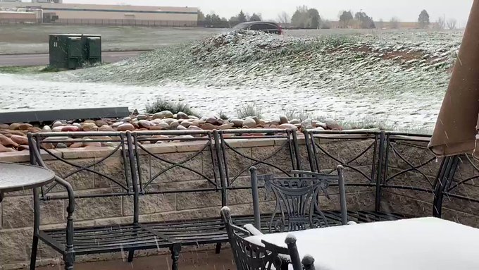
Significant snow fell in parts of Colorado as well. Winter storm warnings and watches were posted in and around the Boulder and Colorado Springs areas on Thursday.
The snow made for a wintry scene at the University of Colorado Boulder campus on Thursday, where graduation was taking place. School officials reportedly soldiered on with commencement festivities despite the snow.
Mekialaya White@Mekialaya
It is ON at @CUBoulder, rain (#snow) or shine!!! #Boulder grads will still celebrate their big day with a commencement ceremony in about an hour. It starts at 8:30. We’ll be here! Photos courtesy: @eddiecastro55#COwx#4wx@CBSDenver
Meanwhile, some spots in Colorado piled up snow accumulations in excess of 10 inches. As of Thursday morning, Westcliffe topped the list with reports of 12 inches of snow, followed by 11 inches in Ward and 10 inches in Weston Pass.
Doyle Rice, USA TODAY Published 12:03 p.m. ET May 8, 2019 | Updated 8:27 p.m. ET May 8, 2019
The first seasonal record distinguishing types of el Nino events over the last 400 years says the pattern has dramatically changed in recent years. Veuer’s Josh King has that story.
May continues to bring a wild potpourri of violent weather across a large portion of the nation: Tens of millions of people are in the path of the storms.
A day after at least a dozen tornadoes ripped through Texas and Oklahoma, more rounds of severe storms slammed portions of the South on Wednesday. Still more storms were forecast for Thursday
“The severe weather threat on both Wednesday and Thursday will shift away from the wide-open spaces of the High Plains to the more heavily populated areas on the lower Plains & the Mississippi and Ohio Valleys,” AccuWeather warned. Over 13 million people live where severe storms are possible Wednesday, the Storm Prediction Center said.
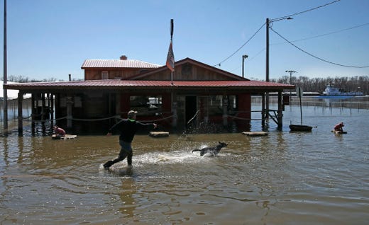
17 Photos
Heavy rain swamps Texas
1 of 17
The storm threat area on Thursday will be in the Deep South, mainly in Mississippi, Tennessee, Arkansas and Louisiana.
Meanwhile, ongoing bouts of drenching rain continue to pelt waterlogged portions of the region, exacerbating relentless flooding. The Houston area was particularly hard hit on Tuesday, as nearly 10 inches of rain soaked the metro area, inundating homes and roads.
The heavy rain prompted flash flood emergencies in some communities because of rapidly rising floodwaters.
The storms soaked parts of Texas that have been repeatedly hit by flooding in recent years, including the deadly and devastating floods from Hurricane Harvey in 2017.
The sodden weather wasn’t confined to Texas. “There is ongoing flooding from Texas to Wisconsin … and more rain over the next three days will make flooding worse in some locations,” the National Weather Service said.
Evacuations were under way in portions of Kansas, where flooding is forcing people from their homes, closing roads and prompting schools to call off classes.
More than 20 million people live where flooding is possible this week, the weather service said.
Flooding is likely to continue along a portion of the Mississippi River and perhaps others over the central United States into June as rounds of excessive rain continue, AccuWeather said.
People living in a Houston suburb are coping with flooded roads and stalled vehicles after up to 10 inches of rain fell in the area. (May 8) AP, AP
In Missouri, almost a dozen levees already have been breached or threatened in recent days.
Chris Gamm, presiding commissioner for Pike County, Mo., told USA TODAY that some communities along the Mississippi River have been flooded for two weeks. The county’s levees all blew out over the weekend, he said.
“The governor is going to see if there is some emergency relief we can get from federal and state people,” he said. “Apparently they can’t employ emergency resource assets until the water goes down and they can see the damage. But some areas have been underwater for two weeks.”
“There are several thousand acres of farmland that are already covered. It’s pretty drastic,” Gamm said.
68 Photos
Historic flooding strikes Upper Midwest
Wintry North, West
Snow was also expected overnight Wednesday and into Thursday in northeastern Minnesota, far northern Wisconsin, and the Upper Peninsula of Michigan, where a few inches of snow could accumulate, the weather service said.
“Snow is also likely in the West, and accumulating snow could be heavy for higher elevations,” weather service meteorologist Jennifer Tate said.
Heavy snow is expected to fall over the central Rockies where 1 to 2 feet of new snow is likely through Friday evening. Up to 30 inches of snow is possible for the San Juan mountains of southwestern Colorado and northwestern New Mexico.
Contributing: The Associated Press; John Bacon, USA TODAY
UPDATE 5/7/19
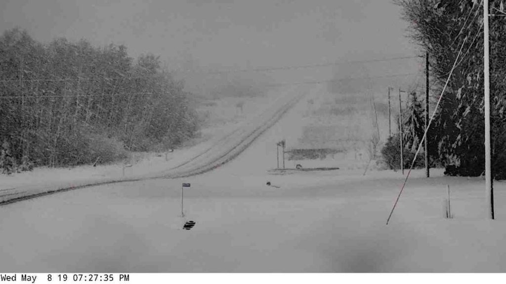
TORNADO WARNINGS FOR Wednesday 5/8/19 across the US
It’s going to be another epic Mayday May. God bless everyone,
video on today’s situation https://weather.com/storms/severe/new… Rounds of Severe Thunderstorms and Flooding Rain Expected in the Central and Southern Plains This Week Severe thunderstorms are expected in parts of the Plains each day through at least Wednesday. Hail, damaging winds and tornadoes are possible. Rounds of soaking rain may result in flooding, as the ground is already saturated in many areas. Severe thunderstorms will flare up in parts of the Plains states through midweek with hail, high winds, tornadoes and flooding rainfall. Showers and thunderstorms will persist in parts of the Plains through Tuesday morning and strong winds and an isolated brief tornado cannot be ruled out. The setup this week will feature a southward dip in the jet stream, or trough, over the West and an area of high pressure, or upper-level ridge, over the Southeast. A frontal system is expected between the trough and ridge. Upper-level winds are expected to be strong, and plenty of moisture will surge northward out of the Gulf of Mexico into portions of the south-central states. As a result, numerous thunderstorms will develop, and some of them could pack damaging winds, large hail, tornadoes and torrential rainfall. Tuesday The upper-level trough will begin to shift into the Plains Tuesday and will encounter moisture and instability, which will likely result in the chance for numerous severe thunderstorms. The chance for severe storms looks highest from south-central Oklahoma into southeastern Kansas, southwestern Missouri and far northwestern Arkansas. There is the potential for very large hail, damaging wind gusts and tornadoes. There could be multiple rounds of thunderstorms in this zone, first in the morning, then again in the afternoon, evening and overnight hours. Heavy rain could also trigger flash flooding from far northern Texas to as far north as Lower Michigan. NOAA’s Weather Prediction Center has issued a moderate risk of flash flooding in parts of eastern Oklahoma, far southeastern Kansas, southwestern Missouri and northwestern Arkansas.
On Wednesday, scattered strong to severe storms are possible from parts of Texas into the Ohio Valley, with hail and damaging winds being the primary threats, although an isolated tornado cannot be ruled out. Once again, there could be both afternoon and evening storms and thunderstorm clusters that persist through the overnight in some areas. Heavy rainfall could lead to flooding on Wednesday, mainly from northern Texas into southeastern Oklahoma and western Arkansas.
Flood Threat As mentioned earlier, flash flooding will also be a significant concern in the Plains and Midwest this week. A widespread area of 1 to 3 inches of rainfall is expected from parts of Texas into Michigan. Some areas will see locally higher amounts topping 3 inches, especially where overnight thunderstorm clusters occur. This additional rainfall will increase the chance for flooding this week, especially in areas that receive heavy rainfall in a short period of time. The National Weather Service has issued flood watches for parts of the Plains and mid-Mississippi Valley.
River flooding concerns may also increase late this week, as many river gauges along the Mississippi River and in the Midwest are already in at least minor flood stage. The ground is saturated in many locations in this region. Oklahoma City has received more than 4.5 inches of rain in April, and Dallas/Fort Worth has picked up 6.74 inches so far this month, almost 4 inches above average. Storm Reports So Far A line of severe storms roared through parts of Kansas overnight Sunday, producing hail up to baseball-size and damaging winds. Up to 20 power poles were downed by high winds at the Eureka, Kansas, airport, and a semi was blown off U.S. Highway 169 near Greeley, Kansas, injuring the driver.
Exceptionally critical geometry could trigger a major to mega-thrust earthquake warning from 30 April to 3 May 2019. The geometry is very similar to that at the time of high 7 to 8+ magnitude earthquakes in the past. So BE ON WATCH, just in case. Current Seismic Indicator: https://www.ditrianum.org Introduction Video: “Earthquakes & Electromagnetic Waves” https://www.youtube.com/watch?v=27nIr… Growing Evidence Radiation Pressure Triggers Earthquakes https://www.youtube.com/watch?v=Nnhhc… Earthquake Alarm – electromagnetic signals: https://spectrum.ieee.org/computing/h…
Another Round of Severe weather is returning tomorrow early afternoon across Oklahoma area and the Texas area with a threat of Large hail, and Damaging Winds, Also a Threat for Flooding, Will the Severe weather threat last into Wednesday and Thursday. Watch the Video to find out. IF YOUR A NEW VIEWER and you love my weather content, Please Subscribe to my channel to get daily forecasts on a daily basis and I plan on covering hurricane season with my first forecast expected to get released on May 25th, 2019. Also make sure to like the video, comment and ring the bell icon, Thanks for Support, it keeps me moving. Link listed below https://www.youtube.com/channel/UC5C6… Support this Channel on Paterson, link listed below: https://www.patreon.com/DavidSchlotth…
Severe Weather Alert Day Tuesday. J7409 Weather 4/29/19. watch https://www.youtube.com/watch?v=Evhcf… A few strong to severe thunderstorms are possible Monday afternoon and evening from the High Plains of West Texas northeastward into central Oklahoma, as well as across a part of the upper Ohio Valley. Strong to severe storms are also possible Monday night from northeast New Mexico into the Texas Panhandle, a portion of Oklahoma and southern Kansas overnight. Severe thunderstorms are possible in a corridor across parts of the southern Plains into the lower Missouri Valley Tuesday afternoon into Tuesday night. This will include a risk for large hail, locally damaging wind gusts and tornadoes. The weather pattern will continue to be unsettled across much of the Plains and extending westward across the Rockies. A quasi-stationary frontal boundary is forecast to become established from the central Rockies to the Midwest, and also extending eastward to the Mid-Atlantic region. Multiple waves of low pressure are expected along this front and result in areas of enhanced rainfall. The heaviest rain is likely from northern Oklahoma to southern Michigan, with some locations getting 2 to 4 inches of rain by Wednesday morning. There is an increased threat of flash flooding across the central plains where multiple rounds of thunderstorms are expected. The threat of severe weather increases across the southern plains on Monday with the best moisture and upper level forcing residing over this region, and then across the central plains on Tuesday in the warm sector of the surface low. Across the Rockies, heavy snow will be making headlines for the beginning of the week with the potential for 1 to 2 feet of accumulation for the higher mountain ranges. This will be enhanced by moist upslope flow on the north side of the front. Some snow is also likely across the western High Plains from western Nebraska to eastern Montana. Temperatures will continue to remain below average across the northern tier of the nation through the beginning of the week, with the greatest departures from normal across the northern plains. Warmer than normal readings are expected across the Desert Southwest and southern plains, south of the frontal boundaries. The weather pattern will continue to be unsettled across much of the Plains and extending westward across the Rockies. A quasi-stationary frontal boundary is forecast to become established from the central Rockies to the Midwest, and also extending eastward to the Mid-Atlantic region. Multiple waves of low pressure are expected along this front and result in areas of enhanced rainfall. The heaviest rain is likely from northern Oklahoma to southern Michigan, with some locations getting 2 to 4 inches of rain by Wednesday morning. There is an increased threat of flash flooding across the central plains where multiple rounds of thunderstorms are expected. The threat of severe weather increases across the southern plains on Monday with the best moisture and upper level forcing residing over this region, and then across the central plains on Tuesday in the warm sector of the surface low. Across the Rockies, heavy snow will be making headlines for the beginning of the week with the potential for 1 to 2 feet of accumulation for the higher mountain ranges. This will be enhanced by moist upslope flow on the north side of the front. Some snow is also likely across the western High Plains from western Nebraska to eastern Montana. Temperatures will continue to remain below average across the northern tier of the nation through the beginning of the week, with the greatest departures from normal across the northern plains. Warmer than normal readings are expected across the Desert Southwest and southern plains, south of the frontal boundaries.
Is that Winter Storm EXILER?? As in forcing people into EXILE??? Very interesting choice of names for this particular Storm, especially when you consider how many people have already lost their homes or been displaced by storms across the US and the World.
portions of Texas Oklahoma Arkansas Missouri Kansas Illinois Indiana Ohio Pennsylvania New York. This will intensify the river flooding problem the region is battling. God bless everyone,
Severe weather is about return and it could be another couple of days of Large Hail, Damaging winds, Heavy Rain, and a threat for Tornadoes. A Persistent amount of atmospheric river moisture will park its self across the Texas, and Oklahoma area with the low-level Jet increasing to 40 to 50 mph, Surface wind look to be 15 to 25 mph. This will increase the threat for moderate cape shear value, promoting the threat for a slight risk for Tornadoes. High CAPE value will be present also increasing the threat for Large hail the size of Golf to Tennis ball hail, and damaging winds. Based on CAPE, Shear, Helicity, and the Listed index this could be a very significant outbreak. Please stay tuned for the latest forecast as this looks to be life-threatening


 Update On Oroville and the Surrounding Lakes
 Susan Wolding
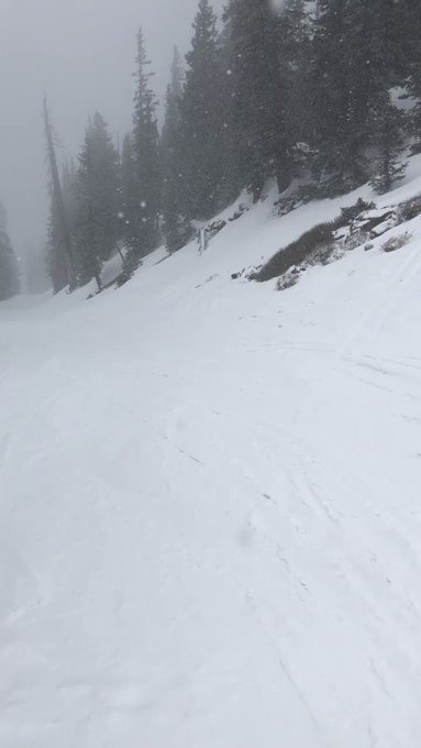

 : 5.19.19


 HELLO SNOW! Spring snow seen this evening from Culver, Minnesota. Photo courtesy of Deborah Moe.
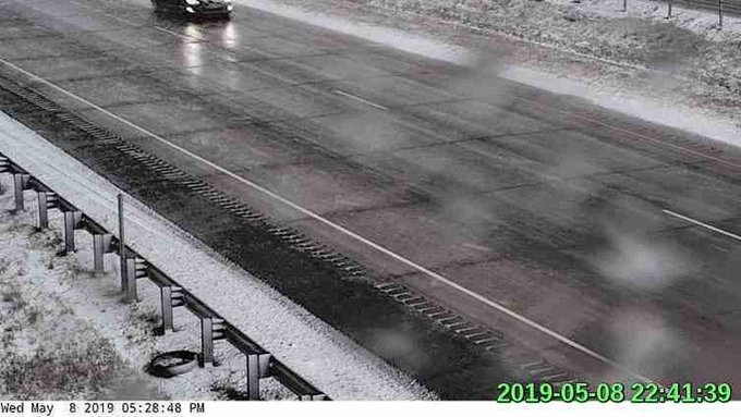


 It starts at 8:30. We’ll be here! Photos courtesy:
 1 of 17


 Update 4/30 PM