Flood Warning
National Weather Service Houston/Galveston TX
426 PM CDT Wed Sep 18 2019

TXC167-190030-
/O.NEW.KHGX.FA.W.0016.190918T2126Z-190919T0030Z/
/00000.0.ER.000000T0000Z.000000T0000Z.000000T0000Z.OO/
Galveston TX-
426 PM CDT Wed Sep 18 2019

The National Weather Service in League City has issued a

* Flood Warning for...
  Northwestern Galveston County in southeastern Texas...

* Until 730 PM CDT.

* At 425 PM CDT, trained weather spotters reported flooding
  occurring due to Dickinson Bayou flowing out of banks and flooding
  the boat ramp at Highway 3 and Dickinson Bayou. Additional
  rainfall is expected so flood waters will be slow to recede.

* Some locations that will experience flooding include...
  Dickinson.

PRECAUTIONARY/PREPAREDNESS ACTIONS...

Turn around, don`t drown when encountering flooded roads. Most flood
deaths occur in vehicles.

A Flood Warning means that flooding is imminent or occurring. All
interested parties should take necessary precautions immediately.

&&

LAT...LON 2945 9500 2945 9507 2946 9507 2947 9502
      2947 9500

$$
Flood Statement
National Weather Service Milwaukee/Sullivan WI
356 PM CDT Wed Sep 18 2019

...The Flood Warning continues for the following rivers in
Illinois...Wisconsin...
  Fox River Near New Munster affecting Lake and Kenosha Counties
  Pecatonica River At Martintown affecting Green County


&&
ILC097-WIC059-190855-
/O.CON.KMKX.FL.W.0069.000000T0000Z-190920T1800Z/
/NMSW3.2.ER.190913T1642Z.190915T0315Z.190920T1200Z.NO/
356 PM CDT Wed Sep 18 2019

The Flood Warning continues for
  The Fox River Near New Munster.
* At  3:00 PM Wednesday the stage was 11.8 feet.
* Flood stage is 11.0 feet.
* Minor flooding is occurring and Minor flooding is forecast.
* Forecast...The river will continue to fall to below flood stage by
  Friday morning.
* Impact...At 11.8 feet...Floodwaters surround a home at the
  intersection of Highway 50 and Highway W in the Town of Wheatland
  area. Water is about 8 inches deep over 77th Street in the Town of
  Wheatland area. Water is in the back yards of some homes in the
  Village of Salem Lakes area. This level is the 50 percent chance
  flood meaning there is a 50 percent chance in any given year of the
  river reaching this level.

&&

River forecasts are available for some but not all river gaging
locations. The 7 day river forecast takes into account past
precipitation, soil moisture conditions, and predicted
precipitation for the basin. Precipitation is for the next 24 hours
in the future from April through September and for 48 hours in the
future from October through March.

(stages in ft.)        Bank-      Latest         Forecast stages
-               Flood  full      observed        ...for 6 pm...
Location        stage  stage    stage/time     Wed  Thu  Fri  Sat
New Munster     11.0  10.0  11.75 03 PM 09/18  11.7 11.2 10.7 10.3

-                   Highest      24 hour change
-                   observed     in river stage
-                   stage in      (ft.) up to      Highest stage
-                   the last    latest observed     forecast in
-                    7 days          stage          next 7 days
New Munster     13.15 10 PM 09/14    -0.48       11.70 07 PM 09/18

Below is the latest predicted precipitation information in 6 hour
increments for the listed sites. This information is updated twice
daily - in the morning and evening. Precipitation prediction is for
48 hours into the future from October through March and for 24
hours into the future from April through September.

New Munster: 6 am-noon  Wed Sep 18  0.00
New Munster: noon-6 pm  Wed Sep 18  0.00
New Munster: 6 pm-midn  Wed Sep 18  0.00
New Munster: midn-6 am  Thu Sep 19  0.00
New Munster: 6 am-noon  Thu Sep 19  0.00
New Munster: noon-6 pm  Thu Sep 19  0.00
New Munster: 6 pm-midn  Thu Sep 19  0.00
New Munster: midn-6 am  Fri Sep 20  0.01
&&

LAT...LON 4262 8830 4262 8817 4255 8814 4246 8814
      4245 8824 4255 8824

$$
Flood Statement
National Weather Service Milwaukee/Sullivan WI
356 PM CDT Wed Sep 18 2019

...The Flood Warning continues for the following rivers in
Illinois...Wisconsin...
  Fox River Near New Munster affecting Lake and Kenosha Counties
  Pecatonica River At Martintown affecting Green County


&&
WIC045-190855-
/O.CON.KMKX.FL.W.0071.000000T0000Z-190920T0834Z/
/MTNW3.1.ER.190915T0900Z.190918T1415Z.190920T0234Z.NO/
356 PM CDT Wed Sep 18 2019

The Flood Warning continues for
  The Pecatonica River At Martintown.
* At  2:00 PM Wednesday the stage was 15.3 feet.
* Flood stage is 13.5 feet.
* Minor flooding is occurring and Minor flooding is forecast.
* Forecast...The river will continue to fall to below flood stage by
  tomorrow late evening.
* Impact...At 16.0 feet...Floodwaters are in the back yard of at
  least one home in Martintown. Floodwaters affect Martintown Road
  and West River Road in the Martintown area. Upstream in Browntown,
  floodwaters affect Highway MM and West Indies Road.

&&

River forecasts are available for some but not all river gaging
locations. The 7 day river forecast takes into account past
precipitation, soil moisture conditions, and predicted
precipitation for the basin. Precipitation is for the next 24 hours
in the future from April through September and for 48 hours in the
future from October through March.

(stages in ft.)        Bank-      Latest         Forecast stages
-               Flood  full      observed        ...for 6 pm...
Location        stage  stage    stage/time     Wed  Thu  Fri  Sat
Martintown      13.5   9.5  15.34 02 PM 09/18  15.3 13.8 11.2  9.7

-                   Highest      24 hour change
-                   observed     in river stage
-                   stage in      (ft.) up to      Highest stage
-                   the last    latest observed     forecast in
-                    7 days          stage          next 7 days
Martintown      15.38 09 AM 09/18     0.07       15.30 07 PM 09/18

Below is the latest predicted precipitation information in 6 hour
increments for the listed sites. This information is updated twice
daily - in the morning and evening. Precipitation prediction is for
48 hours into the future from October through March and for 24
hours into the future from April through September.

Martintown: 6 am-noon  Wed Sep 18  0.00
Martintown: noon-6 pm  Wed Sep 18  0.00
Martintown: 6 pm-midn  Wed Sep 18  0.00
Martintown: midn-6 am  Thu Sep 19  0.07
Martintown: 6 am-noon  Thu Sep 19  0.06
Martintown: noon-6 pm  Thu Sep 19  0.00
Martintown: 6 pm-midn  Thu Sep 19  0.00
Martintown: midn-6 am  Fri Sep 20  0.12
&&

LAT...LON 4272 8992 4272 8984 4263 8980 4251 8970
      4251 8988 4260 8993

$$
FLOOD WARNING
NATIONAL WEATHER SERVICE HOUSTON/GALVESTON, TX
348 PM CDT Wed Sep 18 2019

...The National Weather Service in Houston/Galveston has issued a flood warning
for the following rivers...

  East Fork San Jacinto near New Caney affecting the following counties in
  Texas...Harris...Liberty...Montgomery


For East Fork San Jacinto River at New Caney, Moderate flooding is forecasted.


PRECAUTIONARY/PREPAREDNESS ACTIONS...

Persons with interests along these streams should keep alert to rising water and
take all precautions to protect their property. Do not drive or walk into
flooded areas the depth and water velocity could be too great for you to cross
safely. Motorists should avoid any water covered roads and find an alternate
route. Livestock and equipment should be removed from the flood plain
immediately.


Stay tuned to NOAA Weather radio or other news sources for further updates.

&&

TXC201-291-339-190847-
/O.NEW.KHGX.FL.W.0080.190919T0224Z-190924T0300Z/
/NCET2.2.ER.190919T0224Z.190920T0900Z.190923T1500Z.NO/
348 PM CDT Wed Sep 18 2019

The National Weather Service in Houston/Galveston has issued a

* Flood Warning for
  The East Fork San Jacinto near New Caney.
* from this evening to Monday evening or until the warning is canceled.
* At 0340 PM Wednesday the stage was 55.5 feet.
* Moderate flooding is forecast.
* Flood stage is 58.0 feet.
* Forecast...Rise above flood stage by tonight and continue to rise to near 63.1
  feet by Friday morning. The river will fall below flood stage by late Monday
  morning.


&&


                     Flood  Observed             Forecast 6 PM
Location             Stage  Stage   Day Time      Thu    Fri    Sat    Sun

East Fork San Jacinto River
  New Caney           58.0   55.5   Wed 04 PM     57.2   62.4   62.8   62.4

&&

LAT...LON  3024 9515 3024 9504 3007 9510 3007 9520 3014 9517


$$
Flood Statement
National Weather Service Quad Cities IA/IL
325 PM CDT Wed Sep 18 2019


.Updated flood information for the Pecatonica and Rock Rivers.

River forecasts include past precipitation and forecast rainfall for
the next 24 hours.

PRECAUTIONARY/PREPAREDNESS ACTIONS...

If you encounter a flooded roadway, turn around and find an
alternate route. Turn around, don`t drown.

&&

ILC073-161-191223-
/O.CON.KDVN.FL.W.0164.000000T0000Z-190920T1500Z/
/MLII2.2.ER.190916T0322Z.190918T0130Z.190919T2100Z.NO/
325 PM CDT Wed Sep 18 2019

...Flood Warning remains in effect until Thursday...

The Flood Warning continues for
  The Rock River at Moline.
* Until Thursday.
* At  2:30 PM Wednesday the stage was 13.1 feet and falling.
* Flood stage is 12.0 feet.
* Moderate flooding is occurring.
* Forecast, Fall below flood stage Thursday.
* Impact, At  13.0 feet, Moderate Flood Stage. In Moline, water
  affects homes on South Shore Drive and cuts off access to homes
  east of the I-74 bridge. Water also affects 49th Avenue south of
  the theater.  Water affects Vandruff Island.

&&

LAT...LON 4148 9061 4152 9032 4148 9027 4144 9043
      4145 9064


$$
Haase
Flood Statement
National Weather Service Quad Cities IA/IL
325 PM CDT Wed Sep 18 2019


.Updated flood information for the Pecatonica and Rock Rivers.

River forecasts include past precipitation and forecast rainfall for
the next 24 hours.

PRECAUTIONARY/PREPAREDNESS ACTIONS...

If you encounter a flooded roadway, turn around and find an
alternate route. Turn around, don`t drown.

&&

ILC073-161-195-191223-
/O.CON.KDVN.FL.W.0163.000000T0000Z-190921T0600Z/
/JOSI2.2.ER.190914T1336Z.190917T0845Z.190920T1200Z.NO/
325 PM CDT Wed Sep 18 2019

...Flood Warning remains in effect until Friday morning...

The Flood Warning continues for
  The Rock River near Joslin.
* Until Friday morning.
* At  2:45 PM Wednesday the stage was 13.9 feet and falling.
* Flood stage is 12.0 feet.
* Minor flooding is occurring.
* Forecast, Fall below flood stage Friday morning.
* Impact, At  14.0 feet, Water affects residences in outlying areas
  immediately along the river including basements, yards, driveways,
  and access roads.

&&

LAT...LON 4152 9032 4169 9002 4163 8999 4148 9027


$$
Flood Statement
National Weather Service Quad Cities IA/IL
325 PM CDT Wed Sep 18 2019


.Updated flood information for the Pecatonica and Rock Rivers.

River forecasts include past precipitation and forecast rainfall for
the next 24 hours.

PRECAUTIONARY/PREPAREDNESS ACTIONS...

If you encounter a flooded roadway, turn around and find an
alternate route. Turn around, don`t drown.

&&

ILC177-191224-
/O.CON.KDVN.FL.W.0162.000000T0000Z-190922T2100Z/
/FEEI2.2.ER.190913T0930Z.190916T0245Z.190922T0300Z.NO/
325 PM CDT Wed Sep 18 2019

...Flood Warning remains in effect until Saturday evening...

The Flood Warning continues for
  The Pecatonica River at Freeport.
* Until Saturday evening.
* At  2:30 PM Wednesday the stage was 13.7 feet and steady.
* Flood stage is 13.0 feet.
* Minor flooding is occurring.
* Forecast, Rise to 13.8 feet Thursday morning. Fall below flood
  stage Saturday evening.
* Impact, At  13.0 feet, Flood Stage. Water affects low lying
  sections of Freeport mainly east of the Pecatonica River.

&&

LAT...LON 4250 8981 4250 8972 4233 8961 4235 8940
      4227 8940 4224 8968


$$
Flood Statement
National Weather Service Kansas City/Pleasant Hill MO
1121 AM CDT Wed Sep 18 2019

...The Flood Warning continues for the following rivers in Kansas...
Missouri...

  Missouri River at Atchison affecting Atchison...Buchanan and Platte
  Counties.

  Missouri River at Sibley affecting Clay...Jackson and Ray Counties.

  Missouri River At Miami affecting Carroll...Chariton and Saline
  Counties.

...The Flood Warning continues for the following rivers in Kansas...
Missouri...

  Missouri River at St Joseph affecting Doniphan...Andrew and
  Buchanan Counties.
  Missouri River at Napoleon affecting Jackson...Lafayette and Ray
  Counties.
  Missouri River at Waverly affecting Carroll...Lafayette and Saline
  Counties.

PRECAUTIONARY/PREPAREDNESS ACTIONS...

Do not drive through flowing water. Nearly half of all flood
fatalities are vehicle related. As little as 6 inches of water may
cause you to lose control of your vehicle. Two feet of water will
carry most vehicles away.This product along with additional weather
and stream information is available at www.weather.gov/kc/.

&&

KSC043-MOC003-021-191621-
/O.CON.KEAX.FL.W.0048.000000T0000Z-000000T0000Z/
/SJSM7.3.ER.190313T1124Z.190323T0100Z.000000T0000Z.UU/
1121 AM CDT Wed Sep 18 2019

The Flood Warning continues for
  The Missouri River at St Joseph.
* until further notice.
* At  9:30 AM Wednesday the stage was 18.1 feet.
* Flood stage is 17.0 feet.
* Minor flooding is occurring and Moderate flooding is forecast.
* Forecast...The river will continue rising to near 21.2 feet by
  Monday morning then begin falling.
* At 21.0 feet...Riverfront Park in St. Joseph begins to flood.
* At 19.0 feet...Backwater from the Missouri River floods property
  along the Nodaway river at Nodaway, Missouri.
* At 17.0 feet...Lowland flooding upstream and downstream from St.
  Joseph occurs.


&&
                       Latest
Location          FS   Stage  Day/Time    Forecast

Missouri River
  St Joseph       17   18.1   Wed 09 AM   21.2 Monday morning

&&

LAT...LON 3991 9501 3990 9489 3975 9483 3964 9488 3970 9505


$$
Flood Statement
National Weather Service Kansas City/Pleasant Hill MO
1121 AM CDT Wed Sep 18 2019

...The Flood Warning continues for the following rivers in Kansas...
Missouri...

  Missouri River at Atchison affecting Atchison...Buchanan and Platte
  Counties.

  Missouri River at Sibley affecting Clay...Jackson and Ray Counties.

  Missouri River At Miami affecting Carroll...Chariton and Saline
  Counties.

...The Flood Warning continues for the following rivers in Kansas...
Missouri...

  Missouri River at St Joseph affecting Doniphan...Andrew and
  Buchanan Counties.
  Missouri River at Napoleon affecting Jackson...Lafayette and Ray
  Counties.
  Missouri River at Waverly affecting Carroll...Lafayette and Saline
  Counties.

PRECAUTIONARY/PREPAREDNESS ACTIONS...

Do not drive through flowing water. Nearly half of all flood
fatalities are vehicle related. As little as 6 inches of water may
cause you to lose control of your vehicle. Two feet of water will
carry most vehicles away.This product along with additional weather
and stream information is available at www.weather.gov/kc/.

&&

MOC033-107-195-191621-
/O.CON.KEAX.FL.W.0054.000000T0000Z-000000T0000Z/
/WVYM7.3.ER.190314T0639Z.190601T1500Z.000000T0000Z.UU/
1121 AM CDT Wed Sep 18 2019

The Flood Warning continues for
  The Missouri River at Waverly.
* until further notice.
* At  9:30 AM Wednesday the stage was 21.5 feet.
* Flood stage is 20.0 feet.
* Minor flooding is occurring and Minor flooding is forecast.
* Forecast...The river will continue rising to near 22.7 feet by
  Tuesday evening then begin falling.

&&
                       Latest
Location          FS   Stage  Day/Time    Forecast

Missouri River
  Waverly         20   21.5   Wed 09 AM   22.7 Tuesday evening

&&

LAT...LON 3925 9386 3933 9331 3928 9327 3922 9330 3918 9384


$$
Flood Statement
National Weather Service Kansas City/Pleasant Hill MO
1121 AM CDT Wed Sep 18 2019

...The Flood Warning continues for the following rivers in Kansas...
Missouri...

  Missouri River at Atchison affecting Atchison...Buchanan and Platte
  Counties.

  Missouri River at Sibley affecting Clay...Jackson and Ray Counties.

  Missouri River At Miami affecting Carroll...Chariton and Saline
  Counties.

...The Flood Warning continues for the following rivers in Kansas...
Missouri...

  Missouri River at St Joseph affecting Doniphan...Andrew and
  Buchanan Counties.
  Missouri River at Napoleon affecting Jackson...Lafayette and Ray
  Counties.
  Missouri River at Waverly affecting Carroll...Lafayette and Saline
  Counties.

PRECAUTIONARY/PREPAREDNESS ACTIONS...

Do not drive through flowing water. Nearly half of all flood
fatalities are vehicle related. As little as 6 inches of water may
cause you to lose control of your vehicle. Two feet of water will
carry most vehicles away.This product along with additional weather
and stream information is available at www.weather.gov/kc/.

&&

KSC005-MOC021-165-191621-
/O.EXT.KEAX.FL.W.0345.190921T1200Z-190929T0600Z/
/ATCK1.1.ER.190921T1200Z.190923T1800Z.190928T0600Z.NO/
1121 AM CDT Wed Sep 18 2019

The Flood Warning continues for
  The Missouri River at Atchison.
* from Saturday morning to Sunday September 29.
* At 11:02 AM Wednesday the stage was 20.1 feet.
* Flood stage is 22.0 feet.
* Minor flooding is forecast.
* Forecast...Rise above flood stage by Saturday morning and continue
  to rise to near 23.4 feet by early Monday afternoon. The river will
  fall below flood stage by early Saturday morning.
* At 22.0 feet...Low-lying areas on the Missouri side of the river
  begin to flood.

&&
                       Latest
Location          FS   Stage  Day/Time    Forecast

Missouri River
  Atchison        22   20.1   Wed 11 AM   23.4 early Monday afternoon

&&

LAT...LON 3970 9505 3964 9488 3942 9493 3942 9508 3958 9516


$$
Flood Statement
National Weather Service Kansas City/Pleasant Hill MO
1121 AM CDT Wed Sep 18 2019

...The Flood Warning continues for the following rivers in Kansas...
Missouri...

  Missouri River at Atchison affecting Atchison...Buchanan and Platte
  Counties.

  Missouri River at Sibley affecting Clay...Jackson and Ray Counties.

  Missouri River At Miami affecting Carroll...Chariton and Saline
  Counties.

...The Flood Warning continues for the following rivers in Kansas...
Missouri...

  Missouri River at St Joseph affecting Doniphan...Andrew and
  Buchanan Counties.
  Missouri River at Napoleon affecting Jackson...Lafayette and Ray
  Counties.
  Missouri River at Waverly affecting Carroll...Lafayette and Saline
  Counties.

PRECAUTIONARY/PREPAREDNESS ACTIONS...

Do not drive through flowing water. Nearly half of all flood
fatalities are vehicle related. As little as 6 inches of water may
cause you to lose control of your vehicle. Two feet of water will
carry most vehicles away.This product along with additional weather
and stream information is available at www.weather.gov/kc/.

&&

MOC095-107-177-191621-
/O.CON.KEAX.FL.W.0053.000000T0000Z-000000T0000Z/
/NAPM7.2.ER.190314T0055Z.190602T1545Z.000000T0000Z.UU/
1121 AM CDT Wed Sep 18 2019

The Flood Warning continues for
  The Missouri River at Napoleon.
* until further notice.
* At 11:00 AM Wednesday the stage was 18.7 feet.
* Flood stage is 17.0 feet.
* Minor flooding is occurring and Minor flooding is forecast.
* Forecast...The river will continue rising to near 19.9 feet by
  early Tuesday afternoon.
* At 17.0 feet...Low-lying areas unprotected by levees begin to
  flood.

&&
                       Latest
Location          FS   Stage  Day/Time    Forecast

Missouri River
  Napoleon        17   18.7   Wed 11 AM   19.9 early Tuesday
afternoon

&&

LAT...LON 3916 9415 3922 9417 3925 9386 3918 9384 3911 9405


$$
Flood Statement
National Weather Service Kansas City/Pleasant Hill MO
1121 AM CDT Wed Sep 18 2019

...The Flood Warning continues for the following rivers in Kansas...
Missouri...

  Missouri River at Atchison affecting Atchison...Buchanan and Platte
  Counties.

  Missouri River at Sibley affecting Clay...Jackson and Ray Counties.

  Missouri River At Miami affecting Carroll...Chariton and Saline
  Counties.

...The Flood Warning continues for the following rivers in Kansas...
Missouri...

  Missouri River at St Joseph affecting Doniphan...Andrew and
  Buchanan Counties.
  Missouri River at Napoleon affecting Jackson...Lafayette and Ray
  Counties.
  Missouri River at Waverly affecting Carroll...Lafayette and Saline
  Counties.

PRECAUTIONARY/PREPAREDNESS ACTIONS...

Do not drive through flowing water. Nearly half of all flood
fatalities are vehicle related. As little as 6 inches of water may
cause you to lose control of your vehicle. Two feet of water will
carry most vehicles away.This product along with additional weather
and stream information is available at www.weather.gov/kc/.

&&

MOC033-041-195-191621-
/O.EXT.KEAX.FL.W.0055.000000T0000Z-191009T1200Z/
/MIAM7.3.ER.000000T0000Z.190606T0037Z.191008T1200Z.NR/
1121 AM CDT Wed Sep 18 2019

The Flood Warning continues for
  The Missouri River At Miami.
* until Wednesday October 09.
* At  8:33 AM Wednesday the stage was 19.5 feet.
* Flood stage is 18.0 feet.
* Minor flooding is occurring and Minor flooding is forecast.
* Forecast...The river will continue rising to near 20.9 feet by
  early Wednesday morning. The river will fall below flood stage
  Tuesday morning.
* At 18.0 feet...Low-lying rural areas outside of levees begin to
  flood.

&&
                       Latest
Location          FS   Stage  Day/Time    Forecast

Missouri River
  Miami           18   19.5   Wed 09 AM   20.9 early Wednesday
morning

&&

LAT...LON 3933 9331 3943 9319 3938 9307 3928 9327


$$
Flood Statement
National Weather Service Kansas City/Pleasant Hill MO
1121 AM CDT Wed Sep 18 2019

...The Flood Warning continues for the following rivers in Kansas...
Missouri...

  Missouri River at Atchison affecting Atchison...Buchanan and Platte
  Counties.

  Missouri River at Sibley affecting Clay...Jackson and Ray Counties.

  Missouri River At Miami affecting Carroll...Chariton and Saline
  Counties.

...The Flood Warning continues for the following rivers in Kansas...
Missouri...

  Missouri River at St Joseph affecting Doniphan...Andrew and
  Buchanan Counties.
  Missouri River at Napoleon affecting Jackson...Lafayette and Ray
  Counties.
  Missouri River at Waverly affecting Carroll...Lafayette and Saline
  Counties.

PRECAUTIONARY/PREPAREDNESS ACTIONS...

Do not drive through flowing water. Nearly half of all flood
fatalities are vehicle related. As little as 6 inches of water may
cause you to lose control of your vehicle. Two feet of water will
carry most vehicles away.This product along with additional weather
and stream information is available at www.weather.gov/kc/.

&&

MOC047-095-177-191621-
/O.EXT.KEAX.FL.W.0344.190923T1800Z-190927T0600Z/
/SBEM7.1.ER.190923T1800Z.190924T1200Z.190926T0600Z.NO/
1121 AM CDT Wed Sep 18 2019

The Flood Warning continues for
  The Missouri River at Sibley.
* from Monday afternoon to Friday September 27.
* At  7:35 AM Wednesday the stage was 21.1 feet.
* Flood stage is 22.0 feet.
* Minor flooding is forecast.
* Forecast...Rise above flood stage by early Monday afternoon and
  continue to rise to near 22.3 feet by Tuesday morning. The river
  will fall below flood stage by early Thursday morning.
* At 22.0 feet...Low-lying rural areas along the river and outside of
  levee protection flood.

&&
                       Latest
Location          FS   Stage  Day/Time    Forecast

Missouri River
  Sibley          22   21.1   Wed 08 AM   22.3 Tuesday morning

&&

LAT...LON 3925 9431 3922 9417 3916 9415 3918 9420 3918 9432


$$
Flood Statement
National Weather Service Lake Charles La
1054 AM CDT Wed Sep 18 2019

...The Flood Warning continues for the following rivers in
Louisiana...Texas...

  Calcasieu River At Old Town Bay
  Village Creek Near Kountze
  Pine Island Bayou Near Sour Lake
  Calcasieu River Near Salt Water Barrier
  Neches River at Neches River Saltwater Barrier

LAC019-190554-
/O.EXT.KLCH.FL.W.0147.000000T0000Z-000000T0000Z/
/OTBL1.1.WT.190919T0500Z.190922T1200Z.000000T0000Z.NO/
1054 AM CDT Wed Sep 18 2019

...Flood Warning extended until further notice...The Flood Warning
continues for
  The Calcasieu River At Old Town Bay.
* until further notice...or until the warning is cancelled.
* At  7:00 AM Wednesday the stage was estimated at 4.0 feet.
* Minor flooding is forecast.
* Flood stage is 4.0 feet.
* Forecast...The river will fluctuate around flood stage for the next
  several days.
* Impact...At stages near 4.0 feet...Minor flooding of Goos Ferry
  Road will occur.
* Impact...At stages near 3.5 feet...Ponding of water on low spots
  along Goos Ferry Road will occur.

&&

LAT...LON 3038 9314 3031 9303 3025 9308 3019 9321 3030 9329

$$
Flood Statement
National Weather Service Lake Charles La
1054 AM CDT Wed Sep 18 2019

...The Flood Warning continues for the following rivers in
Louisiana...Texas...

  Calcasieu River At Old Town Bay
  Village Creek Near Kountze
  Pine Island Bayou Near Sour Lake
  Calcasieu River Near Salt Water Barrier
  Neches River at Neches River Saltwater Barrier

TXC199-241-245-361-190554-
/O.CON.KLCH.FL.W.0148.190919T1800Z-000000T0000Z/
/NSBT2.1.ER.190919T1800Z.190923T1200Z.000000T0000Z.NO/
1054 AM CDT Wed Sep 18 2019

The Flood Warning continues for
  The Neches River at Neches River Saltwater Barrier.
* from Thursday afternoon until further notice...or until the warning
  is cancelled.
* At 10:15 AM Wednesday the stage was 3.3 feet.
* Minor flooding is forecast.
* Flood stage is 4.0 feet.
* Forecast...rise above flood stage by tomorrow early afternoon and
  continue to rise to near 4.9 feet by Monday morning. Additional
  rises are possible thereafter.
* Impact...At stages near 5.0 feet...Water is about two feet over
  portions of Four Oaks Ranch Road.

&&

LAT...LON 3033 9404 3008 9401 3008 9413 3033 9421

$$
Flood Statement
National Weather Service Lake Charles La
1054 AM CDT Wed Sep 18 2019

...The Flood Warning continues for the following rivers in
Louisiana...Texas...

  Calcasieu River At Old Town Bay
  Village Creek Near Kountze
  Pine Island Bayou Near Sour Lake
  Calcasieu River Near Salt Water Barrier
  Neches River at Neches River Saltwater Barrier

TXC199-245-190554-
/O.EXT.KLCH.FL.W.0150.190919T1200Z-000000T0000Z/
/SOLT2.1.ER.190919T1200Z.190922T0000Z.000000T0000Z.NO/
1054 AM CDT Wed Sep 18 2019

The Flood Warning continues for
  The Pine Island Bayou Near Sour Lake.
* from Thursday morning until further notice...or until the warning
  is cancelled.
* At  9:45 AM Wednesday the stage was 22.6 feet.
* Minor flooding is forecast.
* Flood stage is 25.0 feet.
* Forecast...rise above flood stage by tomorrow morning and continue
  to rise to near 26.8 feet by Saturday evening.
* Impact...At stages near 25.0 feet...Water inundates roads in
  lowland areas near the river. Low spots on Old Sour Lake Road are
  under water.
* Impact...At stages near 22.0 feet...River is at bankfull stage.

&&

LAT...LON 3012 9445 3024 9423 3021 9407 3013 9406 3004 9445

$$
Flood Statement
National Weather Service Lake Charles La
1054 AM CDT Wed Sep 18 2019

...The Flood Warning continues for the following rivers in
Louisiana...Texas...

  Calcasieu River At Old Town Bay
  Village Creek Near Kountze
  Pine Island Bayou Near Sour Lake
  Calcasieu River Near Salt Water Barrier
  Neches River at Neches River Saltwater Barrier

TXC199-190554-
/O.EXT.KLCH.FL.W.0149.190920T1044Z-190923T2308Z/
/KOUT2.1.ER.190920T1044Z.190921T0600Z.190923T1108Z.NO/
1054 AM CDT Wed Sep 18 2019

The Flood Warning continues for
  The Village Creek Near Kountze.
* from late Thursday night to Monday evening...or until the warning
  is cancelled.
* At 10:30 AM Wednesday the stage was 2.9 feet.
* Minor flooding is forecast.
* Flood stage is 17.0 feet.
* Forecast...rise above flood stage by Friday morning and continue to
  rise to near 20.0 feet by early Saturday morning. The river will
  fall below flood stage by Monday morning.
* Impact...At stages near 20.0 feet...Water begins to flow over the
  bridge on Farm to Market Road 418. Water also begins to cover F.M.
  418 at several other locations. Road in Village Creek State Park
  begins to have water across it.
* Impact...At stages near 19.0 feet...Water over Village Creek Road
  Bridge in Lumberton. Significant backwater flooding of homes and
  camp sites along the creek in the north side of Lumberton.
* Impact...At stages near 18.4 feet...The water will be at the low
  chord of Highway 418.
* Impact...At stages near 17.0 feet...Water covers low spots on
  Willard Lake Road and Village Creek Road near Lumberton.
* Impact...At stages near 12.0 feet...The river is at bankfull
  stage.

&&

LAT...LON 3048 9433 3050 9423 3026 9404 3016 9414 3033 9433

$$
Flood Statement
National Weather Service Lake Charles La
1054 AM CDT Wed Sep 18 2019

...The Flood Warning continues for the following rivers in
Louisiana...Texas...

  Calcasieu River At Old Town Bay
  Village Creek Near Kountze
  Pine Island Bayou Near Sour Lake
  Calcasieu River Near Salt Water Barrier
  Neches River at Neches River Saltwater Barrier

LAC019-190554-
/O.CON.KLCH.FL.W.0151.190921T1200Z-190923T0000Z/
/LCHL1.1.ER.190921T1200Z.190921T1200Z.190922T1200Z.NO/
1054 AM CDT Wed Sep 18 2019

The Flood Warning continues for
  The Calcasieu River Near Salt Water Barrier.
* from Saturday morning to Sunday evening...or until the warning is
  cancelled.
* At  6:00 AM Wednesday the stage was 3.6 feet.
* Minor flooding is forecast.
* Flood stage is 4.0 feet.
* Forecast...The river is expected to rise to near flood stage
  Saturday morning.
* Impact...At stages near 4.5 feet...Water covers portions of River
  Road in north Lake Charles.
* Impact...At stages near 4.0 feet...Minor marshland flooding
  occurs. Flooding also begins on River Road in north Lake Charles.

&&

LAT...LON 3036 9309 3029 9303 3014 9328 3017 9335 3035 9332

$$
Flood Statement
National Weather Service Sioux Falls SD
1051 AM CDT Wed Sep 18 2019

...The Flood Warning is cancelled for the following rivers in Iowa...
Nebraska...South Dakota...

  Missouri River At South Sioux City
  East Fork Vermillion River Near Parker

...The Flood Warning continues for the following rivers in South
Dakota...Iowa...Nebraska...

  Missouri River At Niobrara
  Missouri River At Springfield
  Missouri River Near Ponca
  James River At Huron
  James River Near Forestburg
  James River At Mitchell
  James River Near Scotland
  James River Above Yankton
  Firesteel Creek Near Mount Vernon
  Vermillion River Near Davis
  Vermillion River Near Wakonda
  Vermillion River Near Vermillion
  Big Sioux River near Estelline
  Big Sioux River Near Bruce
  Big Sioux River Near Brookings
  Big Sioux River near Flandreau
  Big Sioux River near Egan
  Big Sioux River near Trent
  Big Sioux River near Dell Rapids
  Big Sioux River below Dell Rapids
  Big Sioux River At Sioux Falls I-90
  Silver Creek At Sioux Falls
  Big Sioux River At Sioux Falls Western Avenue
  Big Sioux River At Sioux Falls North Cliff
  Big Sioux River at Brandon
  Big Sioux River near Canton
  Big Sioux River at Fairview
  Big Sioux River above Hawarden
  Big Sioux River At Akron
  Big Sioux River near Richland
  Big Sioux River near Jefferson
  Big Sioux River At Sioux City
  Skunk Creek Near Hartford

...The Flood Warning continues for the following rivers in
Minnesota...

  West Fork Des Moines River near Avoca

.The following river forecasts include forecast precipitation through
tonight. Any additional future rains could affect the crest
forecasts.

PRECAUTIONARY/PREPAREDNESS ACTIONS...

Safety message...Do not drive cars through flooded areas. the water
depth and road condition may be unsafe.

Additional information is available at

http://water.weather.gov/ahps2/index.php?wfo=fsd

Stay tuned for further updates by listening to NOAA weather radio...
or your local radio and TV stations.

The next scheduled statement will be issued tomorrow morning.

&&

SDC011-101-191949-
/O.CON.KFSD.FL.W.0269.000000T0000Z-000000T0000Z/
/BRKS2.3.ER.190911T1321Z.190913T2030Z.000000T0000Z.NR/
1051 AM CDT Wed Sep 18 2019

The Flood Warning continues for
  The Big Sioux River Near Brookings.
* until further notice.
* At 09AM Wednesday the stage was 12.07 feet.
* Major flooding is occurring and Major flooding is forecast.
* Flood stage is 9.00 feet.
* Forecast...The river will continue to fall to a stage of 11.5 feet
  by 7 AM Thursday.
* At stages near 12.0 feet...475th Avenue and 222nd Street being to
  flood.

&&

LAT...LON 4417 9678 4420 9675 4414 9659 4410 9658
          4410 9666 4411 9666

$$
Flood Statement
National Weather Service Sioux Falls SD
1051 AM CDT Wed Sep 18 2019

...The Flood Warning is cancelled for the following rivers in Iowa...
Nebraska...South Dakota...

  Missouri River At South Sioux City
  East Fork Vermillion River Near Parker

...The Flood Warning continues for the following rivers in South
Dakota...Iowa...Nebraska...

  Missouri River At Niobrara
  Missouri River At Springfield
  Missouri River Near Ponca
  James River At Huron
  James River Near Forestburg
  James River At Mitchell
  James River Near Scotland
  James River Above Yankton
  Firesteel Creek Near Mount Vernon
  Vermillion River Near Davis
  Vermillion River Near Wakonda
  Vermillion River Near Vermillion
  Big Sioux River near Estelline
  Big Sioux River Near Bruce
  Big Sioux River Near Brookings
  Big Sioux River near Flandreau
  Big Sioux River near Egan
  Big Sioux River near Trent
  Big Sioux River near Dell Rapids
  Big Sioux River below Dell Rapids
  Big Sioux River At Sioux Falls I-90
  Silver Creek At Sioux Falls
  Big Sioux River At Sioux Falls Western Avenue
  Big Sioux River At Sioux Falls North Cliff
  Big Sioux River at Brandon
  Big Sioux River near Canton
  Big Sioux River at Fairview
  Big Sioux River above Hawarden
  Big Sioux River At Akron
  Big Sioux River near Richland
  Big Sioux River near Jefferson
  Big Sioux River At Sioux City
  Skunk Creek Near Hartford

...The Flood Warning continues for the following rivers in
Minnesota...

  West Fork Des Moines River near Avoca

.The following river forecasts include forecast precipitation through
tonight. Any additional future rains could affect the crest
forecasts.

PRECAUTIONARY/PREPAREDNESS ACTIONS...

Safety message...Do not drive cars through flooded areas. the water
depth and road condition may be unsafe.

Additional information is available at

http://water.weather.gov/ahps2/index.php?wfo=fsd

Stay tuned for further updates by listening to NOAA weather radio...
or your local radio and TV stations.

The next scheduled statement will be issued tomorrow morning.

&&

IAC119-SDC083-099-191949-
/O.CON.KFSD.FL.W.0276.000000T0000Z-000000T0000Z/
/SXFS2.2.ER.190912T0734Z.190914T1730Z.000000T0000Z.NO/
1051 AM CDT Wed Sep 18 2019

The Flood Warning continues for
  The Big Sioux River At Sioux Falls North Cliff.
* until further notice.
* At 09AM Wednesday the stage was 22.59 feet.
* Moderate flooding is occurring and Moderate flooding is forecast.
* Flood stage is 16.00 feet.
* Forecast...The river will continue to fall to a stage of 21.5 feet
  by 7 AM Thursday.

&&

LAT...LON 4356 9672 4358 9672 4358 9668 4359 9668
          4362 9664 4359 9665 4356 9667

$$
Flood Statement
National Weather Service Sioux Falls SD
1051 AM CDT Wed Sep 18 2019

...The Flood Warning is cancelled for the following rivers in Iowa...
Nebraska...South Dakota...

  Missouri River At South Sioux City
  East Fork Vermillion River Near Parker

...The Flood Warning continues for the following rivers in South
Dakota...Iowa...Nebraska...

  Missouri River At Niobrara
  Missouri River At Springfield
  Missouri River Near Ponca
  James River At Huron
  James River Near Forestburg
  James River At Mitchell
  James River Near Scotland
  James River Above Yankton
  Firesteel Creek Near Mount Vernon
  Vermillion River Near Davis
  Vermillion River Near Wakonda
  Vermillion River Near Vermillion
  Big Sioux River near Estelline
  Big Sioux River Near Bruce
  Big Sioux River Near Brookings
  Big Sioux River near Flandreau
  Big Sioux River near Egan
  Big Sioux River near Trent
  Big Sioux River near Dell Rapids
  Big Sioux River below Dell Rapids
  Big Sioux River At Sioux Falls I-90
  Silver Creek At Sioux Falls
  Big Sioux River At Sioux Falls Western Avenue
  Big Sioux River At Sioux Falls North Cliff
  Big Sioux River at Brandon
  Big Sioux River near Canton
  Big Sioux River at Fairview
  Big Sioux River above Hawarden
  Big Sioux River At Akron
  Big Sioux River near Richland
  Big Sioux River near Jefferson
  Big Sioux River At Sioux City
  Skunk Creek Near Hartford

...The Flood Warning continues for the following rivers in
Minnesota...

  West Fork Des Moines River near Avoca

.The following river forecasts include forecast precipitation through
tonight. Any additional future rains could affect the crest
forecasts.

PRECAUTIONARY/PREPAREDNESS ACTIONS...

Safety message...Do not drive cars through flooded areas. the water
depth and road condition may be unsafe.

Additional information is available at

http://water.weather.gov/ahps2/index.php?wfo=fsd

Stay tuned for further updates by listening to NOAA weather radio...
or your local radio and TV stations.

The next scheduled statement will be issued tomorrow morning.

&&

SDC067-135-191949-
/O.CON.KFSD.FL.W.0239.000000T0000Z-000000T0000Z/
/SCOS2.3.ER.190710T0318Z.190914T0615Z.000000T0000Z.NR/
1051 AM CDT Wed Sep 18 2019

The Flood Warning continues for
  The James River Near Scotland.
* until further notice.
* At 09AM Wednesday the stage was 18.96 feet.
* Major flooding is occurring and Major flooding is forecast.
* Flood stage is 13.00 feet.
* Forecast...The river will continue to fall to a stage of 18.4 feet
  by 7 AM Thursday.
* At stages near 18.5 feet...Flooding begins to affect some farm
  buildings.

&&

LAT...LON 4338 9777 4340 9763 4321 9755 4308 9736
          4308 9750 4317 9769

$$
Flood Statement
National Weather Service Sioux Falls SD
1051 AM CDT Wed Sep 18 2019

...The Flood Warning is cancelled for the following rivers in Iowa...
Nebraska...South Dakota...

  Missouri River At South Sioux City
  East Fork Vermillion River Near Parker

...The Flood Warning continues for the following rivers in South
Dakota...Iowa...Nebraska...

  Missouri River At Niobrara
  Missouri River At Springfield
  Missouri River Near Ponca
  James River At Huron
  James River Near Forestburg
  James River At Mitchell
  James River Near Scotland
  James River Above Yankton
  Firesteel Creek Near Mount Vernon
  Vermillion River Near Davis
  Vermillion River Near Wakonda
  Vermillion River Near Vermillion
  Big Sioux River near Estelline
  Big Sioux River Near Bruce
  Big Sioux River Near Brookings
  Big Sioux River near Flandreau
  Big Sioux River near Egan
  Big Sioux River near Trent
  Big Sioux River near Dell Rapids
  Big Sioux River below Dell Rapids
  Big Sioux River At Sioux Falls I-90
  Silver Creek At Sioux Falls
  Big Sioux River At Sioux Falls Western Avenue
  Big Sioux River At Sioux Falls North Cliff
  Big Sioux River at Brandon
  Big Sioux River near Canton
  Big Sioux River at Fairview
  Big Sioux River above Hawarden
  Big Sioux River At Akron
  Big Sioux River near Richland
  Big Sioux River near Jefferson
  Big Sioux River At Sioux City
  Skunk Creek Near Hartford

...The Flood Warning continues for the following rivers in
Minnesota...

  West Fork Des Moines River near Avoca

.The following river forecasts include forecast precipitation through
tonight. Any additional future rains could affect the crest
forecasts.

PRECAUTIONARY/PREPAREDNESS ACTIONS...

Safety message...Do not drive cars through flooded areas. the water
depth and road condition may be unsafe.

Additional information is available at

http://water.weather.gov/ahps2/index.php?wfo=fsd

Stay tuned for further updates by listening to NOAA weather radio...
or your local radio and TV stations.

The next scheduled statement will be issued tomorrow morning.

&&

SDC005-191949-
/O.CON.KFSD.FL.W.0078.000000T0000Z-000000T0000Z/
/HURS2.3.RS.190321T0837Z.190425T1045Z.000000T0000Z.NO/
1051 AM CDT Wed Sep 18 2019

The Flood Warning continues for
  The James River At Huron.
* until further notice.
* At 09AM Wednesday the stage was 13.91 feet.
* Moderate flooding is occurring and Moderate flooding is forecast.
* Flood stage is 11.00 feet.
* Forecast...The river will continue to fall to a stage of 13.9 feet
  by 7 AM Thursday.
* At stages near 14.0 feet...Numerous county and township roads in
  Beadle County will be flooded.

&&

LAT...LON 4463 9833 4463 9821 4449 9810 4420 9810
          4420 9822 4447 9824

$$
Flood Statement
National Weather Service Sioux Falls SD
1051 AM CDT Wed Sep 18 2019

...The Flood Warning is cancelled for the following rivers in Iowa...
Nebraska...South Dakota...

  Missouri River At South Sioux City
  East Fork Vermillion River Near Parker

...The Flood Warning continues for the following rivers in South
Dakota...Iowa...Nebraska...

  Missouri River At Niobrara
  Missouri River At Springfield
  Missouri River Near Ponca
  James River At Huron
  James River Near Forestburg
  James River At Mitchell
  James River Near Scotland
  James River Above Yankton
  Firesteel Creek Near Mount Vernon
  Vermillion River Near Davis
  Vermillion River Near Wakonda
  Vermillion River Near Vermillion
  Big Sioux River near Estelline
  Big Sioux River Near Bruce
  Big Sioux River Near Brookings
  Big Sioux River near Flandreau
  Big Sioux River near Egan
  Big Sioux River near Trent
  Big Sioux River near Dell Rapids
  Big Sioux River below Dell Rapids
  Big Sioux River At Sioux Falls I-90
  Silver Creek At Sioux Falls
  Big Sioux River At Sioux Falls Western Avenue
  Big Sioux River At Sioux Falls North Cliff
  Big Sioux River at Brandon
  Big Sioux River near Canton
  Big Sioux River at Fairview
  Big Sioux River above Hawarden
  Big Sioux River At Akron
  Big Sioux River near Richland
  Big Sioux River near Jefferson
  Big Sioux River At Sioux City
  Skunk Creek Near Hartford

...The Flood Warning continues for the following rivers in
Minnesota...

  West Fork Des Moines River near Avoca

.The following river forecasts include forecast precipitation through
tonight. Any additional future rains could affect the crest
forecasts.

PRECAUTIONARY/PREPAREDNESS ACTIONS...

Safety message...Do not drive cars through flooded areas. the water
depth and road condition may be unsafe.

Additional information is available at

http://water.weather.gov/ahps2/index.php?wfo=fsd

Stay tuned for further updates by listening to NOAA weather radio...
or your local radio and TV stations.

The next scheduled statement will be issued tomorrow morning.

&&

SDC125-191949-
/O.EXT.KFSD.FL.W.0283.000000T0000Z-190922T1500Z/
/DVSS2.3.ER.190912T1406Z.190914T1200Z.190921T1500Z.NR/
1051 AM CDT Wed Sep 18 2019

The Flood Warning continues for
  The Vermillion River Near Davis.
* until Sunday morning.
* At 08AM Wednesday the stage was 13.70 feet.
* Moderate flooding is occurring and Moderate flooding is forecast.
* Flood stage is 11.00 feet.
* Forecast...The river will continue to fall to below flood stage by
  Saturday September 21.
* At stages near 13.5 feet...Water reaches the bottom of the bridge 1
  mile west of Davis on Highway 18.

&&

LAT...LON 4340 9710 4340 9704 4327 9696 4318 9689
          4310 9694 4310 9703

$$
Flood Statement
National Weather Service Sioux Falls SD
1051 AM CDT Wed Sep 18 2019

...The Flood Warning is cancelled for the following rivers in Iowa...
Nebraska...South Dakota...

  Missouri River At South Sioux City
  East Fork Vermillion River Near Parker

...The Flood Warning continues for the following rivers in South
Dakota...Iowa...Nebraska...

  Missouri River At Niobrara
  Missouri River At Springfield
  Missouri River Near Ponca
  James River At Huron
  James River Near Forestburg
  James River At Mitchell
  James River Near Scotland
  James River Above Yankton
  Firesteel Creek Near Mount Vernon
  Vermillion River Near Davis
  Vermillion River Near Wakonda
  Vermillion River Near Vermillion
  Big Sioux River near Estelline
  Big Sioux River Near Bruce
  Big Sioux River Near Brookings
  Big Sioux River near Flandreau
  Big Sioux River near Egan
  Big Sioux River near Trent
  Big Sioux River near Dell Rapids
  Big Sioux River below Dell Rapids
  Big Sioux River At Sioux Falls I-90
  Silver Creek At Sioux Falls
  Big Sioux River At Sioux Falls Western Avenue
  Big Sioux River At Sioux Falls North Cliff
  Big Sioux River at Brandon
  Big Sioux River near Canton
  Big Sioux River at Fairview
  Big Sioux River above Hawarden
  Big Sioux River At Akron
  Big Sioux River near Richland
  Big Sioux River near Jefferson
  Big Sioux River At Sioux City
  Skunk Creek Near Hartford

...The Flood Warning continues for the following rivers in
Minnesota...

  West Fork Des Moines River near Avoca

.The following river forecasts include forecast precipitation through
tonight. Any additional future rains could affect the crest
forecasts.

PRECAUTIONARY/PREPAREDNESS ACTIONS...

Safety message...Do not drive cars through flooded areas. the water
depth and road condition may be unsafe.

Additional information is available at

http://water.weather.gov/ahps2/index.php?wfo=fsd

Stay tuned for further updates by listening to NOAA weather radio...
or your local radio and TV stations.

The next scheduled statement will be issued tomorrow morning.

&&

SDC099-191949-
/O.CON.KFSD.FL.W.0294.000000T0000Z-000000T0000Z/
/HTFS2.3.ER.190912T0541Z.190912T2001Z.000000T0000Z.NR/
1051 AM CDT Wed Sep 18 2019

The Flood Warning continues for
  The Skunk Creek Near Hartford.
* until further notice.
* At 09AM Wednesday the stage was 11.11 feet.
* Flood stage is 10.00 feet.
* At stages near 11.0 feet...The higher left banks are overtopped
  flooding significant amounts of pasture land, and Highway 38 east of
  Hartford begins flooding.

&&

LAT...LON 4372 9692 4372 9684 4366 9688 4361 9684
          4361 9693 4368 9696

$$
Flood Statement
National Weather Service Sioux Falls SD
1051 AM CDT Wed Sep 18 2019

...The Flood Warning is cancelled for the following rivers in Iowa...
Nebraska...South Dakota...

  Missouri River At South Sioux City
  East Fork Vermillion River Near Parker

...The Flood Warning continues for the following rivers in South
Dakota...Iowa...Nebraska...

  Missouri River At Niobrara
  Missouri River At Springfield
  Missouri River Near Ponca
  James River At Huron
  James River Near Forestburg
  James River At Mitchell
  James River Near Scotland
  James River Above Yankton
  Firesteel Creek Near Mount Vernon
  Vermillion River Near Davis
  Vermillion River Near Wakonda
  Vermillion River Near Vermillion
  Big Sioux River near Estelline
  Big Sioux River Near Bruce
  Big Sioux River Near Brookings
  Big Sioux River near Flandreau
  Big Sioux River near Egan
  Big Sioux River near Trent
  Big Sioux River near Dell Rapids
  Big Sioux River below Dell Rapids
  Big Sioux River At Sioux Falls I-90
  Silver Creek At Sioux Falls
  Big Sioux River At Sioux Falls Western Avenue
  Big Sioux River At Sioux Falls North Cliff
  Big Sioux River at Brandon
  Big Sioux River near Canton
  Big Sioux River at Fairview
  Big Sioux River above Hawarden
  Big Sioux River At Akron
  Big Sioux River near Richland
  Big Sioux River near Jefferson
  Big Sioux River At Sioux City
  Skunk Creek Near Hartford

...The Flood Warning continues for the following rivers in
Minnesota...

  West Fork Des Moines River near Avoca

.The following river forecasts include forecast precipitation through
tonight. Any additional future rains could affect the crest
forecasts.

PRECAUTIONARY/PREPAREDNESS ACTIONS...

Safety message...Do not drive cars through flooded areas. the water
depth and road condition may be unsafe.

Additional information is available at

http://water.weather.gov/ahps2/index.php?wfo=fsd

Stay tuned for further updates by listening to NOAA weather radio...
or your local radio and TV stations.

The next scheduled statement will be issued tomorrow morning.

&&

NEC107-SDC009-191949-
/O.CON.KFSD.FL.W.0109.000000T0000Z-000000T0000Z/
/MRNN1.3.RS.190329T0300Z.190914T1715Z.000000T0000Z.NR/
1051 AM CDT Wed Sep 18 2019

The Flood Warning continues for
  The Missouri River At Niobrara.
* until further notice.
* At 09AM Wednesday the stage was 25.25 feet.
* Flood stage is 21.00 feet.
* At stages near 25.5 feet...Bottom Road in Bon Homme County begins
  flooding.

&&

LAT...LON 4279 9811 4284 9810 4279 9801 4282 9795
          4278 9790 4274 9801

$$
Flood Statement
National Weather Service Sioux Falls SD
1051 AM CDT Wed Sep 18 2019

...The Flood Warning is cancelled for the following rivers in Iowa...
Nebraska...South Dakota...

  Missouri River At South Sioux City
  East Fork Vermillion River Near Parker

...The Flood Warning continues for the following rivers in South
Dakota...Iowa...Nebraska...

  Missouri River At Niobrara
  Missouri River At Springfield
  Missouri River Near Ponca
  James River At Huron
  James River Near Forestburg
  James River At Mitchell
  James River Near Scotland
  James River Above Yankton
  Firesteel Creek Near Mount Vernon
  Vermillion River Near Davis
  Vermillion River Near Wakonda
  Vermillion River Near Vermillion
  Big Sioux River near Estelline
  Big Sioux River Near Bruce
  Big Sioux River Near Brookings
  Big Sioux River near Flandreau
  Big Sioux River near Egan
  Big Sioux River near Trent
  Big Sioux River near Dell Rapids
  Big Sioux River below Dell Rapids
  Big Sioux River At Sioux Falls I-90
  Silver Creek At Sioux Falls
  Big Sioux River At Sioux Falls Western Avenue
  Big Sioux River At Sioux Falls North Cliff
  Big Sioux River at Brandon
  Big Sioux River near Canton
  Big Sioux River at Fairview
  Big Sioux River above Hawarden
  Big Sioux River At Akron
  Big Sioux River near Richland
  Big Sioux River near Jefferson
  Big Sioux River At Sioux City
  Skunk Creek Near Hartford

...The Flood Warning continues for the following rivers in
Minnesota...

  West Fork Des Moines River near Avoca

.The following river forecasts include forecast precipitation through
tonight. Any additional future rains could affect the crest
forecasts.

PRECAUTIONARY/PREPAREDNESS ACTIONS...

Safety message...Do not drive cars through flooded areas. the water
depth and road condition may be unsafe.

Additional information is available at

http://water.weather.gov/ahps2/index.php?wfo=fsd

Stay tuned for further updates by listening to NOAA weather radio...
or your local radio and TV stations.

The next scheduled statement will be issued tomorrow morning.

&&

NEC107-SDC009-191949-
/O.CON.KFSD.FL.W.0141.000000T0000Z-000000T0000Z/
/SPGS2.2.ER.190411T1410Z.190707T1445Z.000000T0000Z.NO/
1051 AM CDT Wed Sep 18 2019

The Flood Warning continues for
  The Missouri River At Springfield.
* until further notice.
* At 09AM Wednesday the stage was 10.85 feet.
* Flood stage is 10.00 feet.
* At stages near 11.0 feet...The boat landing near Santee is flooded,
  and the access road to some of the recreational homes east of the
  boat landing is flooded.

&&

LAT...LON 4278 9790 4282 9795 4287 9791 4288 9784
          4283 9783 4281 9788

$$
Flood Statement
National Weather Service Sioux Falls SD
1051 AM CDT Wed Sep 18 2019

...The Flood Warning is cancelled for the following rivers in Iowa...
Nebraska...South Dakota...

  Missouri River At South Sioux City
  East Fork Vermillion River Near Parker

...The Flood Warning continues for the following rivers in South
Dakota...Iowa...Nebraska...

  Missouri River At Niobrara
  Missouri River At Springfield
  Missouri River Near Ponca
  James River At Huron
  James River Near Forestburg
  James River At Mitchell
  James River Near Scotland
  James River Above Yankton
  Firesteel Creek Near Mount Vernon
  Vermillion River Near Davis
  Vermillion River Near Wakonda
  Vermillion River Near Vermillion
  Big Sioux River near Estelline
  Big Sioux River Near Bruce
  Big Sioux River Near Brookings
  Big Sioux River near Flandreau
  Big Sioux River near Egan
  Big Sioux River near Trent
  Big Sioux River near Dell Rapids
  Big Sioux River below Dell Rapids
  Big Sioux River At Sioux Falls I-90
  Silver Creek At Sioux Falls
  Big Sioux River At Sioux Falls Western Avenue
  Big Sioux River At Sioux Falls North Cliff
  Big Sioux River at Brandon
  Big Sioux River near Canton
  Big Sioux River at Fairview
  Big Sioux River above Hawarden
  Big Sioux River At Akron
  Big Sioux River near Richland
  Big Sioux River near Jefferson
  Big Sioux River At Sioux City
  Skunk Creek Near Hartford

...The Flood Warning continues for the following rivers in
Minnesota...

  West Fork Des Moines River near Avoca

.The following river forecasts include forecast precipitation through
tonight. Any additional future rains could affect the crest
forecasts.

PRECAUTIONARY/PREPAREDNESS ACTIONS...

Safety message...Do not drive cars through flooded areas. the water
depth and road condition may be unsafe.

Additional information is available at

http://water.weather.gov/ahps2/index.php?wfo=fsd

Stay tuned for further updates by listening to NOAA weather radio...
or your local radio and TV stations.

The next scheduled statement will be issued tomorrow morning.

&&

SDC035-061-191949-
/O.CON.KFSD.FL.W.0052.000000T0000Z-000000T0000Z/
/JRMS2.3.RS.190314T0905Z.190914T0500Z.000000T0000Z.NR/
1051 AM CDT Wed Sep 18 2019

The Flood Warning continues for
  The James River At Mitchell.
* until further notice.
* At 09AM Wednesday the stage was 23.25 feet.
* Major flooding is occurring and Major flooding is forecast.
* Flood stage is 17.00 feet.
* Forecast...The river will continue to fall to a stage of 23.1 feet
  by 7 AM Thursday.
* At stages near 23.0 feet...416th Avenue is flooded near Rosedale
  Colony.

&&

LAT...LON 4393 9812 4393 9798 4370 9789 4340 9763
          4338 9777 4351 9797

$$
Flood Statement
National Weather Service Sioux Falls SD
1051 AM CDT Wed Sep 18 2019

...The Flood Warning is cancelled for the following rivers in Iowa...
Nebraska...South Dakota...

  Missouri River At South Sioux City
  East Fork Vermillion River Near Parker

...The Flood Warning continues for the following rivers in South
Dakota...Iowa...Nebraska...

  Missouri River At Niobrara
  Missouri River At Springfield
  Missouri River Near Ponca
  James River At Huron
  James River Near Forestburg
  James River At Mitchell
  James River Near Scotland
  James River Above Yankton
  Firesteel Creek Near Mount Vernon
  Vermillion River Near Davis
  Vermillion River Near Wakonda
  Vermillion River Near Vermillion
  Big Sioux River near Estelline
  Big Sioux River Near Bruce
  Big Sioux River Near Brookings
  Big Sioux River near Flandreau
  Big Sioux River near Egan
  Big Sioux River near Trent
  Big Sioux River near Dell Rapids
  Big Sioux River below Dell Rapids
  Big Sioux River At Sioux Falls I-90
  Silver Creek At Sioux Falls
  Big Sioux River At Sioux Falls Western Avenue
  Big Sioux River At Sioux Falls North Cliff
  Big Sioux River at Brandon
  Big Sioux River near Canton
  Big Sioux River at Fairview
  Big Sioux River above Hawarden
  Big Sioux River At Akron
  Big Sioux River near Richland
  Big Sioux River near Jefferson
  Big Sioux River At Sioux City
  Skunk Creek Near Hartford

...The Flood Warning continues for the following rivers in
Minnesota...

  West Fork Des Moines River near Avoca

.The following river forecasts include forecast precipitation through
tonight. Any additional future rains could affect the crest
forecasts.

PRECAUTIONARY/PREPAREDNESS ACTIONS...

Safety message...Do not drive cars through flooded areas. the water
depth and road condition may be unsafe.

Additional information is available at

http://water.weather.gov/ahps2/index.php?wfo=fsd

Stay tuned for further updates by listening to NOAA weather radio...
or your local radio and TV stations.

The next scheduled statement will be issued tomorrow morning.

&&

SDC135-191949-
/O.CON.KFSD.FL.W.0280.000000T0000Z-000000T0000Z/
/YNNS2.3.ER.190912T0905Z.190916T0401Z.000000T0000Z.NR/
1051 AM CDT Wed Sep 18 2019

The Flood Warning continues for
  The James River Above Yankton.
* until further notice.
* At 10AM Wednesday the stage was 22.73 feet.
* Major flooding is occurring and Major flooding is forecast.
* Flood stage is 12.00 feet.
* Forecast...The river will continue to fall to a stage of 21.7 feet
  by 7 AM Thursday.
* At stages near 23.0 feet...The bridge on 303rd Street at the gauge
  will be overtopped

&&

LAT...LON 4308 9750 4308 9736 4298 9731 4287 9722
          4287 9737 4298 9741

$$
Flood Statement
National Weather Service Sioux Falls SD
1051 AM CDT Wed Sep 18 2019

...The Flood Warning is cancelled for the following rivers in Iowa...
Nebraska...South Dakota...

  Missouri River At South Sioux City
  East Fork Vermillion River Near Parker

...The Flood Warning continues for the following rivers in South
Dakota...Iowa...Nebraska...

  Missouri River At Niobrara
  Missouri River At Springfield
  Missouri River Near Ponca
  James River At Huron
  James River Near Forestburg
  James River At Mitchell
  James River Near Scotland
  James River Above Yankton
  Firesteel Creek Near Mount Vernon
  Vermillion River Near Davis
  Vermillion River Near Wakonda
  Vermillion River Near Vermillion
  Big Sioux River near Estelline
  Big Sioux River Near Bruce
  Big Sioux River Near Brookings
  Big Sioux River near Flandreau
  Big Sioux River near Egan
  Big Sioux River near Trent
  Big Sioux River near Dell Rapids
  Big Sioux River below Dell Rapids
  Big Sioux River At Sioux Falls I-90
  Silver Creek At Sioux Falls
  Big Sioux River At Sioux Falls Western Avenue
  Big Sioux River At Sioux Falls North Cliff
  Big Sioux River at Brandon
  Big Sioux River near Canton
  Big Sioux River at Fairview
  Big Sioux River above Hawarden
  Big Sioux River At Akron
  Big Sioux River near Richland
  Big Sioux River near Jefferson
  Big Sioux River At Sioux City
  Skunk Creek Near Hartford

...The Flood Warning continues for the following rivers in
Minnesota...

  West Fork Des Moines River near Avoca

.The following river forecasts include forecast precipitation through
tonight. Any additional future rains could affect the crest
forecasts.

PRECAUTIONARY/PREPAREDNESS ACTIONS...

Safety message...Do not drive cars through flooded areas. the water
depth and road condition may be unsafe.

Additional information is available at

http://water.weather.gov/ahps2/index.php?wfo=fsd

Stay tuned for further updates by listening to NOAA weather radio...
or your local radio and TV stations.

The next scheduled statement will be issued tomorrow morning.

&&

SDC083-099-191949-
/O.CON.KFSD.FL.W.0298.000000T0000Z-000000T0000Z/
/WAVS2.2.ER.190912T0752Z.190913T2115Z.000000T0000Z.NO/
1051 AM CDT Wed Sep 18 2019

The Flood Warning continues for
  The Big Sioux River At Sioux Falls Western Avenue.
* until further notice.
* At 10AM Wednesday the stage was 9.17 feet.
* Flood stage is 8.00 feet.
* At stages near 10.0 feet...City parks in southern Sioux Falls begin
  to have significant flooding.

&&

LAT...LON 4352 9678 4353 9676 4350 9675 4352 9671
          4353 9670 4355 9673 4357 9672 4356 9672
          4355 9672 4353 9669 4352 9669 4349 9675
          4350 9676

$$
Flood Statement
National Weather Service Sioux Falls SD
1051 AM CDT Wed Sep 18 2019

...The Flood Warning is cancelled for the following rivers in Iowa...
Nebraska...South Dakota...

  Missouri River At South Sioux City
  East Fork Vermillion River Near Parker

...The Flood Warning continues for the following rivers in South
Dakota...Iowa...Nebraska...

  Missouri River At Niobrara
  Missouri River At Springfield
  Missouri River Near Ponca
  James River At Huron
  James River Near Forestburg
  James River At Mitchell
  James River Near Scotland
  James River Above Yankton
  Firesteel Creek Near Mount Vernon
  Vermillion River Near Davis
  Vermillion River Near Wakonda
  Vermillion River Near Vermillion
  Big Sioux River near Estelline
  Big Sioux River Near Bruce
  Big Sioux River Near Brookings
  Big Sioux River near Flandreau
  Big Sioux River near Egan
  Big Sioux River near Trent
  Big Sioux River near Dell Rapids
  Big Sioux River below Dell Rapids
  Big Sioux River At Sioux Falls I-90
  Silver Creek At Sioux Falls
  Big Sioux River At Sioux Falls Western Avenue
  Big Sioux River At Sioux Falls North Cliff
  Big Sioux River at Brandon
  Big Sioux River near Canton
  Big Sioux River at Fairview
  Big Sioux River above Hawarden
  Big Sioux River At Akron
  Big Sioux River near Richland
  Big Sioux River near Jefferson
  Big Sioux River At Sioux City
  Skunk Creek Near Hartford

...The Flood Warning continues for the following rivers in
Minnesota...

  West Fork Des Moines River near Avoca

.The following river forecasts include forecast precipitation through
tonight. Any additional future rains could affect the crest
forecasts.

PRECAUTIONARY/PREPAREDNESS ACTIONS...

Safety message...Do not drive cars through flooded areas. the water
depth and road condition may be unsafe.

Additional information is available at

http://water.weather.gov/ahps2/index.php?wfo=fsd

Stay tuned for further updates by listening to NOAA weather radio...
or your local radio and TV stations.

The next scheduled statement will be issued tomorrow morning.

&&

SDC111-191949-
/O.CON.KFSD.FL.W.0079.000000T0000Z-000000T0000Z/
/FORS2.3.RS.190320T0550Z.190425T1400Z.000000T0000Z.NO/
1051 AM CDT Wed Sep 18 2019

The Flood Warning continues for
  The James River Near Forestburg.
* until further notice.
* At 09AM Wednesday the stage was 15.55 feet.
* Moderate flooding is occurring and Moderate flooding is forecast.
* Flood stage is 12.00 feet.
* Forecast...The river will continue to fall to a stage of 15.3 feet
  by 7 AM Thursday.
* At stages near 16.0 feet...Most of the flood plain is under water,
  and the water reaches the bottom of the bridge on Highway 34.

&&

LAT...LON 4420 9822 4420 9810 4402 9802 4393 9798
          4393 9812 4409 9816

$$
Flood Statement
National Weather Service Sioux Falls SD
1051 AM CDT Wed Sep 18 2019

...The Flood Warning is cancelled for the following rivers in Iowa...
Nebraska...South Dakota...

  Missouri River At South Sioux City
  East Fork Vermillion River Near Parker

...The Flood Warning continues for the following rivers in South
Dakota...Iowa...Nebraska...

  Missouri River At Niobrara
  Missouri River At Springfield
  Missouri River Near Ponca
  James River At Huron
  James River Near Forestburg
  James River At Mitchell
  James River Near Scotland
  James River Above Yankton
  Firesteel Creek Near Mount Vernon
  Vermillion River Near Davis
  Vermillion River Near Wakonda
  Vermillion River Near Vermillion
  Big Sioux River near Estelline
  Big Sioux River Near Bruce
  Big Sioux River Near Brookings
  Big Sioux River near Flandreau
  Big Sioux River near Egan
  Big Sioux River near Trent
  Big Sioux River near Dell Rapids
  Big Sioux River below Dell Rapids
  Big Sioux River At Sioux Falls I-90
  Silver Creek At Sioux Falls
  Big Sioux River At Sioux Falls Western Avenue
  Big Sioux River At Sioux Falls North Cliff
  Big Sioux River at Brandon
  Big Sioux River near Canton
  Big Sioux River at Fairview
  Big Sioux River above Hawarden
  Big Sioux River At Akron
  Big Sioux River near Richland
  Big Sioux River near Jefferson
  Big Sioux River At Sioux City
  Skunk Creek Near Hartford

...The Flood Warning continues for the following rivers in
Minnesota...

  West Fork Des Moines River near Avoca

.The following river forecasts include forecast precipitation through
tonight. Any additional future rains could affect the crest
forecasts.

PRECAUTIONARY/PREPAREDNESS ACTIONS...

Safety message...Do not drive cars through flooded areas. the water
depth and road condition may be unsafe.

Additional information is available at

http://water.weather.gov/ahps2/index.php?wfo=fsd

Stay tuned for further updates by listening to NOAA weather radio...
or your local radio and TV stations.

The next scheduled statement will be issued tomorrow morning.

&&

SDC099-191949-
/O.CON.KFSD.FL.W.0314.000000T0000Z-000000T0000Z/
/AGCS2.3.ER.190913T2008Z.190914T2046Z.000000T0000Z.NR/
1051 AM CDT Wed Sep 18 2019

The Flood Warning continues for
  The Silver Creek At Sioux Falls.
* until further notice.
* At 09AM Wednesday the stage was 6.75 feet.
* Flood stage is 6.00 feet.
* At stages near 7.0 feet...Water reaches the top of the bridge
  supports on the 60th Street North bridge.

&&

LAT...LON 4370 9672 4370 9670 4362 9671 4359 9672
          4361 9674 4362 9674

$$
Flood Statement
National Weather Service Sioux Falls SD
1051 AM CDT Wed Sep 18 2019

...The Flood Warning is cancelled for the following rivers in Iowa...
Nebraska...South Dakota...

  Missouri River At South Sioux City
  East Fork Vermillion River Near Parker

...The Flood Warning continues for the following rivers in South
Dakota...Iowa...Nebraska...

  Missouri River At Niobrara
  Missouri River At Springfield
  Missouri River Near Ponca
  James River At Huron
  James River Near Forestburg
  James River At Mitchell
  James River Near Scotland
  James River Above Yankton
  Firesteel Creek Near Mount Vernon
  Vermillion River Near Davis
  Vermillion River Near Wakonda
  Vermillion River Near Vermillion
  Big Sioux River near Estelline
  Big Sioux River Near Bruce
  Big Sioux River Near Brookings
  Big Sioux River near Flandreau
  Big Sioux River near Egan
  Big Sioux River near Trent
  Big Sioux River near Dell Rapids
  Big Sioux River below Dell Rapids
  Big Sioux River At Sioux Falls I-90
  Silver Creek At Sioux Falls
  Big Sioux River At Sioux Falls Western Avenue
  Big Sioux River At Sioux Falls North Cliff
  Big Sioux River at Brandon
  Big Sioux River near Canton
  Big Sioux River at Fairview
  Big Sioux River above Hawarden
  Big Sioux River At Akron
  Big Sioux River near Richland
  Big Sioux River near Jefferson
  Big Sioux River At Sioux City
  Skunk Creek Near Hartford

...The Flood Warning continues for the following rivers in
Minnesota...

  West Fork Des Moines River near Avoca

.The following river forecasts include forecast precipitation through
tonight. Any additional future rains could affect the crest
forecasts.

PRECAUTIONARY/PREPAREDNESS ACTIONS...

Safety message...Do not drive cars through flooded areas. the water
depth and road condition may be unsafe.

Additional information is available at

http://water.weather.gov/ahps2/index.php?wfo=fsd

Stay tuned for further updates by listening to NOAA weather radio...
or your local radio and TV stations.

The next scheduled statement will be issued tomorrow morning.

&&

SDC011-057-191950-
/O.CON.KFSD.FL.W.0310.000000T0000Z-000000T0000Z/
/BSES2.1.ER.190912T1830Z.190914T0015Z.000000T0000Z.NO/
1051 AM CDT Wed Sep 18 2019

The Flood Warning continues for
  The Big Sioux River near Estelline.
* until further notice.
* At 10AM Wednesday the stage was 1644.29 feet.
* Flood stage is 1644.00 feet.
* At stages near 1644 feet...Significant flooding of crop and pasture
  land begins.

&&

LAT...LON 4460 9700 4464 9695 4451 9683 4451 9690

$$
Flood Statement
National Weather Service Sioux Falls SD
1051 AM CDT Wed Sep 18 2019

...The Flood Warning is cancelled for the following rivers in Iowa...
Nebraska...South Dakota...

  Missouri River At South Sioux City
  East Fork Vermillion River Near Parker

...The Flood Warning continues for the following rivers in South
Dakota...Iowa...Nebraska...

  Missouri River At Niobrara
  Missouri River At Springfield
  Missouri River Near Ponca
  James River At Huron
  James River Near Forestburg
  James River At Mitchell
  James River Near Scotland
  James River Above Yankton
  Firesteel Creek Near Mount Vernon
  Vermillion River Near Davis
  Vermillion River Near Wakonda
  Vermillion River Near Vermillion
  Big Sioux River near Estelline
  Big Sioux River Near Bruce
  Big Sioux River Near Brookings
  Big Sioux River near Flandreau
  Big Sioux River near Egan
  Big Sioux River near Trent
  Big Sioux River near Dell Rapids
  Big Sioux River below Dell Rapids
  Big Sioux River At Sioux Falls I-90
  Silver Creek At Sioux Falls
  Big Sioux River At Sioux Falls Western Avenue
  Big Sioux River At Sioux Falls North Cliff
  Big Sioux River at Brandon
  Big Sioux River near Canton
  Big Sioux River at Fairview
  Big Sioux River above Hawarden
  Big Sioux River At Akron
  Big Sioux River near Richland
  Big Sioux River near Jefferson
  Big Sioux River At Sioux City
  Skunk Creek Near Hartford

...The Flood Warning continues for the following rivers in
Minnesota...

  West Fork Des Moines River near Avoca

.The following river forecasts include forecast precipitation through
tonight. Any additional future rains could affect the crest
forecasts.

PRECAUTIONARY/PREPAREDNESS ACTIONS...

Safety message...Do not drive cars through flooded areas. the water
depth and road condition may be unsafe.

Additional information is available at

http://water.weather.gov/ahps2/index.php?wfo=fsd

Stay tuned for further updates by listening to NOAA weather radio...
or your local radio and TV stations.

The next scheduled statement will be issued tomorrow morning.

&&

IAC149-167-SDC127-191949-
/O.EXT.KFSD.FL.W.0277.000000T0000Z-000000T0000Z/
/HWDI4.3.ER.190912T1430Z.190916T0345Z.000000T0000Z.NO/
1051 AM CDT Wed Sep 18 2019

The Flood Warning continues for
  The Big Sioux River above Hawarden.
* until further notice.
* At 09AM Wednesday the stage was 29.57 feet.
* Major flooding is occurring and Major flooding is forecast.
* Flood stage is 20.50 feet.
* Forecast...The river will continue to fall to a stage of 28.0 feet
  by 7 AM Thursday.
* At stages near 29.5 feet...County Road 13 begins to flood west of
  Hawarden.

&&

LAT...LON 4308 9654 4308 9641 4302 9646 4291 9649
          4291 9658

$$
Flood Statement
National Weather Service Sioux Falls SD
1051 AM CDT Wed Sep 18 2019

...The Flood Warning is cancelled for the following rivers in Iowa...
Nebraska...South Dakota...

  Missouri River At South Sioux City
  East Fork Vermillion River Near Parker

...The Flood Warning continues for the following rivers in South
Dakota...Iowa...Nebraska...

  Missouri River At Niobrara
  Missouri River At Springfield
  Missouri River Near Ponca
  James River At Huron
  James River Near Forestburg
  James River At Mitchell
  James River Near Scotland
  James River Above Yankton
  Firesteel Creek Near Mount Vernon
  Vermillion River Near Davis
  Vermillion River Near Wakonda
  Vermillion River Near Vermillion
  Big Sioux River near Estelline
  Big Sioux River Near Bruce
  Big Sioux River Near Brookings
  Big Sioux River near Flandreau
  Big Sioux River near Egan
  Big Sioux River near Trent
  Big Sioux River near Dell Rapids
  Big Sioux River below Dell Rapids
  Big Sioux River At Sioux Falls I-90
  Silver Creek At Sioux Falls
  Big Sioux River At Sioux Falls Western Avenue
  Big Sioux River At Sioux Falls North Cliff
  Big Sioux River at Brandon
  Big Sioux River near Canton
  Big Sioux River at Fairview
  Big Sioux River above Hawarden
  Big Sioux River At Akron
  Big Sioux River near Richland
  Big Sioux River near Jefferson
  Big Sioux River At Sioux City
  Skunk Creek Near Hartford

...The Flood Warning continues for the following rivers in
Minnesota...

  West Fork Des Moines River near Avoca

.The following river forecasts include forecast precipitation through
tonight. Any additional future rains could affect the crest
forecasts.

PRECAUTIONARY/PREPAREDNESS ACTIONS...

Safety message...Do not drive cars through flooded areas. the water
depth and road condition may be unsafe.

Additional information is available at

http://water.weather.gov/ahps2/index.php?wfo=fsd

Stay tuned for further updates by listening to NOAA weather radio...
or your local radio and TV stations.

The next scheduled statement will be issued tomorrow morning.

&&

IAC149-SDC127-191949-
/O.EXT.KFSD.FL.W.0278.000000T0000Z-190924T0900Z/
/AKRI4.3.ER.000000T0000Z.190916T1500Z.190923T0900Z.NO/
1051 AM CDT Wed Sep 18 2019

The Flood Warning continues for
  The Big Sioux River At Akron.
* until late Monday night.
* At 10AM Wednesday the stage was 21.18 feet.
* Major flooding is occurring and Major flooding is forecast.
* Flood stage is 16.00 feet.
* Forecast...The river will continue to fall to below flood stage by
  Monday September 23.
* At stages near 21.5 feet...Highway 48 near the intersection with
  Iowa Highway 12 north of Akron begins to flood.

&&

LAT...LON 4291 9658 4291 9649 4281 9654 4277 9659
          4278 9665

$$
Flood Statement
National Weather Service Sioux Falls SD
1051 AM CDT Wed Sep 18 2019

...The Flood Warning is cancelled for the following rivers in Iowa...
Nebraska...South Dakota...

  Missouri River At South Sioux City
  East Fork Vermillion River Near Parker

...The Flood Warning continues for the following rivers in South
Dakota...Iowa...Nebraska...

  Missouri River At Niobrara
  Missouri River At Springfield
  Missouri River Near Ponca
  James River At Huron
  James River Near Forestburg
  James River At Mitchell
  James River Near Scotland
  James River Above Yankton
  Firesteel Creek Near Mount Vernon
  Vermillion River Near Davis
  Vermillion River Near Wakonda
  Vermillion River Near Vermillion
  Big Sioux River near Estelline
  Big Sioux River Near Bruce
  Big Sioux River Near Brookings
  Big Sioux River near Flandreau
  Big Sioux River near Egan
  Big Sioux River near Trent
  Big Sioux River near Dell Rapids
  Big Sioux River below Dell Rapids
  Big Sioux River At Sioux Falls I-90
  Silver Creek At Sioux Falls
  Big Sioux River At Sioux Falls Western Avenue
  Big Sioux River At Sioux Falls North Cliff
  Big Sioux River at Brandon
  Big Sioux River near Canton
  Big Sioux River at Fairview
  Big Sioux River above Hawarden
  Big Sioux River At Akron
  Big Sioux River near Richland
  Big Sioux River near Jefferson
  Big Sioux River At Sioux City
  Skunk Creek Near Hartford

...The Flood Warning continues for the following rivers in
Minnesota...

  West Fork Des Moines River near Avoca

.The following river forecasts include forecast precipitation through
tonight. Any additional future rains could affect the crest
forecasts.

PRECAUTIONARY/PREPAREDNESS ACTIONS...

Safety message...Do not drive cars through flooded areas. the water
depth and road condition may be unsafe.

Additional information is available at

http://water.weather.gov/ahps2/index.php?wfo=fsd

Stay tuned for further updates by listening to NOAA weather radio...
or your local radio and TV stations.

The next scheduled statement will be issued tomorrow morning.

&&

SDC099-101-191949-
/O.CON.KFSD.FL.W.0288.000000T0000Z-000000T0000Z/
/TRES2.3.ER.190911T1416Z.190913T1200Z.000000T0000Z.NR/
1051 AM CDT Wed Sep 18 2019

The Flood Warning continues for
  The Big Sioux River near Trent.
* until further notice.
* At 09AM Wednesday the stage was 1498.88 feet.
* Flood stage is 1495.00 feet.
* At stages near 1499 feet...Several houses in Trent will be
  surrounded by water.

&&

LAT...LON 4396 9672 4396 9667 4392 9665 4391 9663
          4385 9663 4385 9669 4387 9668

$$
Flood Statement
National Weather Service Sioux Falls SD
1051 AM CDT Wed Sep 18 2019

...The Flood Warning is cancelled for the following rivers in Iowa...
Nebraska...South Dakota...

  Missouri River At South Sioux City
  East Fork Vermillion River Near Parker

...The Flood Warning continues for the following rivers in South
Dakota...Iowa...Nebraska...

  Missouri River At Niobrara
  Missouri River At Springfield
  Missouri River Near Ponca
  James River At Huron
  James River Near Forestburg
  James River At Mitchell
  James River Near Scotland
  James River Above Yankton
  Firesteel Creek Near Mount Vernon
  Vermillion River Near Davis
  Vermillion River Near Wakonda
  Vermillion River Near Vermillion
  Big Sioux River near Estelline
  Big Sioux River Near Bruce
  Big Sioux River Near Brookings
  Big Sioux River near Flandreau
  Big Sioux River near Egan
  Big Sioux River near Trent
  Big Sioux River near Dell Rapids
  Big Sioux River below Dell Rapids
  Big Sioux River At Sioux Falls I-90
  Silver Creek At Sioux Falls
  Big Sioux River At Sioux Falls Western Avenue
  Big Sioux River At Sioux Falls North Cliff
  Big Sioux River at Brandon
  Big Sioux River near Canton
  Big Sioux River at Fairview
  Big Sioux River above Hawarden
  Big Sioux River At Akron
  Big Sioux River near Richland
  Big Sioux River near Jefferson
  Big Sioux River At Sioux City
  Skunk Creek Near Hartford

...The Flood Warning continues for the following rivers in
Minnesota...

  West Fork Des Moines River near Avoca

.The following river forecasts include forecast precipitation through
tonight. Any additional future rains could affect the crest
forecasts.

PRECAUTIONARY/PREPAREDNESS ACTIONS...

Safety message...Do not drive cars through flooded areas. the water
depth and road condition may be unsafe.

Additional information is available at

http://water.weather.gov/ahps2/index.php?wfo=fsd

Stay tuned for further updates by listening to NOAA weather radio...
or your local radio and TV stations.

The next scheduled statement will be issued tomorrow morning.

&&

SDC099-101-191949-
/O.CON.KFSD.FL.W.0289.000000T0000Z-000000T0000Z/
/DRBS2.3.ER.190911T1915Z.190913T0915Z.000000T0000Z.NR/
1051 AM CDT Wed Sep 18 2019

The Flood Warning continues for
  The Big Sioux River near Dell Rapids.
* until further notice.
* At 10AM Wednesday the stage was 1485.35 feet.
* Flood stage is 1481.00 feet.
* At stages near 1487 feet...244th Avenue and Jasper Street will
  begin flooding, and other roads in Dell Rapids will be flooded.

&&

LAT...LON 4385 9669 4385 9663 4381 9666 4381 9672
          4382 9674 4384 9669

$$
Flood Statement
National Weather Service Sioux Falls SD
1051 AM CDT Wed Sep 18 2019

...The Flood Warning is cancelled for the following rivers in Iowa...
Nebraska...South Dakota...

  Missouri River At South Sioux City
  East Fork Vermillion River Near Parker

...The Flood Warning continues for the following rivers in South
Dakota...Iowa...Nebraska...

  Missouri River At Niobrara
  Missouri River At Springfield
  Missouri River Near Ponca
  James River At Huron
  James River Near Forestburg
  James River At Mitchell
  James River Near Scotland
  James River Above Yankton
  Firesteel Creek Near Mount Vernon
  Vermillion River Near Davis
  Vermillion River Near Wakonda
  Vermillion River Near Vermillion
  Big Sioux River near Estelline
  Big Sioux River Near Bruce
  Big Sioux River Near Brookings
  Big Sioux River near Flandreau
  Big Sioux River near Egan
  Big Sioux River near Trent
  Big Sioux River near Dell Rapids
  Big Sioux River below Dell Rapids
  Big Sioux River At Sioux Falls I-90
  Silver Creek At Sioux Falls
  Big Sioux River At Sioux Falls Western Avenue
  Big Sioux River At Sioux Falls North Cliff
  Big Sioux River at Brandon
  Big Sioux River near Canton
  Big Sioux River at Fairview
  Big Sioux River above Hawarden
  Big Sioux River At Akron
  Big Sioux River near Richland
  Big Sioux River near Jefferson
  Big Sioux River At Sioux City
  Skunk Creek Near Hartford

...The Flood Warning continues for the following rivers in
Minnesota...

  West Fork Des Moines River near Avoca

.The following river forecasts include forecast precipitation through
tonight. Any additional future rains could affect the crest
forecasts.

PRECAUTIONARY/PREPAREDNESS ACTIONS...

Safety message...Do not drive cars through flooded areas. the water
depth and road condition may be unsafe.

Additional information is available at

http://water.weather.gov/ahps2/index.php?wfo=fsd

Stay tuned for further updates by listening to NOAA weather radio...
or your local radio and TV stations.

The next scheduled statement will be issued tomorrow morning.

&&

IAC167-SDC083-191949-
/O.CON.KFSD.FL.W.0309.000000T0000Z-000000T0000Z/
/FVWS2.3.ER.190912T1600Z.190915T2300Z.000000T0000Z.NR/
1051 AM CDT Wed Sep 18 2019

The Flood Warning continues for
  The Big Sioux River at Fairview.
* until further notice.
* At 09AM Wednesday the stage was 1210.26 feet.
* Flood stage is 1202.00 feet.

&&

LAT...LON 4324 9652 4323 9643 4313 9639 4307 9640
          4308 9654 4313 9650 4320 9652

$$
Flood Statement
National Weather Service Sioux Falls SD
1051 AM CDT Wed Sep 18 2019

...The Flood Warning is cancelled for the following rivers in Iowa...
Nebraska...South Dakota...

  Missouri River At South Sioux City
  East Fork Vermillion River Near Parker

...The Flood Warning continues for the following rivers in South
Dakota...Iowa...Nebraska...

  Missouri River At Niobrara
  Missouri River At Springfield
  Missouri River Near Ponca
  James River At Huron
  James River Near Forestburg
  James River At Mitchell
  James River Near Scotland
  James River Above Yankton
  Firesteel Creek Near Mount Vernon
  Vermillion River Near Davis
  Vermillion River Near Wakonda
  Vermillion River Near Vermillion
  Big Sioux River near Estelline
  Big Sioux River Near Bruce
  Big Sioux River Near Brookings
  Big Sioux River near Flandreau
  Big Sioux River near Egan
  Big Sioux River near Trent
  Big Sioux River near Dell Rapids
  Big Sioux River below Dell Rapids
  Big Sioux River At Sioux Falls I-90
  Silver Creek At Sioux Falls
  Big Sioux River At Sioux Falls Western Avenue
  Big Sioux River At Sioux Falls North Cliff
  Big Sioux River at Brandon
  Big Sioux River near Canton
  Big Sioux River at Fairview
  Big Sioux River above Hawarden
  Big Sioux River At Akron
  Big Sioux River near Richland
  Big Sioux River near Jefferson
  Big Sioux River At Sioux City
  Skunk Creek Near Hartford

...The Flood Warning continues for the following rivers in
Minnesota...

  West Fork Des Moines River near Avoca

.The following river forecasts include forecast precipitation through
tonight. Any additional future rains could affect the crest
forecasts.

PRECAUTIONARY/PREPAREDNESS ACTIONS...

Safety message...Do not drive cars through flooded areas. the water
depth and road condition may be unsafe.

Additional information is available at

http://water.weather.gov/ahps2/index.php?wfo=fsd

Stay tuned for further updates by listening to NOAA weather radio...
or your local radio and TV stations.

The next scheduled statement will be issued tomorrow morning.

&&

SDC027-191333-
/O.EXT.KFSD.FL.W.0284.000000T0000Z-190919T1333Z/
/WKAS2.3.ER.190913T1046Z.190917T1200Z.190918T1333Z.NR/
1051 AM CDT Wed Sep 18 2019

The Flood Warning continues for
  The Vermillion River Near Wakonda.
* until Thursday morning.
* At 09AM Tuesday the stage was 15.06 feet.
* Minor flooding is occurring.
* Flood stage is 14.00 feet.
* Forecast...The river will continue to fall to below flood stage by
  Wednesday September 18.
* At stages near 14.0 feet...Minor flooding of low lying areas begins
  in non-leveed areas and some agricultural land will flood if the
  levees fail.

&&

LAT...LON 4310 9703 4310 9694 4291 9690 4291 9701
          4295 9700 4300 9704

$$
Flood Statement
National Weather Service Sioux Falls SD
1051 AM CDT Wed Sep 18 2019

...The Flood Warning is cancelled for the following rivers in Iowa...
Nebraska...South Dakota...

  Missouri River At South Sioux City
  East Fork Vermillion River Near Parker

...The Flood Warning continues for the following rivers in South
Dakota...Iowa...Nebraska...

  Missouri River At Niobrara
  Missouri River At Springfield
  Missouri River Near Ponca
  James River At Huron
  James River Near Forestburg
  James River At Mitchell
  James River Near Scotland
  James River Above Yankton
  Firesteel Creek Near Mount Vernon
  Vermillion River Near Davis
  Vermillion River Near Wakonda
  Vermillion River Near Vermillion
  Big Sioux River near Estelline
  Big Sioux River Near Bruce
  Big Sioux River Near Brookings
  Big Sioux River near Flandreau
  Big Sioux River near Egan
  Big Sioux River near Trent
  Big Sioux River near Dell Rapids
  Big Sioux River below Dell Rapids
  Big Sioux River At Sioux Falls I-90
  Silver Creek At Sioux Falls
  Big Sioux River At Sioux Falls Western Avenue
  Big Sioux River At Sioux Falls North Cliff
  Big Sioux River at Brandon
  Big Sioux River near Canton
  Big Sioux River at Fairview
  Big Sioux River above Hawarden
  Big Sioux River At Akron
  Big Sioux River near Richland
  Big Sioux River near Jefferson
  Big Sioux River At Sioux City
  Skunk Creek Near Hartford

...The Flood Warning continues for the following rivers in
Minnesota...

  West Fork Des Moines River near Avoca

.The following river forecasts include forecast precipitation through
tonight. Any additional future rains could affect the crest
forecasts.

PRECAUTIONARY/PREPAREDNESS ACTIONS...

Safety message...Do not drive cars through flooded areas. the water
depth and road condition may be unsafe.

Additional information is available at

http://water.weather.gov/ahps2/index.php?wfo=fsd

Stay tuned for further updates by listening to NOAA weather radio...
or your local radio and TV stations.

The next scheduled statement will be issued tomorrow morning.

&&

SDC027-191949-
/O.EXT.KFSD.FL.W.0285.190918T1631Z-190923T1200Z/
/VERS2.2.ER.190918T1631Z.190920T0000Z.190922T1200Z.NO/
1051 AM CDT Wed Sep 18 2019

...Flood Warning extended until Monday September 23...

The Flood Warning continues for
  The Vermillion River Near Vermillion.
* until Monday morning.
* At 09AM Wednesday the stage was 20.38 feet.
* Moderate flooding is forecast.
* Flood stage is 21.00 feet.
* Forecast...Rise above flood stage by Wednesday September 18 and
  crest near 25.0 feet by Thursday September 19. The river will fall
  below flood stage by Sunday September 22.
* At stages near 26.0 feet...The bridge on North Crawford Avenue
  northeast of the gauge is overtopped

&&

LAT...LON 4291 9701 4291 9690 4285 9686 4278 9689
          4273 9684 4274 9696

$$
Flood Statement
National Weather Service Sioux Falls SD
1051 AM CDT Wed Sep 18 2019

...The Flood Warning is cancelled for the following rivers in Iowa...
Nebraska...South Dakota...

  Missouri River At South Sioux City
  East Fork Vermillion River Near Parker

...The Flood Warning continues for the following rivers in South
Dakota...Iowa...Nebraska...

  Missouri River At Niobrara
  Missouri River At Springfield
  Missouri River Near Ponca
  James River At Huron
  James River Near Forestburg
  James River At Mitchell
  James River Near Scotland
  James River Above Yankton
  Firesteel Creek Near Mount Vernon
  Vermillion River Near Davis
  Vermillion River Near Wakonda
  Vermillion River Near Vermillion
  Big Sioux River near Estelline
  Big Sioux River Near Bruce
  Big Sioux River Near Brookings
  Big Sioux River near Flandreau
  Big Sioux River near Egan
  Big Sioux River near Trent
  Big Sioux River near Dell Rapids
  Big Sioux River below Dell Rapids
  Big Sioux River At Sioux Falls I-90
  Silver Creek At Sioux Falls
  Big Sioux River At Sioux Falls Western Avenue
  Big Sioux River At Sioux Falls North Cliff
  Big Sioux River at Brandon
  Big Sioux River near Canton
  Big Sioux River at Fairview
  Big Sioux River above Hawarden
  Big Sioux River At Akron
  Big Sioux River near Richland
  Big Sioux River near Jefferson
  Big Sioux River At Sioux City
  Skunk Creek Near Hartford

...The Flood Warning continues for the following rivers in
Minnesota...

  West Fork Des Moines River near Avoca

.The following river forecasts include forecast precipitation through
tonight. Any additional future rains could affect the crest
forecasts.

PRECAUTIONARY/PREPAREDNESS ACTIONS...

Safety message...Do not drive cars through flooded areas. the water
depth and road condition may be unsafe.

Additional information is available at

http://water.weather.gov/ahps2/index.php?wfo=fsd

Stay tuned for further updates by listening to NOAA weather radio...
or your local radio and TV stations.

The next scheduled statement will be issued tomorrow morning.

&&

SDC101-191949-
/O.CON.KFSD.FL.W.0286.000000T0000Z-000000T0000Z/
/EGAS2.3.ER.190911T1400Z.190912T2000Z.000000T0000Z.NR/
1051 AM CDT Wed Sep 18 2019

The Flood Warning continues for
  The Big Sioux River near Egan.
* until further notice.
* At 10AM Wednesday the stage was 1520.82 feet.
* Flood stage is 1516.50 feet.

&&

LAT...LON 4405 9664 4402 9659 4397 9662 4396 9667
          4396 9672 4400 9668 4401 9665

$$
Flood Statement
National Weather Service Sioux Falls SD
1051 AM CDT Wed Sep 18 2019

...The Flood Warning is cancelled for the following rivers in Iowa...
Nebraska...South Dakota...

  Missouri River At South Sioux City
  East Fork Vermillion River Near Parker

...The Flood Warning continues for the following rivers in South
Dakota...Iowa...Nebraska...

  Missouri River At Niobrara
  Missouri River At Springfield
  Missouri River Near Ponca
  James River At Huron
  James River Near Forestburg
  James River At Mitchell
  James River Near Scotland
  James River Above Yankton
  Firesteel Creek Near Mount Vernon
  Vermillion River Near Davis
  Vermillion River Near Wakonda
  Vermillion River Near Vermillion
  Big Sioux River near Estelline
  Big Sioux River Near Bruce
  Big Sioux River Near Brookings
  Big Sioux River near Flandreau
  Big Sioux River near Egan
  Big Sioux River near Trent
  Big Sioux River near Dell Rapids
  Big Sioux River below Dell Rapids
  Big Sioux River At Sioux Falls I-90
  Silver Creek At Sioux Falls
  Big Sioux River At Sioux Falls Western Avenue
  Big Sioux River At Sioux Falls North Cliff
  Big Sioux River at Brandon
  Big Sioux River near Canton
  Big Sioux River at Fairview
  Big Sioux River above Hawarden
  Big Sioux River At Akron
  Big Sioux River near Richland
  Big Sioux River near Jefferson
  Big Sioux River At Sioux City
  Skunk Creek Near Hartford

...The Flood Warning continues for the following rivers in
Minnesota...

  West Fork Des Moines River near Avoca

.The following river forecasts include forecast precipitation through
tonight. Any additional future rains could affect the crest
forecasts.

PRECAUTIONARY/PREPAREDNESS ACTIONS...

Safety message...Do not drive cars through flooded areas. the water
depth and road condition may be unsafe.

Additional information is available at

http://water.weather.gov/ahps2/index.php?wfo=fsd

Stay tuned for further updates by listening to NOAA weather radio...
or your local radio and TV stations.

The next scheduled statement will be issued tomorrow morning.

&&

IAC119-167-SDC083-191949-
/O.CON.KFSD.FL.W.0303.000000T0000Z-000000T0000Z/
/CBSS2.3.ER.190912T1130Z.190914T0445Z.000000T0000Z.NO/
1051 AM CDT Wed Sep 18 2019

The Flood Warning continues for
  The Big Sioux River near Canton.
* until further notice.
* At 10AM Wednesday the stage was 1242.58 feet.
* Flood stage is 1235.00 feet.

&&

LAT...LON 4339 9658 4338 9648 4327 9648 4327 9652
          4324 9652 4320 9652 4321 9661
          4332 9660 4331 9656

$$
Flood Statement
National Weather Service Sioux Falls SD
1051 AM CDT Wed Sep 18 2019

...The Flood Warning is cancelled for the following rivers in Iowa...
Nebraska...South Dakota...

  Missouri River At South Sioux City
  East Fork Vermillion River Near Parker

...The Flood Warning continues for the following rivers in South
Dakota...Iowa...Nebraska...

  Missouri River At Niobrara
  Missouri River At Springfield
  Missouri River Near Ponca
  James River At Huron
  James River Near Forestburg
  James River At Mitchell
  James River Near Scotland
  James River Above Yankton
  Firesteel Creek Near Mount Vernon
  Vermillion River Near Davis
  Vermillion River Near Wakonda
  Vermillion River Near Vermillion
  Big Sioux River near Estelline
  Big Sioux River Near Bruce
  Big Sioux River Near Brookings
  Big Sioux River near Flandreau
  Big Sioux River near Egan
  Big Sioux River near Trent
  Big Sioux River near Dell Rapids
  Big Sioux River below Dell Rapids
  Big Sioux River At Sioux Falls I-90
  Silver Creek At Sioux Falls
  Big Sioux River At Sioux Falls Western Avenue
  Big Sioux River At Sioux Falls North Cliff
  Big Sioux River at Brandon
  Big Sioux River near Canton
  Big Sioux River at Fairview
  Big Sioux River above Hawarden
  Big Sioux River At Akron
  Big Sioux River near Richland
  Big Sioux River near Jefferson
  Big Sioux River At Sioux City
  Skunk Creek Near Hartford

...The Flood Warning continues for the following rivers in
Minnesota...

  West Fork Des Moines River near Avoca

.The following river forecasts include forecast precipitation through
tonight. Any additional future rains could affect the crest
forecasts.

PRECAUTIONARY/PREPAREDNESS ACTIONS...

Safety message...Do not drive cars through flooded areas. the water
depth and road condition may be unsafe.

Additional information is available at

http://water.weather.gov/ahps2/index.php?wfo=fsd

Stay tuned for further updates by listening to NOAA weather radio...
or your local radio and TV stations.

The next scheduled statement will be issued tomorrow morning.

&&

IAC119-SDC099-191949-
/O.CON.KFSD.FL.W.0273.000000T0000Z-000000T0000Z/
/BBSS2.3.ER.190911T1015Z.190915T0030Z.000000T0000Z.NR/
1051 AM CDT Wed Sep 18 2019

The Flood Warning continues for
  The Big Sioux River at Brandon.
* until further notice.
* At 10AM Wednesday the stage was 1310.89 feet.
* Flood stage is 1304.00 feet.

&&

LAT...LON 4359 9665 4362 9664 4360 9657 4345 9656
          4338 9646 4339 9658 4343 9662 4358 9662

$$
Flood Statement
National Weather Service Sioux Falls SD
1051 AM CDT Wed Sep 18 2019

...The Flood Warning is cancelled for the following rivers in Iowa...
Nebraska...South Dakota...

  Missouri River At South Sioux City
  East Fork Vermillion River Near Parker

...The Flood Warning continues for the following rivers in South
Dakota...Iowa...Nebraska...

  Missouri River At Niobrara
  Missouri River At Springfield
  Missouri River Near Ponca
  James River At Huron
  James River Near Forestburg
  James River At Mitchell
  James River Near Scotland
  James River Above Yankton
  Firesteel Creek Near Mount Vernon
  Vermillion River Near Davis
  Vermillion River Near Wakonda
  Vermillion River Near Vermillion
  Big Sioux River near Estelline
  Big Sioux River Near Bruce
  Big Sioux River Near Brookings
  Big Sioux River near Flandreau
  Big Sioux River near Egan
  Big Sioux River near Trent
  Big Sioux River near Dell Rapids
  Big Sioux River below Dell Rapids
  Big Sioux River At Sioux Falls I-90
  Silver Creek At Sioux Falls
  Big Sioux River At Sioux Falls Western Avenue
  Big Sioux River At Sioux Falls North Cliff
  Big Sioux River at Brandon
  Big Sioux River near Canton
  Big Sioux River at Fairview
  Big Sioux River above Hawarden
  Big Sioux River At Akron
  Big Sioux River near Richland
  Big Sioux River near Jefferson
  Big Sioux River At Sioux City
  Skunk Creek Near Hartford

...The Flood Warning continues for the following rivers in
Minnesota...

  West Fork Des Moines River near Avoca

.The following river forecasts include forecast precipitation through
tonight. Any additional future rains could affect the crest
forecasts.

PRECAUTIONARY/PREPAREDNESS ACTIONS...

Safety message...Do not drive cars through flooded areas. the water
depth and road condition may be unsafe.

Additional information is available at

http://water.weather.gov/ahps2/index.php?wfo=fsd

Stay tuned for further updates by listening to NOAA weather radio...
or your local radio and TV stations.

The next scheduled statement will be issued tomorrow morning.

&&

IAC149-SDC127-191949-
/O.CON.KFSD.FL.W.0313.000000T0000Z-000000T0000Z/
/BSRS2.3.ER.190913T1552Z.190917T0730Z.000000T0000Z.UU/
1051 AM CDT Wed Sep 18 2019

The Flood Warning continues for
  The Big Sioux River near Richland.
* until further notice.
* At 10AM Wednesday the stage was 1122.81 feet.
* Flood stage is 1117.00 feet.
* At stages near 1124 feet...Iowa Highway 3 begins flooding.

&&

LAT...LON 4278 9665 4277 9659 4273 9660 4268 9655
          4264 9661 4270 9666

$$
Flood Statement
National Weather Service Sioux Falls SD
1051 AM CDT Wed Sep 18 2019

...The Flood Warning is cancelled for the following rivers in Iowa...
Nebraska...South Dakota...

  Missouri River At South Sioux City
  East Fork Vermillion River Near Parker

...The Flood Warning continues for the following rivers in South
Dakota...Iowa...Nebraska...

  Missouri River At Niobrara
  Missouri River At Springfield
  Missouri River Near Ponca
  James River At Huron
  James River Near Forestburg
  James River At Mitchell
  James River Near Scotland
  James River Above Yankton
  Firesteel Creek Near Mount Vernon
  Vermillion River Near Davis
  Vermillion River Near Wakonda
  Vermillion River Near Vermillion
  Big Sioux River near Estelline
  Big Sioux River Near Bruce
  Big Sioux River Near Brookings
  Big Sioux River near Flandreau
  Big Sioux River near Egan
  Big Sioux River near Trent
  Big Sioux River near Dell Rapids
  Big Sioux River below Dell Rapids
  Big Sioux River At Sioux Falls I-90
  Silver Creek At Sioux Falls
  Big Sioux River At Sioux Falls Western Avenue
  Big Sioux River At Sioux Falls North Cliff
  Big Sioux River at Brandon
  Big Sioux River near Canton
  Big Sioux River at Fairview
  Big Sioux River above Hawarden
  Big Sioux River At Akron
  Big Sioux River near Richland
  Big Sioux River near Jefferson
  Big Sioux River At Sioux City
  Skunk Creek Near Hartford

...The Flood Warning continues for the following rivers in
Minnesota...

  West Fork Des Moines River near Avoca

.The following river forecasts include forecast precipitation through
tonight. Any additional future rains could affect the crest
forecasts.

PRECAUTIONARY/PREPAREDNESS ACTIONS...

Safety message...Do not drive cars through flooded areas. the water
depth and road condition may be unsafe.

Additional information is available at

http://water.weather.gov/ahps2/index.php?wfo=fsd

Stay tuned for further updates by listening to NOAA weather radio...
or your local radio and TV stations.

The next scheduled statement will be issued tomorrow morning.

&&

SDC099-101-191949-
/O.CON.KFSD.FL.W.0271.000000T0000Z-000000T0000Z/
/DERS2.3.ER.190911T1806Z.190914T0500Z.000000T0000Z.NR/
1051 AM CDT Wed Sep 18 2019

The Flood Warning continues for
  The Big Sioux River below Dell Rapids.
* until further notice.
* At 09AM Wednesday the stage was 14.61 feet.
* Moderate flooding is occurring and Moderate flooding is forecast.
* Flood stage is 12.00 feet.
* Forecast...The river will continue to fall to a stage of 14.4 feet
  by 7 AM Thursday.
* At stages near 14.5 feet...250th Street west of Baltic is flooded,
  Park Road in Dell Rapids is flooded, and some homes and businesses
  along 1st Avenue in Dell Rapids are flooded.

&&

LAT...LON 4382 9674 4381 9672 4369 9671 4369 9676
          4373 9678 4379 9676

$$
Flood Statement
National Weather Service Sioux Falls SD
1051 AM CDT Wed Sep 18 2019

...The Flood Warning is cancelled for the following rivers in Iowa...
Nebraska...South Dakota...

  Missouri River At South Sioux City
  East Fork Vermillion River Near Parker

...The Flood Warning continues for the following rivers in South
Dakota...Iowa...Nebraska...

  Missouri River At Niobrara
  Missouri River At Springfield
  Missouri River Near Ponca
  James River At Huron
  James River Near Forestburg
  James River At Mitchell
  James River Near Scotland
  James River Above Yankton
  Firesteel Creek Near Mount Vernon
  Vermillion River Near Davis
  Vermillion River Near Wakonda
  Vermillion River Near Vermillion
  Big Sioux River near Estelline
  Big Sioux River Near Bruce
  Big Sioux River Near Brookings
  Big Sioux River near Flandreau
  Big Sioux River near Egan
  Big Sioux River near Trent
  Big Sioux River near Dell Rapids
  Big Sioux River below Dell Rapids
  Big Sioux River At Sioux Falls I-90
  Silver Creek At Sioux Falls
  Big Sioux River At Sioux Falls Western Avenue
  Big Sioux River At Sioux Falls North Cliff
  Big Sioux River at Brandon
  Big Sioux River near Canton
  Big Sioux River at Fairview
  Big Sioux River above Hawarden
  Big Sioux River At Akron
  Big Sioux River near Richland
  Big Sioux River near Jefferson
  Big Sioux River At Sioux City
  Skunk Creek Near Hartford

...The Flood Warning continues for the following rivers in
Minnesota...

  West Fork Des Moines River near Avoca

.The following river forecasts include forecast precipitation through
tonight. Any additional future rains could affect the crest
forecasts.

PRECAUTIONARY/PREPAREDNESS ACTIONS...

Safety message...Do not drive cars through flooded areas. the water
depth and road condition may be unsafe.

Additional information is available at

http://water.weather.gov/ahps2/index.php?wfo=fsd

Stay tuned for further updates by listening to NOAA weather radio...
or your local radio and TV stations.

The next scheduled statement will be issued tomorrow morning.

&&

SDC099-191949-
/O.CON.KFSD.FL.W.0272.000000T0000Z-000000T0000Z/
/SFLS2.3.ER.190911T2137Z.190914T2100Z.000000T0000Z.NR/
1051 AM CDT Wed Sep 18 2019

The Flood Warning continues for
  The Big Sioux River At Sioux Falls I-90.
* until further notice.
* At 10AM Wednesday the stage was 16.82 feet.
* Moderate flooding is occurring and Moderate flooding is forecast.
* Flood stage is 12.00 feet.
* Forecast...The river will continue to fall to a stage of 16.3 feet
  by 7 AM Thursday.
* At stages near 17.0 feet...Flooding begins to affect roads, homes,
  and businesses in Renner.

&&

LAT...LON 4369 9676 4369 9671 4362 9672 4358 9672
          4356 9672 4357 9674 4359 9673 4360 9675
          4363 9676

$$
Flood Statement
National Weather Service Sioux Falls SD
1051 AM CDT Wed Sep 18 2019

...The Flood Warning is cancelled for the following rivers in Iowa...
Nebraska...South Dakota...

  Missouri River At South Sioux City
  East Fork Vermillion River Near Parker

...The Flood Warning continues for the following rivers in South
Dakota...Iowa...Nebraska...

  Missouri River At Niobrara
  Missouri River At Springfield
  Missouri River Near Ponca
  James River At Huron
  James River Near Forestburg
  James River At Mitchell
  James River Near Scotland
  James River Above Yankton
  Firesteel Creek Near Mount Vernon
  Vermillion River Near Davis
  Vermillion River Near Wakonda
  Vermillion River Near Vermillion
  Big Sioux River near Estelline
  Big Sioux River Near Bruce
  Big Sioux River Near Brookings
  Big Sioux River near Flandreau
  Big Sioux River near Egan
  Big Sioux River near Trent
  Big Sioux River near Dell Rapids
  Big Sioux River below Dell Rapids
  Big Sioux River At Sioux Falls I-90
  Silver Creek At Sioux Falls
  Big Sioux River At Sioux Falls Western Avenue
  Big Sioux River At Sioux Falls North Cliff
  Big Sioux River at Brandon
  Big Sioux River near Canton
  Big Sioux River at Fairview
  Big Sioux River above Hawarden
  Big Sioux River At Akron
  Big Sioux River near Richland
  Big Sioux River near Jefferson
  Big Sioux River At Sioux City
  Skunk Creek Near Hartford

...The Flood Warning continues for the following rivers in
Minnesota...

  West Fork Des Moines River near Avoca

.The following river forecasts include forecast precipitation through
tonight. Any additional future rains could affect the crest
forecasts.

PRECAUTIONARY/PREPAREDNESS ACTIONS...

Safety message...Do not drive cars through flooded areas. the water
depth and road condition may be unsafe.

Additional information is available at

http://water.weather.gov/ahps2/index.php?wfo=fsd

Stay tuned for further updates by listening to NOAA weather radio...
or your local radio and TV stations.

The next scheduled statement will be issued tomorrow morning.

&&

SDC035-191949-
/O.EXT.KFSD.FL.W.0270.000000T0000Z-190921T1000Z/
/MTVS2.3.ER.190911T1832Z.190913T1245Z.190920T1000Z.NO/
1051 AM CDT Wed Sep 18 2019

The Flood Warning continues for
  The Firesteel Creek Near Mount Vernon.
* until late Friday night.
* At 09AM Wednesday the stage was 10.05 feet.
* Minor flooding is occurring and Minor flooding is forecast.
* Flood stage is  8.00 feet.
* Forecast...The river will continue to fall to below flood stage by
  Friday September 20.

&&

LAT...LON 4383 9850 4392 9842 4381 9829 4379 9807
          4373 9805 4374 9831

$$

&&
Location Flood    Latest Observed    Maximum Forecast  Recent Observed
         Stage    Stage  Time        Stage  Time       Crest  Time

BIG SIOUX RIVER
BSES2    1644.0   1644.29 Wed 10 AM                   1645.0  Fri Sep 13
BRCS2       8.0      8.58 Wed 10 AM                      9.7  Sat Sep 14
BRKS2       9.0     12.07 Wed 10 AM                     14.4  Fri Sep 13
BSFS2    1540.0   1542.07 Wed  9 AM                   1545.3  Fri Sep 13
EGAS2    1516.5   1520.82 Wed 10 AM                   1523.3  Thu Sep 12
TRES2    1495.0   1498.88 Wed  9 AM                   1501.4  Fri Sep 13
DRBS2    1481.0   1485.35 Wed 10 AM                   1489.8  Fri Sep 13
DERS2      12.0     14.61 Wed  9 AM                     16.7  Fri Sep 13
SFLS2      12.0     16.82 Wed 10 AM                     18.9  Sat Sep 14
AGCS2       6.0      6.75 Wed  9 AM                      9.6  Sat Sep 14
WAVS2       8.0      9.17 Wed 10 AM                     13.2  Fri Sep 13
SXFS2      16.0     22.59 Wed  9 AM                     26.1  Sat Sep 14
BBSS2    1304.0   1310.89 Wed 10 AM                   1313.5  Sat Sep 14
CBSS2    1235.0   1242.58 Wed 10 AM                   1245.6  Fri Sep 13
FVWS2    1202.0   1210.26 Wed  9 AM                   1213.1  Sun Sep 15
HWDI4      20.5     29.57 Wed  9 AM                     32.8  Sun Sep 15
AKRI4      16.0     21.18 Wed 10 AM                     22.3  Mon Sep 16
BSRS2    1117.0   1122.81 Wed 10 AM                   1123.5  Tue Sep 17
BSJS2      31.0     36.79 Wed  9 AM                     36.8  Wed Sep 18
SXCI4      32.0     32.76 Wed  9 AM                     32.8  Wed Sep 18

MISSOURI RIVER
MRNN1      21.0     25.25 Wed  9 AM                     26.0  Sat Sep 14
SPGS2      10.0     10.85 Wed  9 AM                     11.9  Sat Sep 14
MRPN1      20.0     21.95 Wed  9 AM                     23.1  Sun Sep 15
SSCN1      30.0     29.67 Wed 10 AM                     29.8  Tue Sep 17

JAMES RIVER
HURS2      11.0     13.91 Wed  9 AM                     14.0  Tue Sep 17
FORS2      12.0     15.55 Wed  9 AM                     15.9  Tue Sep 17
JRMS2      17.0     23.25 Wed 10 AM                     25.0  Fri Sep 13
SCOS2      13.0     18.96 Wed  9 AM                     22.2  Sat Sep 14
YNNS2      12.0     22.73 Wed 10 AM                     27.0  Sat Sep 14

VERMILLION RIVER
VRPS2      12.0     11.99 Wed  9 AM                     17.1  Fri Sep 13
DVSS2      11.0     13.70 Wed  8 AM                     15.7  Sat Sep 14
WKAS2      14.0     15.06 Tue  9 AM                     15.6  Mon Sep 16
VERS2      21.0     20.38 Wed  9 AM    25.0  Thu 7 PM

SKUNK CREEK
HTFS2      10.0     11.11 Wed 10 AM                     14.1  Thu Sep 12

WEST FORK DES MOINES RIVER
AVOM5    1425.0   1427.21 Wed  9 AM                   1427.7  Mon Sep 16

FIRESTEEL CREEK
MTVS2       8.0     10.05 Wed 9 AM                      15.2  Fri Sep 13
Flood Statement
National Weather Service Sioux Falls SD
1051 AM CDT Wed Sep 18 2019

...The Flood Warning is cancelled for the following rivers in Iowa...
Nebraska...South Dakota...

  Missouri River At South Sioux City
  East Fork Vermillion River Near Parker

...The Flood Warning continues for the following rivers in South
Dakota...Iowa...Nebraska...

  Missouri River At Niobrara
  Missouri River At Springfield
  Missouri River Near Ponca
  James River At Huron
  James River Near Forestburg
  James River At Mitchell
  James River Near Scotland
  James River Above Yankton
  Firesteel Creek Near Mount Vernon
  Vermillion River Near Davis
  Vermillion River Near Wakonda
  Vermillion River Near Vermillion
  Big Sioux River near Estelline
  Big Sioux River Near Bruce
  Big Sioux River Near Brookings
  Big Sioux River near Flandreau
  Big Sioux River near Egan
  Big Sioux River near Trent
  Big Sioux River near Dell Rapids
  Big Sioux River below Dell Rapids
  Big Sioux River At Sioux Falls I-90
  Silver Creek At Sioux Falls
  Big Sioux River At Sioux Falls Western Avenue
  Big Sioux River At Sioux Falls North Cliff
  Big Sioux River at Brandon
  Big Sioux River near Canton
  Big Sioux River at Fairview
  Big Sioux River above Hawarden
  Big Sioux River At Akron
  Big Sioux River near Richland
  Big Sioux River near Jefferson
  Big Sioux River At Sioux City
  Skunk Creek Near Hartford

...The Flood Warning continues for the following rivers in
Minnesota...

  West Fork Des Moines River near Avoca

.The following river forecasts include forecast precipitation through
tonight. Any additional future rains could affect the crest
forecasts.

PRECAUTIONARY/PREPAREDNESS ACTIONS...

Safety message...Do not drive cars through flooded areas. the water
depth and road condition may be unsafe.

Additional information is available at

http://water.weather.gov/ahps2/index.php?wfo=fsd

Stay tuned for further updates by listening to NOAA weather radio...
or your local radio and TV stations.

The next scheduled statement will be issued tomorrow morning.

&&

NEC043-051-SDC127-191949-
/O.CON.KFSD.FL.W.0317.000000T0000Z-000000T0000Z/
/MRPN1.2.ER.190914T0903Z.190915T2330Z.000000T0000Z.NO/
1051 AM CDT Wed Sep 18 2019

The Flood Warning continues for
  The Missouri River Near Ponca.
* until further notice.
* At 09AM Wednesday the stage was 21.95 feet.
* Flood stage is 20.00 feet.

&&

LAT...LON 4264 9679 4269 9673 4267 9668 4262 9669
          4254 9659 4250 9663

$$
Flood Statement
National Weather Service Sioux Falls SD
1051 AM CDT Wed Sep 18 2019

...The Flood Warning is cancelled for the following rivers in Iowa...
Nebraska...South Dakota...

  Missouri River At South Sioux City
  East Fork Vermillion River Near Parker

...The Flood Warning continues for the following rivers in South
Dakota...Iowa...Nebraska...

  Missouri River At Niobrara
  Missouri River At Springfield
  Missouri River Near Ponca
  James River At Huron
  James River Near Forestburg
  James River At Mitchell
  James River Near Scotland
  James River Above Yankton
  Firesteel Creek Near Mount Vernon
  Vermillion River Near Davis
  Vermillion River Near Wakonda
  Vermillion River Near Vermillion
  Big Sioux River near Estelline
  Big Sioux River Near Bruce
  Big Sioux River Near Brookings
  Big Sioux River near Flandreau
  Big Sioux River near Egan
  Big Sioux River near Trent
  Big Sioux River near Dell Rapids
  Big Sioux River below Dell Rapids
  Big Sioux River At Sioux Falls I-90
  Silver Creek At Sioux Falls
  Big Sioux River At Sioux Falls Western Avenue
  Big Sioux River At Sioux Falls North Cliff
  Big Sioux River at Brandon
  Big Sioux River near Canton
  Big Sioux River at Fairview
  Big Sioux River above Hawarden
  Big Sioux River At Akron
  Big Sioux River near Richland
  Big Sioux River near Jefferson
  Big Sioux River At Sioux City
  Skunk Creek Near Hartford

...The Flood Warning continues for the following rivers in
Minnesota...

  West Fork Des Moines River near Avoca

.The following river forecasts include forecast precipitation through
tonight. Any additional future rains could affect the crest
forecasts.

PRECAUTIONARY/PREPAREDNESS ACTIONS...

Safety message...Do not drive cars through flooded areas. the water
depth and road condition may be unsafe.

Additional information is available at

http://water.weather.gov/ahps2/index.php?wfo=fsd

Stay tuned for further updates by listening to NOAA weather radio...
or your local radio and TV stations.

The next scheduled statement will be issued tomorrow morning.

&&

MNC101-191949-
/O.CON.KFSD.FL.W.0311.000000T0000Z-000000T0000Z/
/AVOM5.2.ER.190912T2140Z.190916T1430Z.000000T0000Z.NO/
1051 AM CDT Wed Sep 18 2019

The Flood Warning continues for
  The West Fork Des Moines River near Avoca.
* until further notice.
* At 09AM Wednesday the stage was 1427.21 feet.
* Flood stage is 1425.00 feet.
* At stages near 1428 feet...County Road 6 and County Road 44 begin
  to flood, and there is widespread significant flooding of crop and
  pasture land.

&&

LAT...LON 4406 9571 4411 9564 4389 9537 4382 9533
          4386 9546 4396 9557

$$
Flood Statement
National Weather Service Sioux Falls SD
1051 AM CDT Wed Sep 18 2019

...The Flood Warning is cancelled for the following rivers in Iowa...
Nebraska...South Dakota...

  Missouri River At South Sioux City
  East Fork Vermillion River Near Parker

...The Flood Warning continues for the following rivers in South
Dakota...Iowa...Nebraska...

  Missouri River At Niobrara
  Missouri River At Springfield
  Missouri River Near Ponca
  James River At Huron
  James River Near Forestburg
  James River At Mitchell
  James River Near Scotland
  James River Above Yankton
  Firesteel Creek Near Mount Vernon
  Vermillion River Near Davis
  Vermillion River Near Wakonda
  Vermillion River Near Vermillion
  Big Sioux River near Estelline
  Big Sioux River Near Bruce
  Big Sioux River Near Brookings
  Big Sioux River near Flandreau
  Big Sioux River near Egan
  Big Sioux River near Trent
  Big Sioux River near Dell Rapids
  Big Sioux River below Dell Rapids
  Big Sioux River At Sioux Falls I-90
  Silver Creek At Sioux Falls
  Big Sioux River At Sioux Falls Western Avenue
  Big Sioux River At Sioux Falls North Cliff
  Big Sioux River at Brandon
  Big Sioux River near Canton
  Big Sioux River at Fairview
  Big Sioux River above Hawarden
  Big Sioux River At Akron
  Big Sioux River near Richland
  Big Sioux River near Jefferson
  Big Sioux River At Sioux City
  Skunk Creek Near Hartford

...The Flood Warning continues for the following rivers in
Minnesota...

  West Fork Des Moines River near Avoca

.The following river forecasts include forecast precipitation through
tonight. Any additional future rains could affect the crest
forecasts.

PRECAUTIONARY/PREPAREDNESS ACTIONS...

Safety message...Do not drive cars through flooded areas. the water
depth and road condition may be unsafe.

Additional information is available at

http://water.weather.gov/ahps2/index.php?wfo=fsd

Stay tuned for further updates by listening to NOAA weather radio...
or your local radio and TV stations.

The next scheduled statement will be issued tomorrow morning.

&&

IAC193-NEC043-SDC127-191949-
/O.EXT.KFSD.FL.W.0316.000000T0000Z-190920T1100Z/
/SXCI4.1.ER.190917T1722Z.190918T1800Z.190919T1100Z.NO/
1051 AM CDT Wed Sep 18 2019

The Flood Warning continues for
  The Big Sioux River At Sioux City.
* until Friday morning.
* At 09AM Wednesday the stage was 32.76 feet.
* Minor flooding is occurring and Minor flooding is forecast.
* Flood stage is 32.00 feet.
* Forecast...The river is near at 32.8 feet. The river will fall
  below flood stage Thursday September 19.
* At stages near 32.0 feet...Agricultural land north of the leveed
  area begins to flood.

&&

LAT...LON 4257 9651 4257 9647 4256 9647 4251 9647
          4250 9646 4250 9644 4248 9645 4249 9650
          4253 9652

$$
Flood Statement
National Weather Service Sioux Falls SD
1051 AM CDT Wed Sep 18 2019

...The Flood Warning is cancelled for the following rivers in Iowa...
Nebraska...South Dakota...

  Missouri River At South Sioux City
  East Fork Vermillion River Near Parker

...The Flood Warning continues for the following rivers in South
Dakota...Iowa...Nebraska...

  Missouri River At Niobrara
  Missouri River At Springfield
  Missouri River Near Ponca
  James River At Huron
  James River Near Forestburg
  James River At Mitchell
  James River Near Scotland
  James River Above Yankton
  Firesteel Creek Near Mount Vernon
  Vermillion River Near Davis
  Vermillion River Near Wakonda
  Vermillion River Near Vermillion
  Big Sioux River near Estelline
  Big Sioux River Near Bruce
  Big Sioux River Near Brookings
  Big Sioux River near Flandreau
  Big Sioux River near Egan
  Big Sioux River near Trent
  Big Sioux River near Dell Rapids
  Big Sioux River below Dell Rapids
  Big Sioux River At Sioux Falls I-90
  Silver Creek At Sioux Falls
  Big Sioux River At Sioux Falls Western Avenue
  Big Sioux River At Sioux Falls North Cliff
  Big Sioux River at Brandon
  Big Sioux River near Canton
  Big Sioux River at Fairview
  Big Sioux River above Hawarden
  Big Sioux River At Akron
  Big Sioux River near Richland
  Big Sioux River near Jefferson
  Big Sioux River At Sioux City
  Skunk Creek Near Hartford

...The Flood Warning continues for the following rivers in
Minnesota...

  West Fork Des Moines River near Avoca

.The following river forecasts include forecast precipitation through
tonight. Any additional future rains could affect the crest
forecasts.

PRECAUTIONARY/PREPAREDNESS ACTIONS...

Safety message...Do not drive cars through flooded areas. the water
depth and road condition may be unsafe.

Additional information is available at

http://water.weather.gov/ahps2/index.php?wfo=fsd

Stay tuned for further updates by listening to NOAA weather radio...
or your local radio and TV stations.

The next scheduled statement will be issued tomorrow morning.

&&

SDC011-191949-
/O.CON.KFSD.FL.W.0301.000000T0000Z-000000T0000Z/
/BRCS2.2.ER.190912T1100Z.190914T1400Z.000000T0000Z.NO/
1051 AM CDT Wed Sep 18 2019

The Flood Warning continues for
  The Big Sioux River Near Bruce.
* until further notice.
* At 09AM Wednesday the stage was 8.58 feet.
* Flood stage is 8.00 feet.
* At stages near 8.0 feet...The lower banks on the left side of the
  river overflow.

&&

LAT...LON 4451 9690 4451 9683 4441 9688 4433 9686
          4433 9692 4443 9696 4448 9690

$$
Flood Statement
National Weather Service Sioux Falls SD
1051 AM CDT Wed Sep 18 2019

...The Flood Warning is cancelled for the following rivers in Iowa...
Nebraska...South Dakota...

  Missouri River At South Sioux City
  East Fork Vermillion River Near Parker

...The Flood Warning continues for the following rivers in South
Dakota...Iowa...Nebraska...

  Missouri River At Niobrara
  Missouri River At Springfield
  Missouri River Near Ponca
  James River At Huron
  James River Near Forestburg
  James River At Mitchell
  James River Near Scotland
  James River Above Yankton
  Firesteel Creek Near Mount Vernon
  Vermillion River Near Davis
  Vermillion River Near Wakonda
  Vermillion River Near Vermillion
  Big Sioux River near Estelline
  Big Sioux River Near Bruce
  Big Sioux River Near Brookings
  Big Sioux River near Flandreau
  Big Sioux River near Egan
  Big Sioux River near Trent
  Big Sioux River near Dell Rapids
  Big Sioux River below Dell Rapids
  Big Sioux River At Sioux Falls I-90
  Silver Creek At Sioux Falls
  Big Sioux River At Sioux Falls Western Avenue
  Big Sioux River At Sioux Falls North Cliff
  Big Sioux River at Brandon
  Big Sioux River near Canton
  Big Sioux River at Fairview
  Big Sioux River above Hawarden
  Big Sioux River At Akron
  Big Sioux River near Richland
  Big Sioux River near Jefferson
  Big Sioux River At Sioux City
  Skunk Creek Near Hartford

...The Flood Warning continues for the following rivers in
Minnesota...

  West Fork Des Moines River near Avoca

.The following river forecasts include forecast precipitation through
tonight. Any additional future rains could affect the crest
forecasts.

PRECAUTIONARY/PREPAREDNESS ACTIONS...

Safety message...Do not drive cars through flooded areas. the water
depth and road condition may be unsafe.

Additional information is available at

http://water.weather.gov/ahps2/index.php?wfo=fsd

Stay tuned for further updates by listening to NOAA weather radio...
or your local radio and TV stations.

The next scheduled statement will be issued tomorrow morning.

&&

SDC101-191949-
/O.CON.KFSD.FL.W.0290.000000T0000Z-000000T0000Z/
/BSFS2.1.ER.190911T1651Z.190914T0400Z.000000T0000Z.UU/
1051 AM CDT Wed Sep 18 2019

The Flood Warning continues for
  The Big Sioux River near Flandreau.
* until further notice.
* At 09AM Wednesday the stage was 1542.07 feet.
* Flood stage is 1540.00 feet.
* At stages near 1541 feet...479th Avenue between 224th and 225th
  Streets begins to flood.

&&

LAT...LON 4410 9666 4410 9658 4407 9652 4404 9653
          4402 9659 4405 9664 4407 9661

$$
Flood Statement
National Weather Service Sioux Falls SD
1051 AM CDT Wed Sep 18 2019

...The Flood Warning is cancelled for the following rivers in Iowa...
Nebraska...South Dakota...

  Missouri River At South Sioux City
  East Fork Vermillion River Near Parker

...The Flood Warning continues for the following rivers in South
Dakota...Iowa...Nebraska...

  Missouri River At Niobrara
  Missouri River At Springfield
  Missouri River Near Ponca
  James River At Huron
  James River Near Forestburg
  James River At Mitchell
  James River Near Scotland
  James River Above Yankton
  Firesteel Creek Near Mount Vernon
  Vermillion River Near Davis
  Vermillion River Near Wakonda
  Vermillion River Near Vermillion
  Big Sioux River near Estelline
  Big Sioux River Near Bruce
  Big Sioux River Near Brookings
  Big Sioux River near Flandreau
  Big Sioux River near Egan
  Big Sioux River near Trent
  Big Sioux River near Dell Rapids
  Big Sioux River below Dell Rapids
  Big Sioux River At Sioux Falls I-90
  Silver Creek At Sioux Falls
  Big Sioux River At Sioux Falls Western Avenue
  Big Sioux River At Sioux Falls North Cliff
  Big Sioux River at Brandon
  Big Sioux River near Canton
  Big Sioux River at Fairview
  Big Sioux River above Hawarden
  Big Sioux River At Akron
  Big Sioux River near Richland
  Big Sioux River near Jefferson
  Big Sioux River At Sioux City
  Skunk Creek Near Hartford

...The Flood Warning continues for the following rivers in
Minnesota...

  West Fork Des Moines River near Avoca

.The following river forecasts include forecast precipitation through
tonight. Any additional future rains could affect the crest
forecasts.

PRECAUTIONARY/PREPAREDNESS ACTIONS...

Safety message...Do not drive cars through flooded areas. the water
depth and road condition may be unsafe.

Additional information is available at

http://water.weather.gov/ahps2/index.php?wfo=fsd

Stay tuned for further updates by listening to NOAA weather radio...
or your local radio and TV stations.

The next scheduled statement will be issued tomorrow morning.

&&

SDC127-191949-
/O.CON.KFSD.FL.W.0319.000000T0000Z-000000T0000Z/
/BSJS2.1.ER.190916T1556Z.190918T1415Z.000000T0000Z.NO/
1051 AM CDT Wed Sep 18 2019

The Flood Warning continues for
  The Big Sioux River near Jefferson.
* until further notice.
* At 09AM Wednesday the stage was 36.79 feet.
* Flood stage is 31.00 feet.

&&

LAT...LON 4264 9661 4268 9655 4265 9651 4257 9647
          4257 9651

$$
Flood Statement
National Weather Service Green Bay WI
1050 AM CDT Wed Sep 18 2019

...The Flood Warning continues for the following rivers in
Wisconsin...

  Wolf River at New London affecting Outagamie...Waupaca and Winnebago
  Counties

  Wolf River near Shiocton affecting Outagamie...Shawano and Waupaca
  Counties

PRECAUTIONARY/PREPAREDNESS ACTIONS...

Caution is urged when walking near riverbanks.

&&

WIC087-115-135-190650-
/O.CON.KGRB.FL.W.0057.000000T0000Z-190921T1500Z/
/SHIW3.1.ER.190915T1959Z.190918T1230Z.190920T0900Z.NO/
1050 AM CDT Wed Sep 18 2019

The Flood Warning continues for
  The Wolf River near Shiocton.
* At 7:30 AM Wednesday the stage was 11.8 feet.
* Flood stage is 11.0 feet.
* Minor flooding is occurring and Minor flooding is forecast.
* Forecast...the river will continue to fall to below flood stage by
  Friday morning.
* Impacts at 12.0 feet. Flooding is confined to lowland and
  agricultural land. The entire boat landing in Shiocton is under
  several feet of floodwaters. Water is surrounding lowland areas
  around homes on Mill and Island street.

&&

LAT...LON 4468 8852 4433 8848 4434 8867 4440 8867
      4450 8863 4468 8867

$$
Flood Statement
National Weather Service Green Bay WI
1050 AM CDT Wed Sep 18 2019

...The Flood Warning continues for the following rivers in
Wisconsin...

  Wolf River at New London affecting Outagamie...Waupaca and Winnebago
  Counties

  Wolf River near Shiocton affecting Outagamie...Shawano and Waupaca
  Counties

PRECAUTIONARY/PREPAREDNESS ACTIONS...

Caution is urged when walking near riverbanks.

&&

WIC087-135-139-190650-
/O.EXT.KGRB.FL.W.0058.000000T0000Z-190920T1800Z/
/NEWW3.1.ER.190917T1100Z.190918T1800Z.190920T0000Z.NO/
1050 AM CDT Wed Sep 18 2019

The Flood Warning continues for
  The Wolf River at New London.
* At 10:00 AM Wednesday the stage was 9.1 feet.
* Flood stage is 9.0 feet.
* Minor flooding is occurring and Minor flooding is forecast.
* Forecast...the river will continue to fall to below flood stage by
  Thursday evening.
* Impacts at 9.0 feet. Flooding affects occur downstream of New
  London. Several inches of floodwaters surround sheds and garages
  in lowland areas along Wolf River Drive in Fremont. There is
  widespread lowland flooding downstream of New London.

&&

LAT...LON 4434 8867 4431 8881 4418 8877 4418 8887
      4441 8890 4442 8867

$$

Hykin
Flood Statement
National Weather Service Omaha/Valley Nebraska
1020 AM CDT Wed Sep 18 2019

...The Flood Warning continues for...

  Missouri River At Decatur affecting Monona...Burt and Thurston
  Counties.

  Missouri River Near Blair affecting Harrison...Pottawattamie and
  Washington Counties.

  Missouri River At Omaha affecting Pottawattamie...Douglas and Sarpy
  Counties.

...The Flood Warning continues for...

  Missouri River at Plattsmouth affecting Mills and Cass Counties.

  Missouri River At Nebraska City affecting Fremont and Otoe
  Counties.

  Missouri River At Brownville affecting Atchison and Nemaha
  Counties.

  Missouri River At Rulo affecting Holt and Richardson Counties.

PRECAUTIONARY/PREPAREDNESS ACTIONS...

Do not drive cars through areas where water covers the road.  The
water depth may be too great to allow your vehicle to pass safely.
Turn around...don`t drown!

Additional information is available at:
http://www.water.weather.gov/ahps2/index.php?wfo=oax

&&

MOC005-NEC127-190620-
/O.CON.KOAX.FL.W.0004.000000T0000Z-000000T0000Z/
/BRON1.2.ER.000000T0000Z.190724T2200Z.000000T0000Z.NO/
1020 AM CDT Wed Sep 18 2019

The Flood Warning continues for
  The Missouri River At Brownville.
* At  9:15 AM Wednesday the stage was 37.7 feet...or 3.7 feet above
  flood stage.
* Flood stage is 34.0 feet.
* Minor flooding is occurring and Moderate flooding is forecast.
* Forecast...The river will continue rising to near 39.9 feet by
  Saturday evening then begin falling.


&&

LAT...LON 4048 9580 4048 9554 4026 9544 4026 9563
      4044 9574


$$
Flood Statement
National Weather Service Omaha/Valley Nebraska
1020 AM CDT Wed Sep 18 2019

...The Flood Warning continues for...

  Missouri River At Decatur affecting Monona...Burt and Thurston
  Counties.

  Missouri River Near Blair affecting Harrison...Pottawattamie and
  Washington Counties.

  Missouri River At Omaha affecting Pottawattamie...Douglas and Sarpy
  Counties.

...The Flood Warning continues for...

  Missouri River at Plattsmouth affecting Mills and Cass Counties.

  Missouri River At Nebraska City affecting Fremont and Otoe
  Counties.

  Missouri River At Brownville affecting Atchison and Nemaha
  Counties.

  Missouri River At Rulo affecting Holt and Richardson Counties.

PRECAUTIONARY/PREPAREDNESS ACTIONS...

Do not drive cars through areas where water covers the road.  The
water depth may be too great to allow your vehicle to pass safely.
Turn around...don`t drown!

Additional information is available at:
http://www.water.weather.gov/ahps2/index.php?wfo=oax

&&

MOC087-NEC147-190620-
/O.CON.KOAX.FL.W.0005.000000T0000Z-000000T0000Z/
/RULN1.3.ER.000000T0000Z.190918T1400Z.000000T0000Z.NR/
1020 AM CDT Wed Sep 18 2019

The Flood Warning continues for
  The Missouri River At Rulo.
* At  9:45 AM Wednesday the stage was 20.4 feet...or 3.4 feet above
  flood stage.
* Flood stage is 17.0 feet.
* Minor flooding is occurring and Moderate flooding is forecast.
* Forecast...The river will continue to rise to a stage of 22.2 feet
  by tomorrow night before slowly falling.


&&

LAT...LON 4026 9563 4026 9544 3991 9501 3982 9503
      3997 9536


$$
Flood Statement
National Weather Service Omaha/Valley Nebraska
1020 AM CDT Wed Sep 18 2019

...The Flood Warning continues for...

  Missouri River At Decatur affecting Monona...Burt and Thurston
  Counties.

  Missouri River Near Blair affecting Harrison...Pottawattamie and
  Washington Counties.

  Missouri River At Omaha affecting Pottawattamie...Douglas and Sarpy
  Counties.

...The Flood Warning continues for...

  Missouri River at Plattsmouth affecting Mills and Cass Counties.

  Missouri River At Nebraska City affecting Fremont and Otoe
  Counties.

  Missouri River At Brownville affecting Atchison and Nemaha
  Counties.

  Missouri River At Rulo affecting Holt and Richardson Counties.

PRECAUTIONARY/PREPAREDNESS ACTIONS...

Do not drive cars through areas where water covers the road.  The
water depth may be too great to allow your vehicle to pass safely.
Turn around...don`t drown!

Additional information is available at:
http://www.water.weather.gov/ahps2/index.php?wfo=oax

&&

IAC071-NEC131-190620-
/O.CON.KOAX.FL.W.0003.000000T0000Z-000000T0000Z/
/NEBN1.2.ER.000000T0000Z.190605T0715Z.000000T0000Z.NO/
1020 AM CDT Wed Sep 18 2019

The Flood Warning continues for
  The Missouri River At Nebraska City.
* At  9:45 AM Wednesday the stage was 21.1 feet...or 3.1 feet above
  flood stage.
* Flood stage is 18.0 feet.
* Minor flooding is occurring and Minor flooding is forecast.
* Forecast...The river will continue rising to near 22.1 feet by
  Friday evening then begin falling.


&&

LAT...LON 4078 9587 4078 9572 4048 9554 4048 9580
      4074 9590


$$
Flood Statement
National Weather Service Omaha/Valley Nebraska
1020 AM CDT Wed Sep 18 2019

...The Flood Warning continues for...

  Missouri River At Decatur affecting Monona...Burt and Thurston
  Counties.

  Missouri River Near Blair affecting Harrison...Pottawattamie and
  Washington Counties.

  Missouri River At Omaha affecting Pottawattamie...Douglas and Sarpy
  Counties.

...The Flood Warning continues for...

  Missouri River at Plattsmouth affecting Mills and Cass Counties.

  Missouri River At Nebraska City affecting Fremont and Otoe
  Counties.

  Missouri River At Brownville affecting Atchison and Nemaha
  Counties.

  Missouri River At Rulo affecting Holt and Richardson Counties.

PRECAUTIONARY/PREPAREDNESS ACTIONS...

Do not drive cars through areas where water covers the road.  The
water depth may be too great to allow your vehicle to pass safely.
Turn around...don`t drown!

Additional information is available at:
http://www.water.weather.gov/ahps2/index.php?wfo=oax

&&

IAC133-NEC021-173-190620-
/O.EXT.KOAX.FL.W.0110.000000T0000Z-190924T0600Z/
/DCTN1.1.ER.190916T1702Z.190918T1800Z.190924T0000Z.NO/
1020 AM CDT Wed Sep 18 2019

The Flood Warning continues for
  The Missouri River At Decatur.
* At  9:45 AM Wednesday the stage was 35.9 feet...or 0.9 feet above
  flood stage.
* Flood stage is 35.0 feet.
* Minor flooding is occurring and Minor flooding is forecast.
* Forecast...The river will remain steady near 36.0 feet into tonight
  before slowly falling.


&&

LAT...LON 4228 9643 4228 9610 4203 9594 4180 9595
      4180 9624


$$
Flood Statement
National Weather Service Omaha/Valley Nebraska
1020 AM CDT Wed Sep 18 2019

...The Flood Warning continues for...

  Missouri River At Decatur affecting Monona...Burt and Thurston
  Counties.

  Missouri River Near Blair affecting Harrison...Pottawattamie and
  Washington Counties.

  Missouri River At Omaha affecting Pottawattamie...Douglas and Sarpy
  Counties.

...The Flood Warning continues for...

  Missouri River at Plattsmouth affecting Mills and Cass Counties.

  Missouri River At Nebraska City affecting Fremont and Otoe
  Counties.

  Missouri River At Brownville affecting Atchison and Nemaha
  Counties.

  Missouri River At Rulo affecting Holt and Richardson Counties.

PRECAUTIONARY/PREPAREDNESS ACTIONS...

Do not drive cars through areas where water covers the road.  The
water depth may be too great to allow your vehicle to pass safely.
Turn around...don`t drown!

Additional information is available at:
http://www.water.weather.gov/ahps2/index.php?wfo=oax

&&

IAC085-155-NEC177-190620-
/O.EXT.KOAX.FL.W.0107.000000T0000Z-000000T0000Z/
/BLAN1.2.ER.190916T1049Z.190920T0000Z.000000T0000Z.NO/
1020 AM CDT Wed Sep 18 2019

The Flood Warning continues for
  The Missouri River Near Blair.
* At  9:00 AM Wednesday the stage was 28.2 feet...or 1.7 feet above
  flood stage.
* Flood stage is 26.5 feet.
* Minor flooding is occurring and Moderate flooding is forecast.
* Forecast...The river will continue rising to near 28.9 feet by
  tomorrow evening then begin falling.


&&

LAT...LON 4180 9624 4180 9595 4142 9583 4142 9602
      4168 9626


$$
Flood Statement
National Weather Service Omaha/Valley Nebraska
1020 AM CDT Wed Sep 18 2019

...The Flood Warning continues for...

  Missouri River At Decatur affecting Monona...Burt and Thurston
  Counties.

  Missouri River Near Blair affecting Harrison...Pottawattamie and
  Washington Counties.

  Missouri River At Omaha affecting Pottawattamie...Douglas and Sarpy
  Counties.

...The Flood Warning continues for...

  Missouri River at Plattsmouth affecting Mills and Cass Counties.

  Missouri River At Nebraska City affecting Fremont and Otoe
  Counties.

  Missouri River At Brownville affecting Atchison and Nemaha
  Counties.

  Missouri River At Rulo affecting Holt and Richardson Counties.

PRECAUTIONARY/PREPAREDNESS ACTIONS...

Do not drive cars through areas where water covers the road.  The
water depth may be too great to allow your vehicle to pass safely.
Turn around...don`t drown!

Additional information is available at:
http://www.water.weather.gov/ahps2/index.php?wfo=oax

&&

IAC129-NEC025-190620-
/O.CON.KOAX.FL.W.0108.000000T0000Z-000000T0000Z/
/PTMN1.1.ER.190915T1117Z.190920T1400Z.000000T0000Z.NO/
1020 AM CDT Wed Sep 18 2019

The Flood Warning continues for
  The Missouri River at Plattsmouth.
* At  9:15 AM Wednesday the stage was 28.5 feet...or 2.5 feet above
  flood stage.
* Flood stage is 26.0 feet.
* Minor flooding is occurring and Minor flooding is forecast.
* Forecast...The river will continue rising to near 29.6 feet by late
  Friday morning. Additional rises may be possible thereafter.


&&

LAT...LON 4106 9591 4107 9574 4078 9572 4078 9587
      4092 9585


$$
Flood Statement
National Weather Service Omaha/Valley Nebraska
1020 AM CDT Wed Sep 18 2019

...The Flood Warning continues for...

  Missouri River At Decatur affecting Monona...Burt and Thurston
  Counties.

  Missouri River Near Blair affecting Harrison...Pottawattamie and
  Washington Counties.

  Missouri River At Omaha affecting Pottawattamie...Douglas and Sarpy
  Counties.

...The Flood Warning continues for...

  Missouri River at Plattsmouth affecting Mills and Cass Counties.

  Missouri River At Nebraska City affecting Fremont and Otoe
  Counties.

  Missouri River At Brownville affecting Atchison and Nemaha
  Counties.

  Missouri River At Rulo affecting Holt and Richardson Counties.

PRECAUTIONARY/PREPAREDNESS ACTIONS...

Do not drive cars through areas where water covers the road.  The
water depth may be too great to allow your vehicle to pass safely.
Turn around...don`t drown!

Additional information is available at:
http://www.water.weather.gov/ahps2/index.php?wfo=oax

&&

IAC155-NEC055-153-190620-
/O.EXT.KOAX.FL.W.0111.000000T0000Z-190925T1200Z/
/OMHN1.1.ER.190918T1800Z.190920T1200Z.190925T0600Z.NO/
1020 AM CDT Wed Sep 18 2019

The Flood Warning continues for
  The Missouri River At Omaha.
* At  9:45 AM Wednesday the stage was 28.9 feet...or 0.1 feet below
  flood stage.
* Flood stage is 29.0 feet.
* Minor flooding is forecast.
* Forecast...The river will rise above flood stage by this afternoon
  with further rises to near 30.2 feet by Friday morning. A slow fall
  in river levels is forecast thereafter.


&&

LAT...LON 4142 9602 4142 9583 4107 9574 4106 9591
      4132 9595


$$
Flood Warning
National Weather Service Sioux Falls SD
1009 AM CDT Wed Sep 18 2019

...The National Weather Service in Sioux Falls has issued a flood
warning for the following rivers in Nebraska...South Dakota...

  Missouri River Near Greenwood

.The following river forecasts include forecast precipitation through
tonight. Any additional future rains could affect the crest
forecasts.

PRECAUTIONARY/PREPAREDNESS ACTIONS...

Safety message...Do not drive cars through flooded areas. the water
depth and road condition may be unsafe.

Additional information is available at

http://water.weather.gov/ahps2/index.php?wfo=fsd

Stay tuned for further updates by listening to NOAA weather radio...
or your local radio and TV stations.

The next scheduled statement will be issued tomorrow morning.

&&

NEC015-SDC023-191908-
/O.NEW.KFSD.FL.W.0320.190918T1509Z-000000T0000Z/
/GRWS2.1.ER.190918T0837Z.190918T1415Z.000000T0000Z.NO/
1009 AM CDT Wed Sep 18 2019

The National Weather Service in Sioux Falls has issued a

* Flood Warning for
  The Missouri River Near Greenwood.
* until further notice.
* At 09AM Wednesday the stage was 30.24 feet.
* Flood stage is 30.00 feet.
* At stages near 30.0 feet...Flooding begins to affect significant
  amounts of agricultural land.

&&

LAT...LON 4304 9859 4309 9854 4296 9844 4291 9830
          4286 9831 4293 9849

$$

&&
Location Flood    Latest Observed   Recent Observed
         Stage    Stage  Time       Crest  Time

MISSOURI RIVER
GRWS2    30.0     30.24 Wed 9 AM    31.5  Wed Sep 11
Flood Statement
National Weather Service Twin Cities/Chanhassen MN
1007 AM CDT Wed Sep 18 2019

...The flood warning continues for the following rivers in
Minnesota...

  Cottonwood River at New Ulm affecting Brown County
  Cottonwood River Above Springfield  affecting Brown County
  Minnesota River at Montevideo affecting Chippewa...Lac qui Parle and
  Yellow Medicine Counties
  South Fork Crow River below Mayer affecting Carver County
  Redwood River near Redwood Falls affecting Redwood County
...The flood warning continues for the following rivers in
Minnesota..
  Minnesota River At Morton  affecting Renville County

.Overview...Some areas saw heavy rains again this morning, particularly
northeast of St. Cloud where 2 to 3 inches of rain fell. There is more
precipiation possible this weekend. We will continue to monitor the
situation.

PRECAUTIONARY/PREPAREDNESS ACTIONS...

Do not drive cars through flooded areas.  Turn Around...Don`t Drown.

Stay tuned to NOAA Weather Radio or your local radio or TV station
for the latest information concerning this flood event.

&&

MNC127-192107-
/O.EXT.KMPX.FL.W.0081.000000T0000Z-190922T0600Z/
/RWDM5.1.ER.190912T2115Z.190916T2015Z.190921T1200Z.NO/
1007 AM CDT Wed Sep 18 2019

...Flood Warning now expected to end late Saturday night...The Flood
Warning continues for
  The Redwood River near Redwood Falls.
* until late Saturday night.
* At 9:30 AM Wednesday the stage was 8.5 feet.
* Minor flooding is occurring and Minor flooding is forecast.
* Flood stage is 6.0 feet.
* Forecast...The river will continue to fall to below flood stage by
  Saturday morning.
* Impact...At 8.5 feet...Swayback bridge in Redwood Falls overtopped.
* Impact...At 6.0 feet...Low lying areas, mainly farmland, and some
  roads along the river begin to experience flooding; bottom of
  Swayback bridge

&&

LAT...LON 4458 9514 4453 9505 4444 9539 4451 9546

$$
CEO
Flood Statement
National Weather Service Twin Cities/Chanhassen MN
1007 AM CDT Wed Sep 18 2019

...The flood warning continues for the following rivers in
Minnesota...

  Cottonwood River at New Ulm affecting Brown County
  Cottonwood River Above Springfield  affecting Brown County
  Minnesota River at Montevideo affecting Chippewa...Lac qui Parle and
  Yellow Medicine Counties
  South Fork Crow River below Mayer affecting Carver County
  Redwood River near Redwood Falls affecting Redwood County
...The flood warning continues for the following rivers in
Minnesota..
  Minnesota River At Morton  affecting Renville County

.Overview...Some areas saw heavy rains again this morning, particularly
northeast of St. Cloud where 2 to 3 inches of rain fell. There is more
precipiation possible this weekend. We will continue to monitor the
situation.

PRECAUTIONARY/PREPAREDNESS ACTIONS...

Do not drive cars through flooded areas.  Turn Around...Don`t Drown.

Stay tuned to NOAA Weather Radio or your local radio or TV station
for the latest information concerning this flood event.

&&

MNC019-192107-
/O.EXT.KMPX.FL.W.0085.000000T0000Z-190922T0000Z/
/MAYM5.1.ER.190916T0400Z.190918T1800Z.190921T1800Z.NO/
1007 AM CDT Wed Sep 18 2019

...Flood Warning now expected to end Saturday evening...The Flood
Warning continues for
  The South Fork Crow River below Mayer.
* until Saturday evening.
* At 9:30 AM Wednesday the stage was 13.1 feet.
* Minor flooding is occurring and Minor flooding is forecast.
* Flood stage is 11.0 feet.
* Forecast...The river will continue rising to near 13.1 feet this
  afternoon. The river will fall below flood stage Saturday
  afternoon.
* Impact...At 13.5 feet...Flooding affects Vega Avenue between Carver
  County Road 32 and 86th Street; Carver County Road 30 is closed
  west of Yancy Avenue to McLeod County line.
* Impact...At 12.0 feet...Flooding affects Mill Avenue from Watertown
  to the Wright County line; Yancy Avenue between Carver County Road
  30 and 78th Street; Vega Avenue between Carver County Road 33 and
  94th Street; and the intersection of Union Avenue and 82nd Street.
* Impact...At 11.0 feet...Carver County Road 123 is closed north of
  Highway 7 to 42nd Street.

&&

LAT...LON 4498 9390 4498 9377 4483 9390 4486 9399

$$
Flood Statement
National Weather Service Topeka KS
1007 AM CDT Wed Sep 18 2019

...The Flood Warning continues for the following streams in Kansas..
  Big Blue River near Blue Rapids affecting Marshall County

PRECAUTIONARY/PREPAREDNESS ACTIONS...

Safety Message...Do not drive into flooded areas. Shallow flowing
water can wash a car from the roadway. Also, the roadbed may be
washed out under the water.

Stay tuned to later developments by listening to NOAA Weather Radio
and local media.

&&

KSC117-190607-
/O.CON.KTOP.FL.W.0003.000000T0000Z-000000T0000Z/
/BLRK1.2.ER.190312T0755Z.190627T1700Z.000000T0000Z.NO/
1007 AM CDT Wed Sep 18 2019

The Flood Warning continues for
  The Big Blue River near Blue Rapids.
* until further notice.
* At  9:15 AM Wednesday the stage was 35.7 feet.
* Flood stage is 26.0 feet.
* Minor flooding is occurring and Minor flooding is forecast.
* Forecast...The river will continue to fall to a stage of 35.2 feet
  by Thursday morning.

&&

LAT...LON 3971 9666 3968 9658 3957 9655 3957 9659 3968 9669


$$
Flood Statement
National Weather Service Twin Cities/Chanhassen MN
1007 AM CDT Wed Sep 18 2019

...The flood warning continues for the following rivers in
Minnesota...

  Cottonwood River at New Ulm affecting Brown County
  Cottonwood River Above Springfield  affecting Brown County
  Minnesota River at Montevideo affecting Chippewa...Lac qui Parle and
  Yellow Medicine Counties
  South Fork Crow River below Mayer affecting Carver County
  Redwood River near Redwood Falls affecting Redwood County
...The flood warning continues for the following rivers in
Minnesota..
  Minnesota River At Morton  affecting Renville County

.Overview...Some areas saw heavy rains again this morning, particularly
northeast of St. Cloud where 2 to 3 inches of rain fell. There is more
precipiation possible this weekend. We will continue to monitor the
situation.

PRECAUTIONARY/PREPAREDNESS ACTIONS...

Do not drive cars through flooded areas.  Turn Around...Don`t Drown.

Stay tuned to NOAA Weather Radio or your local radio or TV station
for the latest information concerning this flood event.

&&

MNC015-191600-
/O.EXT.KMPX.FL.W.0084.000000T0000Z-190919T1600Z/
/NWUM5.2.ER.000000T0000Z.190915T0700Z.190918T2200Z.NO/
1007 AM CDT Wed Sep 18 2019

...Flood Warning now expected to end Thursday morning...The Flood
Warning continues for
  The Cottonwood River at New Ulm.
* until Thursday morning.
* At 9:00 AM Wednesday the stage was 11.4 feet.
* Minor flooding is occurring and Minor flooding is forecast.
* Flood stage is 11.0 feet.
* Forecast...The river will continue to fall to below flood stage
  this afternoon.
* Impact...At 11.0 feet...Flood waters begin to impact low lying
  areas...and some roads along the river.

&&

LAT...LON 4433 9448 4427 9441 4422 9470 4430 9470

$$
Flood Statement
National Weather Service Twin Cities/Chanhassen MN
1007 AM CDT Wed Sep 18 2019

...The flood warning continues for the following rivers in
Minnesota...

  Cottonwood River at New Ulm affecting Brown County
  Cottonwood River Above Springfield  affecting Brown County
  Minnesota River at Montevideo affecting Chippewa...Lac qui Parle and
  Yellow Medicine Counties
  South Fork Crow River below Mayer affecting Carver County
  Redwood River near Redwood Falls affecting Redwood County
...The flood warning continues for the following rivers in
Minnesota..
  Minnesota River At Morton  affecting Renville County

.Overview...Some areas saw heavy rains again this morning, particularly
northeast of St. Cloud where 2 to 3 inches of rain fell. There is more
precipiation possible this weekend. We will continue to monitor the
situation.

PRECAUTIONARY/PREPAREDNESS ACTIONS...

Do not drive cars through flooded areas.  Turn Around...Don`t Drown.

Stay tuned to NOAA Weather Radio or your local radio or TV station
for the latest information concerning this flood event.

&&

MNC129-192107-
/O.CON.KMPX.FL.W.0083.000000T0000Z-000000T0000Z/
/MTNM5.1.ER.190925T0600Z.000000T0000Z.000000T0000Z.NO/
1007 AM CDT Wed Sep 18 2019

The Flood Warning continues for
  The Minnesota River At Morton .
* until further notice.
* At 9:30 AM Wednesday the stage was 22.6 feet.
* Minor flooding is occurring and Minor flooding is forecast.
* Flood stage is 21.0 feet.
* Forecast...The river will continue to fall to a stage of 22.4 feet
  by tomorrow morning.
* Impact...At 23.0 feet...Riverside Rd and Front Street flooded in
  North Redwood.
* Impact...At 19.0 feet...Water reaches flood mitigation culverts on
  Riverside Road

&&

LAT...LON 4460 9519 4465 9514 4455 9487 4442 9487

$$
Flood Statement
National Weather Service Twin Cities/Chanhassen MN
1007 AM CDT Wed Sep 18 2019

...The flood warning continues for the following rivers in
Minnesota...

  Cottonwood River at New Ulm affecting Brown County
  Cottonwood River Above Springfield  affecting Brown County
  Minnesota River at Montevideo affecting Chippewa...Lac qui Parle and
  Yellow Medicine Counties
  South Fork Crow River below Mayer affecting Carver County
  Redwood River near Redwood Falls affecting Redwood County
...The flood warning continues for the following rivers in
Minnesota..
  Minnesota River At Morton  affecting Renville County

.Overview...Some areas saw heavy rains again this morning, particularly
northeast of St. Cloud where 2 to 3 inches of rain fell. There is more
precipiation possible this weekend. We will continue to monitor the
situation.

PRECAUTIONARY/PREPAREDNESS ACTIONS...

Do not drive cars through flooded areas.  Turn Around...Don`t Drown.

Stay tuned to NOAA Weather Radio or your local radio or TV station
for the latest information concerning this flood event.

&&

MNC015-191708-
/O.EXT.KMPX.FL.W.0082.000000T0000Z-190919T1708Z/
/SPFM5.2.ER.000000T0000Z.190914T0745Z.190918T2308Z.NO/
1007 AM CDT Wed Sep 18 2019

...Flood Warning now expected to end Thursday afternoon...The Flood
Warning continues for
  The Cottonwood River Above Springfield .
* until Thursday afternoon.
* At 9:30 AM Wednesday the stage was 23.0 feet.
* Minor flooding is occurring and Minor flooding is forecast.
* Flood stage is 22.0 feet.
* Forecast...The river will continue to fall to below flood stage by
  this evening.

&&

LAT...LON 4421 9510 4425 9497 4425 9490 4421 9490 4417 9510

$$
Flood Statement
National Weather Service Twin Cities/Chanhassen MN
1007 AM CDT Wed Sep 18 2019

...The flood warning continues for the following rivers in
Minnesota...

  Cottonwood River at New Ulm affecting Brown County
  Cottonwood River Above Springfield  affecting Brown County
  Minnesota River at Montevideo affecting Chippewa...Lac qui Parle and
  Yellow Medicine Counties
  South Fork Crow River below Mayer affecting Carver County
  Redwood River near Redwood Falls affecting Redwood County
...The flood warning continues for the following rivers in
Minnesota..
  Minnesota River At Morton  affecting Renville County

.Overview...Some areas saw heavy rains again this morning, particularly
northeast of St. Cloud where 2 to 3 inches of rain fell. There is more
precipiation possible this weekend. We will continue to monitor the
situation.

PRECAUTIONARY/PREPAREDNESS ACTIONS...

Do not drive cars through flooded areas.  Turn Around...Don`t Drown.

Stay tuned to NOAA Weather Radio or your local radio or TV station
for the latest information concerning this flood event.

&&

MNC023-073-173-192107-
/O.EXT.KMPX.FL.W.0086.190922T0000Z-000000T0000Z/
/MVOM5.1.ER.190922T0000Z.190925T0600Z.000000T0000Z.NO/
1007 AM CDT Wed Sep 18 2019

...The Flood Warning continues for
The Minnesota River at Montevideo.
* from Saturday evening until further notice.
* At 9:00 AM Wednesday the stage was 12.3 feet.
* Minor flooding is forecast.
* Flood stage is 14.0 feet.
* Forecast...Rise above flood stage Saturday evening and continue
  to rise to near 15.9 feet by Wednesday morning.
* Impact...At 14.0 feet...Low lying areas and some roads along the
  river begin flooding, along with some basements of houses along the
  river.

&&

LAT...LON 4503 9578 4492 9562 4486 9570 4497 9587

$$
Flood Statement
National Weather Service Aberdeen SD
1006 AM CDT Wed Sep 18 2019

...The Flood Warning continues for the following rivers in South
Dakota...

  James River At Columbia
  James River Near Stratford
  James River At Ashton

.The following river forecasts include forecast precipitation through
the next 24 hours. Any additional future precipitation could affect
the forecasts.


PRECAUTIONARY/PREPAREDNESS ACTIONS...

Safety message...Flood waters can be very dangerous. Never drive
across a flooded road. Turn around don`t drown!

Stay tuned for further updates by listening to NOAA weather radio...
or your favorite local media.

For additional information...check out our web site at
www.weather.gov/abr then left click on the Rivers and Lakes link.

The next scheduled statement will be issued late this week.

&&

SDC115-211506-
/O.CON.KABR.FL.W.0078.000000T0000Z-000000T0000Z/
/ATNS2.2.ER.190912T0845Z.190919T0600Z.000000T0000Z.NO/
1006 AM CDT Wed Sep 18 2019

The Flood Warning continues for
  The James River At Ashton.
* until further notice.
* At  9:45 AM Wednesday the stage was 14.8 feet.
* Moderate flooding is occurring and Moderate flooding is forecast.
* Flood stage is 13.0 feet.
* Forecast...The river will continue rising to near 15.0 feet
  after midnight tomorrow. Additional rises may be possible
  thereafter.
* At 15.0 feet...Significant amounts of farm land begin flooding.

&&

LAT...LON 4515 9835 4496 9845 4492 9852 4497 9854
          4515 9845
$$
Flood Statement
National Weather Service Aberdeen SD
1006 AM CDT Wed Sep 18 2019

...The Flood Warning continues for the following rivers in South
Dakota...

  James River At Columbia
  James River Near Stratford
  James River At Ashton

.The following river forecasts include forecast precipitation through
the next 24 hours. Any additional future precipitation could affect
the forecasts.


PRECAUTIONARY/PREPAREDNESS ACTIONS...

Safety message...Flood waters can be very dangerous. Never drive
across a flooded road. Turn around don`t drown!

Stay tuned for further updates by listening to NOAA weather radio...
or your favorite local media.

For additional information...check out our web site at
www.weather.gov/abr then left click on the Rivers and Lakes link.

The next scheduled statement will be issued late this week.

&&

SDC013-211506-
/O.CON.KABR.FL.W.0035.000000T0000Z-000000T0000Z/
/CMBS2.3.ER.190402T0551Z.190422T0346Z.000000T0000Z.NR/
1006 AM CDT Wed Sep 18 2019

The Flood Warning continues for
  The James River At Columbia.
* until further notice.
* At 9:16 AM Wednesday the stage was 13.9 feet.
* Minor flooding is occurring and Minor flooding is forecast.
* Flood stage is 13.0 feet.
* Forecast...The river will remain near 13.9 feet.
* At 13.0 feet...Flooding of the lower lying agricultural areas
  begins.

&&

LAT...LON 4586 9817 4563 9827 4552 9818 4552 9830
          4563 9837 4586 9824
$$
Flood Statement
National Weather Service Aberdeen SD
1006 AM CDT Wed Sep 18 2019

...The Flood Warning continues for the following rivers in South
Dakota...

  James River At Columbia
  James River Near Stratford
  James River At Ashton

.The following river forecasts include forecast precipitation through
the next 24 hours. Any additional future precipitation could affect
the forecasts.


PRECAUTIONARY/PREPAREDNESS ACTIONS...

Safety message...Flood waters can be very dangerous. Never drive
across a flooded road. Turn around don`t drown!

Stay tuned for further updates by listening to NOAA weather radio...
or your favorite local media.

For additional information...check out our web site at
www.weather.gov/abr then left click on the Rivers and Lakes link.

The next scheduled statement will be issued late this week.

&&

SDC013-115-211506-
/O.CON.KABR.FL.W.0038.000000T0000Z-000000T0000Z/
/SFDS2.3.RS.190403T0833Z.190419T1515Z.000000T0000Z.NR/
1006 AM CDT Wed Sep 18 2019

The Flood Warning continues for
  The James River Near Stratford.
* until further notice.
* At 9:45 AM Wednesday the stage was 16.9 feet.
* Minor flooding is occurring and Minor flooding is forecast.
* Flood stage is 14.0 feet.
* Forecast...The river will remain near 16.8 feet.
* At 17.0 feet...County roads begin flooding and the road 2 miles
  north of the gauging location is one of the first to flood.

&&

LAT...LON 4552 9818 4515 9835 4515 9845 4552 9830

$$
Flood Statement
National Weather Service Chicago/Romeoville IL
1006 AM CDT Wed Sep 18 2019

...The Flood Warning continues for the following rivers in
Illinois...

  Pecatonica River near Shirland affecting Winnebago County

The following forecasts are based on observed precipitation as well
as forecast precipitation 24-48 hours into the future.


PRECAUTIONARY/PREPAREDNESS ACTIONS...

Safety message...If you encounter a flooded roadway...turn around and
find an alternate route.

&&

ILC201-190506-
/O.CON.KLOT.FL.W.0145.000000T0000Z-190924T0600Z/
/SIRI2.1.ER.190913T1515Z.190918T1500Z.190924T0000Z.NO/
1006 AM CDT Wed Sep 18 2019

The Flood Warning continues for
  The Pecatonica River near Shirland, or from Winnebago County line
  downstream to confluence with the Rock River.
* until late Monday night.
* At 1000 AM Wednesday the stage was 13.4 feet.
* Flood stage is 12.0 feet.
* Minor flooding is occurring and Minor flooding is forecast.
* Forecast...The river will continue to fall to below flood stage by
  Monday evening.

&&

LAT...LON 4236 8940 4247 8922 4249 8909 4242 8907
      4240 8917 4226 8940


$$
Flood Statement
National Weather Service Aberdeen SD
1002 AM CDT Wed Sep 18 2019

...The Flood Warning continues for the following rivers in South
Dakota...

  Turtle Creek At Redfield

.The following river forecasts include forecast precipitation through
the next 24 hours. Any additional future precipitation could affect
the forecasts.

PRECAUTIONARY/PREPAREDNESS ACTIONS...

Safety message...Flood waters can be very dangerous. Never drive
across a flooded road. Turn around don`t drown!

Stay tuned for further updates by listening to NOAA weather radio...
or your favorite local media.

For additional information...check out our web site at
www.weather.gov/abr then left click on the Rivers and Lakes link.

The next scheduled statement will be issued Thursday.

&&

SDC115-191901-
/O.EXT.KABR.FL.W.0085.000000T0000Z-190922T1800Z/
/ID8S2.1.ER.000000T0000Z.190918T1150Z.190921T1800Z.NO/
1002 AM CDT Wed Sep 18 2019

The Flood Warning continues for
  The Turtle Creek at Redfield.
* until Sunday afternoon.
* At 6:50 AM Wednesday the stage was 8.4 feet.
* Minor flooding is occurring and Minor flooding is forecast.
* Flood stage is 7.0 feet.
* Forecast...The river will continue to fall to below flood stage by
  Saturday early afternoon.
* At 7.0 feet...Moderate flooding of agricultural land outside of
  Redfield begins on the right side of Turtle Creek.

&&

LAT...LON 4488 9846 4481 9854 4464 9861 4464 9871
          4480 9871 4492 9852

$$
FLOOD STATEMENT
NATIONAL WEATHER SERVICE HOUSTON/GALVESTON, TX
950 AM CDT Wed Sep 18 2019


A river flood warning remains in effect for the Clear Creek.

PRECAUTIONARY/PREPAREDNESS ACTIONS...

Persons are urged to stay away from the river until water levels recede.

Motorists should avoid any water covered roads and find an alternate route.

Livestock and equipment should remain out of the flood plain for the next few
days.


Stay tuned to NOAA Weather radio or other news sources for further updates.

&&

TXC167-201-191450-
/O.CON.KHGX.FL.W.0079.000000T0000Z-000000T0000Z/
/HCCT2.1.ER.190918T1433Z.190918T1700Z.000000T0000Z.NO/
950 AM CDT Wed Sep 18 2019

 The Flood Warning continues for
  The Clear Creek In Friendswood at FM 528
* until further notice or until the warning is canceled.
* At 0930 AM Wednesday the stage was 11.5 feet.
* Minor flooding is forecast.
* Flood stage is 12.0 feet.
* Forecast...Rise above flood stage by late this morning and continue to rise to
  near 15.8 feet by this afternoon. Additional rises are possible thereafter.


&&
                     Flood  Observed             Forecast 6 AM
Location             Stage  Stage   Day Time      Thu    Fri    Sat    Sun

Clear Creek
  Friendswood at      12.0   11.5   Wed 09 AM

&&

LAT...LON  2955 9519 2951 9516 2949 9517 2954 9520


$$
FLOOD STATEMENT
NATIONAL WEATHER SERVICE HOUSTON/GALVESTON, TX
950 AM CDT Wed Sep 18 2019


A river flood warning remains in effect for the Clear Creek.

PRECAUTIONARY/PREPAREDNESS ACTIONS...

Persons are urged to stay away from the river until water levels recede.

Motorists should avoid any water covered roads and find an alternate route.

Livestock and equipment should remain out of the flood plain for the next few
days.


Stay tuned to NOAA Weather radio or other news sources for further updates.

&&

TXC167-201-191450-
/O.CON.KHGX.FL.W.0078.000000T0000Z-000000T0000Z/
/LGCT2.1.ER.190918T0858Z.190918T1335Z.000000T0000Z.NO/
950 AM CDT Wed Sep 18 2019

 The Flood Warning continues for
  The Clear Creek In League City
* until further notice or until the warning is canceled.
* At 0835 AM Wednesday the stage was 6.4 feet.
* Minor flooding is occurring and Minor flooding is forecast.
* Flood stage is 6.0 feet.
* Forecast...The river will remain near 6.0 feet.


&&
                     Flood  Observed             Forecast 6 AM
Location             Stage  Stage   Day Time      Thu    Fri    Sat    Sun

&&


Clear Creek
LAT...LON  2956 9520 2952 9511 2949 9511 2951 9516


$$
FLOOD STATEMENT
NATIONAL WEATHER SERVICE HOUSTON/GALVESTON, TX
950 AM CDT Wed Sep 18 2019


A river flood warning remains in effect for the Clear Creek.

PRECAUTIONARY/PREPAREDNESS ACTIONS...

Persons are urged to stay away from the river until water levels recede.

Motorists should avoid any water covered roads and find an alternate route.

Livestock and equipment should remain out of the flood plain for the next few
days.


Stay tuned to NOAA Weather radio or other news sources for further updates.

&&

TXC167-201-191450-
/O.CON.KHGX.FL.W.0077.000000T0000Z-000000T0000Z/
/CBAT2.1.ER.190918T0600Z.190918T1300Z.000000T0000Z.NO/
950 AM CDT Wed Sep 18 2019

 The Flood Warning continues for
  The Clear Creek At Bay Area Boulevard
* until further notice or until the warning is canceled.
* At 0800 AM Wednesday the stage was 8.5 feet.
* Minor flooding is occurring and Minor flooding is forecast.
* Flood stage is 7.4 feet.
* Forecast...The river will continue to fall to a stage of  feet by .


&&
                     Flood  Observed             Forecast 6 AM
Location             Stage  Stage   Day Time      Thu    Fri    Sat    Sun

&&


Clear Creek
LAT...LON  2955 9519 2951 9516 2952 9511 2949 9511 2948 9517 2953 9521


$$
Flood Statement
National Weather Service Chicago/Romeoville IL
948 AM CDT Wed Sep 18 2019

...The Flood Warning continues for the following rivers in
Illinois...

  Des Plaines River near Russell affecting Lake County
  Des Plaines River near Gurnee affecting Lake County
  Des Plaines River at Lincolnshire affecting Lake County
  Des Plaines River near Des Plaines affecting Cook County
  Fox River at Algonquin Lock & Dam tailwater affecting Kane and
  McHenry Counties
  Fox River at Montgomery affecting Kane and Kendall Counties

The following forecasts are based on observed precipitation as well
as forecast precipitation 24-48 hours into the future.


PRECAUTIONARY/PREPAREDNESS ACTIONS...

Safety message...If you encounter a flooded roadway...turn around and
find an alternate route.

&&

ILC097-190447-
/O.EXT.KLOT.FL.W.0142.000000T0000Z-190921T2100Z/
/LDRI2.2.ER.190913T1000Z.190916T1330Z.190921T1500Z.NR/
948 AM CDT Wed Sep 18 2019

The Flood Warning continues for
  The Des Plaines River at Lincolnshire, or from Townline Road in
  Libertyville downstream to Palatine Road in Prospect Heights.
* until Saturday afternoon.
* At  845 AM Wednesday the stage was 14.5 feet.
* Flood stage is 12.5 feet.
* Moderate flooding is occurring and Moderate flooding is forecast.
* Forecast...The river will continue to fall to below flood stage by
  late Saturday morning.
* Impact...At 14.0 feet...Water threatens Lincolnshire Dr at Wiltshire
  Ln. Residences are threatened east of the river just south of IL-22
  (Half-Day Rd).

&&

LAT...LON 4224 8797 4224 8788 4212 8784 4212 8794


$$
Flood Statement
National Weather Service Chicago/Romeoville IL
948 AM CDT Wed Sep 18 2019

...The Flood Warning continues for the following rivers in
Illinois...

  Des Plaines River near Russell affecting Lake County
  Des Plaines River near Gurnee affecting Lake County
  Des Plaines River at Lincolnshire affecting Lake County
  Des Plaines River near Des Plaines affecting Cook County
  Fox River at Algonquin Lock & Dam tailwater affecting Kane and
  McHenry Counties
  Fox River at Montgomery affecting Kane and Kendall Counties

The following forecasts are based on observed precipitation as well
as forecast precipitation 24-48 hours into the future.


PRECAUTIONARY/PREPAREDNESS ACTIONS...

Safety message...If you encounter a flooded roadway...turn around and
find an alternate route.

&&

ILC089-111-190447-
/O.EXT.KLOT.FL.W.0141.000000T0000Z-190925T1200Z/
/AFBI2.2.ER.190913T0640Z.190917T1615Z.190925T0600Z.NR/
948 AM CDT Wed Sep 18 2019

The Flood Warning continues for
  The Fox River at Algonquin Lock & Dam tailwater, or from Johnsburg
  downstream to Red Gate Road in St. Charles.
* until Wednesday September 25.
* At  930 AM Wednesday the stage was 11.3 feet.
* Flood stage is 9.5 feet.
* Moderate flooding is occurring and Moderate flooding is forecast.
* Forecast...The river will continue to fall to below flood stage by
  early Wednesday morning.
* Impact...At 11.5 feet...Residences threatened along Oceola Drive in
  Algonquin. Jayne Street and Beach Drive threatened in Algonquin.

&&

LAT...LON 4238 8829 4234 8818 4223 8813 4194 8827
      4195 8838 4219 8830


$$
Flood Statement
National Weather Service Chicago/Romeoville IL
948 AM CDT Wed Sep 18 2019

...The Flood Warning continues for the following rivers in
Illinois...

  Des Plaines River near Russell affecting Lake County
  Des Plaines River near Gurnee affecting Lake County
  Des Plaines River at Lincolnshire affecting Lake County
  Des Plaines River near Des Plaines affecting Cook County
  Fox River at Algonquin Lock & Dam tailwater affecting Kane and
  McHenry Counties
  Fox River at Montgomery affecting Kane and Kendall Counties

The following forecasts are based on observed precipitation as well
as forecast precipitation 24-48 hours into the future.


PRECAUTIONARY/PREPAREDNESS ACTIONS...

Safety message...If you encounter a flooded roadway...turn around and
find an alternate route.

&&

ILC089-093-190447-
/O.CON.KLOT.FL.W.0144.000000T0000Z-000000T0000Z/
/MNGI2.1.ER.190913T0856Z.190913T2245Z.000000T0000Z.NR/
948 AM CDT Wed Sep 18 2019

The Flood Warning continues for
  The Fox River at Montgomery, or from Red Gate Road in St. Charles
  downstream to Millington.
* until further notice.
* At  900 AM Wednesday the stage was 13.5 feet.
* Flood stage is 13.0 feet.
* Minor flooding is occurring and Minor flooding is forecast.
* Forecast...The river will remain near 13.5 feet.
* Impact...At 13.5 feet...Low-lying parking lots at city hall and Boy
  Scout Island are threatened in St. Charles. Fox River Trail is
  threatened at St. Mary Park in St. Charles.

&&

LAT...LON 4195 8838 4194 8827 4169 8826 4154 8860
      4163 8860 4173 8838


$$
Flood Statement
National Weather Service Chicago/Romeoville IL
948 AM CDT Wed Sep 18 2019

...The Flood Warning continues for the following rivers in
Illinois...

  Des Plaines River near Russell affecting Lake County
  Des Plaines River near Gurnee affecting Lake County
  Des Plaines River at Lincolnshire affecting Lake County
  Des Plaines River near Des Plaines affecting Cook County
  Fox River at Algonquin Lock & Dam tailwater affecting Kane and
  McHenry Counties
  Fox River at Montgomery affecting Kane and Kendall Counties

The following forecasts are based on observed precipitation as well
as forecast precipitation 24-48 hours into the future.


PRECAUTIONARY/PREPAREDNESS ACTIONS...

Safety message...If you encounter a flooded roadway...turn around and
find an alternate route.

&&

ILC097-190447-
/O.EXT.KLOT.FL.W.0140.000000T0000Z-190922T1800Z/
/GUNI2.2.ER.190912T1215Z.190916T0730Z.190922T1200Z.NR/
948 AM CDT Wed Sep 18 2019

The Flood Warning continues for
  The Des Plaines River near Gurnee, or from US-41 in Gurnee
  downstream to Townline Road in Vernon Hills.
* until Sunday afternoon.
* At  930 AM Wednesday the stage was 9.9 feet.
* Flood stage is 7.0 feet.
* Moderate flooding is occurring and Moderate flooding is forecast.
* Forecast...The river will continue to fall to below flood stage by
  Sunday morning.
* Impact...At 9.5 feet...Outside lanes of IL-132 (Grand Avenue)
  inundated near Peterson Park.

&&

LAT...LON 4239 8796 4239 8787 4230 8791 4224 8788
      4224 8797 4230 8800


$$
Flood Statement
National Weather Service Aberdeen SD
948 AM CDT Wed Sep 18 2019

...The Flood Warning continues for the following rivers in South
Dakota...
  Big Sioux River at Watertown

.The following river forecasts include forecast precipitation through
the next 24 hours. Any additional future precipitation could affect
the forecasts.


PRECAUTIONARY/PREPAREDNESS ACTIONS...

Safety message...Flood waters can be very dangerous. Never drive
across a flooded road. Turn around don`t drown!

Stay tuned for further updates by listening to NOAA weather radio...
or your favorite local media.

For additional information...check out our web site at
www.weather.gov/abr then left click on the Rivers and Lakes link.

The next scheduled statement will be issued Thursday.

&&

SDC029-191847-
/O.CON.KABR.FL.W.0076.000000T0000Z-000000T0000Z/
/WBSS2.1.ER.190911T0745Z.190914T0645Z.000000T0000Z.NO/
948 AM CDT Wed Sep 18 2019

The Flood Warning continues for
  The Big Sioux River at Watertown.
* until further notice.
* At 9:15 AM Wednesday the stage was 9.3 feet.
* Minor flooding is occurring and Minor flooding is forecast.
* Flood stage is 8.0 feet.
* Forecast...The river will remain near 9.3 feet.


&&

LAT...LON 4498 9713 4492 9712 4492 9715 4497 9717


$$
Flood Statement
National Weather Service Chicago/Romeoville IL
948 AM CDT Wed Sep 18 2019

...The Flood Warning continues for the following rivers in
Illinois...

  Des Plaines River near Russell affecting Lake County
  Des Plaines River near Gurnee affecting Lake County
  Des Plaines River at Lincolnshire affecting Lake County
  Des Plaines River near Des Plaines affecting Cook County
  Fox River at Algonquin Lock & Dam tailwater affecting Kane and
  McHenry Counties
  Fox River at Montgomery affecting Kane and Kendall Counties

The following forecasts are based on observed precipitation as well
as forecast precipitation 24-48 hours into the future.


PRECAUTIONARY/PREPAREDNESS ACTIONS...

Safety message...If you encounter a flooded roadway...turn around and
find an alternate route.

&&

ILC097-190447-
/O.EXT.KLOT.FL.W.0139.000000T0000Z-190922T0000Z/
/RUSI2.3.ER.190912T1945Z.190915T1115Z.190921T1800Z.NR/
948 AM CDT Wed Sep 18 2019

The Flood Warning continues for
  The Des Plaines River near Russell, or from IL/WI state line
  downstream to US-41 in Gurnee.
* until Saturday evening.
* At  930 AM Wednesday the stage was 8.9 feet.
* Flood stage is 7.0 feet.
* Minor flooding is occurring and Minor flooding is forecast.
* Forecast...The river will continue to fall to below flood stage by
  Saturday afternoon.
* Impact...At 8.0 feet...Agricultural land and park lands flood. Water
  approaches a few homes near railroad tracks.

&&

LAT...LON 4251 8797 4250 8787 4247 8789 4239 8787
      4239 8796 4247 8799


$$
Flood Statement
National Weather Service Chicago/Romeoville IL
948 AM CDT Wed Sep 18 2019

...The Flood Warning continues for the following rivers in
Illinois...

  Des Plaines River near Russell affecting Lake County
  Des Plaines River near Gurnee affecting Lake County
  Des Plaines River at Lincolnshire affecting Lake County
  Des Plaines River near Des Plaines affecting Cook County
  Fox River at Algonquin Lock & Dam tailwater affecting Kane and
  McHenry Counties
  Fox River at Montgomery affecting Kane and Kendall Counties

The following forecasts are based on observed precipitation as well
as forecast precipitation 24-48 hours into the future.


PRECAUTIONARY/PREPAREDNESS ACTIONS...

Safety message...If you encounter a flooded roadway...turn around and
find an alternate route.

&&

ILC031-190447-
/O.EXT.KLOT.FL.W.0143.000000T0000Z-190921T1200Z/
/DSPI2.1.ER.190913T1330Z.190915T0115Z.190921T0600Z.NO/
948 AM CDT Wed Sep 18 2019

The Flood Warning continues for
  The Des Plaines River near Des Plaines, or from Palatine Road in
  Prospect Heights downstream to Irving Park Road in Chicago.
* until Saturday morning.
* At  845 AM Wednesday the stage was 17.0 feet.
* Flood stage is 15.0 feet.
* Minor flooding is occurring and Minor flooding is forecast.
* Forecast...The river will continue to fall to below flood stage by
  early Saturday morning.
* Impact...At 17.0 feet...Central Avenue and Golf Road are threatened
  in Des Plaines.

&&

LAT...LON 4212 8794 4212 8784 4197 8780 4196 8790


$$
Flood Warning
National Weather Service Shreveport LA
909 AM CDT Wed Sep 18 2019

PRECAUTIONARY/PREPAREDNESS ACTIONS...


Do not drive vehicles through flooded waterways.  Use caution when
walking near flooded riverbanks.  Do not try to wade or swim in
flooded rivers and bayous.

For more hydrologic information, copy and paste the following website
address into your favorite web browser URL bar:
water.weather.gov/ahps2/index.php?wfo=shv

&&

TXC347-401-191408-
/O.NEW.KSHV.FL.W.0175.190920T1000Z-190922T1500Z/
/CUST2.1.ER.190920T1000Z.190920T1800Z.190921T0300Z.NO/
909 AM CDT Wed Sep 18 2019

The National Weather Service in Shreveport has issued a

* FLOOD WARNING FOR
  the East Fork Angelina River Near Cushing, Texas.
* from late Thursday night to Sunday morning...or until the warning
  is cancelled.
* At 8:15 AM Wednesday The stage was 6.7 feet.
* Minor flooding is forecast.
* Flood stage is 15 feet.
* Forecast...Rise above flood stage by Friday morning and continue to
  rise to near 15.2 feet by Friday early afternoon. The East Fork will
  fall below flood stage by Friday before midnight.
* Impact...Minor lowland flooding.

&&

LAT...LON 3180 9497 3188 9490 3187 9477 3184 9477 3182 9493

$$
Flood Warning
National Weather Service Shreveport LA
908 AM CDT Wed Sep 18 2019

PRECAUTIONARY/PREPAREDNESS ACTIONS...


Do not drive vehicles through flooded waterways.  Use caution when
walking near flooded riverbanks.  Do not try to wade or swim in
flooded rivers and bayous.

For more hydrologic information, copy and paste the following website
address into your favorite web browser URL bar:
water.weather.gov/ahps2/index.php?wfo=shv

&&

TXC005-225-373-455-457-191407-
/O.NEW.KSHV.FL.W.0174.190919T2311Z-000000T0000Z/
/DIBT2.1.ER.190919T2311Z.190921T1200Z.000000T0000Z.NO/
908 AM CDT Wed Sep 18 2019

The National Weather Service in Shreveport has issued a

* FLOOD WARNING FOR
  the Neches River Near Diboll, Texas.
* from Thursday evening until further notice...or until the warning
  is cancelled.
* At 8:15 AM Wednesday The stage was 1.8 feet.
* Minor flooding is forecast.
* Flood stage is 12 feet.
* Forecast...Rise above flood stage by Thursday evening and continue
  to rise to near 15.6 feet by Saturday early afternoon.
* Impact...Minor lowland flooding of trails and boatramps.  Move
  livestock near the river to higher ground.

&&

LAT...LON 3138 9492 3107 9455 3103 9459 3111 9485 3136 9500

$$
Flood Warning
National Weather Service Shreveport LA
906 AM CDT Wed Sep 18 2019

PRECAUTIONARY/PREPAREDNESS ACTIONS...


Do not drive vehicles through flooded waterways.  Use caution when
walking near flooded riverbanks.  Do not try to wade or swim in
flooded rivers and bayous.

For more hydrologic information, copy and paste the following website
address into your favorite web browser URL bar:
water.weather.gov/ahps2/index.php?wfo=shv

&&

TXC347-401-405-419-191406-
/O.NEW.KSHV.FL.W.0173.190922T0600Z-190923T0000Z/
/ATBT2.1.ER.190922T0600Z.190922T0600Z.190922T0600Z.NO/
906 AM CDT Wed Sep 18 2019

The National Weather Service in Shreveport has issued a

* FLOOD WARNING FOR
  the Attoyac Bayou Near Chireno, Texas.
* from late Saturday night to Sunday evening...or until the warning
  is cancelled.
* At 8:30 AM Wednesday The stage was 3.8 feet.
* Minor flooding is forecast.
* Flood stage is 14 feet.
* Forecast...The bayou is expected to rise to near flood stage early
  Sunday morning.
* Impact...Minor lowland flooding.

&&

LAT...LON 3142 9432 3191 9451 3192 9447 3157 9429 3150 9430

$$
Flood Warning
National Weather Service Shreveport LA
905 AM CDT Wed Sep 18 2019

PRECAUTIONARY/PREPAREDNESS ACTIONS...


Do not drive vehicles through flooded waterways.  Use caution when
walking near flooded riverbanks.  Do not try to wade or swim in
flooded rivers and bayous.

For more hydrologic information, copy and paste the following website
address into your favorite web browser URL bar:
water.weather.gov/ahps2/index.php?wfo=shv

&&

TXC005-073-347-191405-
/O.NEW.KSHV.FL.W.0172.190920T1017Z-190924T1200Z/
/LUFT2.1.ER.190920T1017Z.190921T0000Z.190923T0000Z.NO/
905 AM CDT Wed Sep 18 2019

The National Weather Service in Shreveport has issued a

* FLOOD WARNING FOR
  the Angelina River Near Lufkin, Texas.
* from late Thursday night to Tuesday morning...or until the warning
  is cancelled.
* At 7:00 AM Wednesday The stage was 2.7 feet.
* Minor flooding is forecast.
* Flood stage is 10 feet.
* Forecast...Rise above flood stage by Friday morning and continue to
  rise to near 11.1 feet by early Saturday morning. The river will
  fall below flood stage by Sunday evening.
* Impact...Minor lowland flooding of trails and the boat ramp.

&&

LAT...LON 3144 9462 3145 9474 3148 9482 3150 9482 3146 9466

$$
FLOOD STATEMENT
NATIONAL WEATHER SERVICE DETROIT/PONTIAC MI
1002 AM EDT Wed Sep 18 2019

...A FLOOD WARNING CONTINUES FOR THE FOLLOWING...

    Huron River

.Dry weather this week allows the river to fall
below flood stage as forecast.

MIC093-190401-
/O.CON.KDTX.FL.W.0019.000000T0000Z-190920T1800Z/
/HMGM4.1.ER.190914T1230Z.190917T0015Z.190920T1200Z.NR/
1002 AM EDT Wed Sep 18 2019

A flood warning continues for
  Huron River near Hamburg..
* From now until further notice.
* At 9 AM Wednesday the stage is 6.6 feet and slowly falling.
* Flood stage is 6.5 feet.
* Minor flooding is occurring.
* Forecast...the river should fall below flood stage Friday morning.


&&

LAT...LON 4250 8376 4245 8374 4243 8381 4243 8393


$$

PRECAUTIONARY/PREPAREDNESS ACTIONS...

Safety message...TURN AROUND..DON`T DROWN!

&&
Flood Statement
National Weather Service Melbourne, FL
904 AM EDT Wed Sep 18 2019

 A River Flood Warning remains in effect for...The St Johns River
 at Astor...

River levels on the St Johns River are forecast to slowly decline,
but still remain in Minor Flood Stage over the next several days.

FLC069-127-201303-
/O.CON.KMLB.FL.W.0001.000000T0000Z-000000T0000Z/
/ASTF1.2.ER.190830T2045Z.190905T0800Z.000000T0000Z.NR/
904 AM EDT Wed Sep 18 2019

The Flood Warning Continues For
  The St Johns River Near Astor.

* Minor Flooding is Occurring and Minor Flooding is Forecast.

*At 2.3 feet, Minor flooding of low lying streets and yards north of
Fox Road on Lake County side of Astor, and from River Road northward
on Volusia side of river.  Water begins to cover docks at South Moon
Fish Camp.

&&


             Fld   Observed         Forecast 7 am EST/8 am EDT
Location     Stg   Stg  Day  Time   Thu    Fri    Sat    Sun    Mon

St. Johns River
 Astor       2.3   2.5  Wed 08 AM   2.5    2.4    2.4    2.3    2.3


&&

LAT...LON 2908 8150 2932 8169 2935 8157 2910 8142


$$

Weitlich


 https://water.weather.gov/ahps/long_range.php
 Flash Flood Watch issued July 23 at 11:33AM MST until July 24 …kvoa.com/weather-alerts/2019/07/23/flash-flood…


DANGEROUS FLOODING: Penn Hills/Plum border near Schemp Auto. Plum Creek is up over road by what looks to be about 3 ft. First responders just arrived. This is right below Unity Church. Cars submurged. #turnarounddontdrown #pawx @NWSPittsburgh #weather #pgh #flooding


 DANGEROUS FLOODING: Penn Hills/Plum border near Schemp Auto. Plum Creek is up over road by what looks to be about 3 ft. First responders just arrived. This is right below Unity Church. Cars submurged.
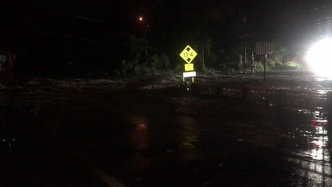


 Flooding continues to be the greatest threat – both from heavy rain and storm surge
 Strong/Damaging winds possible along Barry’s track
 A few tornadoes possible, especially near the coast