 |
 |
The elite are feverishly scrambling to bring everything in line for the implementation of the NEW WORLD ORDER/Great Reset/Agneda 2030/NESARA-GESARA/REGIGN OF THE ANTICHRIST. Why? Because they know that time is short. They know all the Prophecies, they have studied all the ancient texts including the Bible both Old and New Testament as well as all the Apocryphal and lost books. They have been studying the earth and mapping it out for thousands of years. They have been studying human nature and mapping out humanity for just as long. They KNOW what is coming.
We have seen them bombard our skies with atomic bombs, fill the sky with all manner of crafts, spray our atmosphere and stratosphere with numerous concoctions of chemicals and metals, blast the skies above us with an array of energy beams and sound waves. They are not spending all that time and money without cause. And don’t for a moment believe that they are exploring outer space for the good of humanity. NO ONE has ever passed through the firmament!!!
They have been threatening to block out the sun in the name of climate change. It seems that they have found ways to do that without having to take responsibility for it. Using what we know as Natural events or Works of God. Fires and Volcanos. I know most people do not or cannot allow themselves to fathom that is possible. Believe me, it is not only possible, IT IS HAPPENING!!
spacer
This is what the Word of God has to say about the END TIMES (which we are in). Note that early in the timeframe the Sun is given power to scorch men (humanity) with great heat. It is quite possible that we are very close to this event or it has already happened and they are tying to hide it from us.
And I heard a great voice out of the temple saying to the seven angels, Go your ways, and pour out the vials of the wrath of God upon the earth.
And the first went, and poured out his vial upon the earth; and there fell a noisome and grievous sore upon the men which had the mark of the beast, and upon them which worshipped his image.
And the second angel poured out his vial upon the sea; and it became as the blood of a dead man: and every living soul died in the sea. And the third angel poured out his vial upon the rivers and fountains of waters; and they became blood. And I heard the angel of the waters say, Thou art righteous, O Lord, which art, and wast, and shalt be, because thou hast judged thus.For they have shed the blood of saints and prophets, and thou hast given them blood to drink; for they are worthy. 7And I heard another out of the altar say, Even so, Lord God Almighty, true and righteous are thy judgments
And the fourth angel poured out his vial upon the sun; and power was given unto him to scorch men with fire.And men were scorched with great heat, and blasphemed the name of God, which hath power over these plagues: and they repented not to give him glory.
And the fifth angel poured out his vial upon the seat of the beast; and his kingdom was full of darkness; and they gnawed their tongues for pain, And blasphemed the God of heaven because of their pains and their sores, and repented not of their deeds.
And the sixth angel poured out his vial upon the great river Euphrates; and the water thereof was dried up, that the way of the kings of the east might be prepared.
And I saw three unclean spirits like frogs come out of the mouth of the dragon, and out of the mouth of the beast, and out of the mouth of the false prophet. For they are the spirits of devils, working miracles, which go forth unto the kings of the earth and of the whole world, to gather them to the battle of that great day of God Almighty. Behold, I come as a thief. Blessed is he that watcheth, and keepeth his garments, lest he walk naked, and they see his shame. And he gathered them together into a place called in the Hebrew tongue Armageddon.
And the seventh angel poured out his vial into the air; and there came a great voice out of the temple of heaven, from the throne, saying, It is done. And there were voices, and thunders, and lightnings; and there was a great earthquake, such as was not since men were upon the earth, so mighty an earthquake, and so great. And the great city was divided into three parts, and the cities of the nations fell: and great Babylon came in remembrance before God, to give unto her the cup of the wine of the fierceness of his wrath. And every island fled away, and the mountains were not found. And there fell upon men a great hail out of heaven, every stone about the weight of a talent: and men blasphemed God because of the plague of the hail; for the plague thereof was exceeding great. Revelation 16
spacer
If you don’t believe that the rulers have no qualms about killing us with fire, or that they are able to start wildfires from the sky, you need to check out the following posts:
spacer
HELL in PARADISE – Part 1; Part 2; Part 3; Part 4; Part 5:
FIRE
spacer
spacer


As fire season worsens, scientists are exploring a counterintuitive impact of wildfire smoke on the climate.
spacer

A snowstorm in early June 1816 surprised New England, Ontario, and Quebec with a foot of snow. Below-freezing temperatures killed crops throughout the Northeast, forcing thousands of farmers to up and move west in search of warmer pastures. In Europe, the cold air was wetter and soaked the continent for more than 120 of the 150 days of summer; floodwaters displaced thousands. Crop yields in parts of Europe were 75 percent less than normal. With no concept of insurance, and no welfare, the number of people begging in the streets of Europe reached “unmanageable proportions.”
People thought the summer of 1816 was the end of the world. They called it “the Year Without Summer,” “the Poverty Year,” and, memorably, “Eighteen Hundred and Froze to Death.”
Since 2000, some have pointed to global average surface temperatures that haven’t risen as far as computer models predicted as proof that climate change is all a big conspiracy and isn’t happening. Scientists have come up with more plausible theories — including that the heat is disappearing into the oceans, or that the discrepancy is due to volcanic eruptions.
Since 2000, at least seventeen volcanoes have erupted. The emissions from these volcanoes aren’t included in climate models (as we can’t predict in advance when a volcano is going to erupt), so the sun-blocking effect of their aerosols aren’t included in our predictions. A study in Nature attributed about fifteen percent of the difference between predicted and observed warming this century to this effect.
However we can’t rely on this effect to keep us cool in the future. Despite their smaller size, aerosols do eventually drop out of the atmosphere after a few years and fall back to Earth. Once they do, warming continues as it did before.
So why don’t we take advantage of this ‘global dimming’ effect by pumping our own aerosols into the sky? We actually already are — burning coal releases sulphates in the same way that volcanoes do, but the carbon dioxide released at the same time more than outweighs the cooling effect.
Alternatively, some have suggested using balloons, rockets or artillery to deliver large, predictable amounts of sulphates into the atmosphere to trigger the formation of aerosols without carbon dioxide. However, these “geoengineering” approaches are unlikely to work exactly as we expect them to, with climatologists warning that such a “cure” could be worse than the disease.
So the next time that a volcano erupts, think past the rivers of lava. They’ll harden in days. The ash cloud will fall out of the sky within weeks. The biggest effect of volcanoes is in the stratosphere above our heads.
s[acer
The Lord is not slack concerning His promise, as some count slackness, but is longsuffering toward us, not willing that any should perish but that all should come to repentance. But the day of the Lord will come as a thief in the night, in which the heavens will pass away with a great noise, and the elements will melt with fervent heat; both the earth and the works that are in it will be burned up. Therefore, since all these things will be dissolved, what manner of persons ought you to be in holy conduct and godliness, 12looking for and hastening the coming of the day of God, because of which the heavens will be dissolved, being on fire, and the elements will melt with fervent heat? Nevertheless we, according to His promise, look for new heavens and a new earth in which righteousness dwells.
2 Peter 3
spacer
![]()
Lava flows and red alert in Hawaii; Apocalyptic sceneries in New York…
Your daily dose of natural disasters and amazing phenomena for June 7, 2023…
The world is on fire…
Lava flows and red alert… Hawaii’s Kilauea volcano is erupting again in the Halemaumau Crater. The eruption began at around 4.45am today…

 Alert Level: WARNING, Color Code: RED2023-06-07 19:02:22 UTC
Air quality worst ever, fires out of control, eerie haze, Moon turns to blood, end of world imminent, unmarked helicopters, the Lord is coming soon…


Yes! New york city in 2023, everyone wearing mask due to air quality…

In the South and Midwest, 35 million residents are under air quality alerts due to high concentrations of ozone. In more than a dozen states, 65 million people are experiencing poor air quality from smoke due to Canada’s wildfires…

spacer
![]()
spacer
![]()
3.92M subscribers
Critically Important News Articles – Analysis
![]()
1. “The Cities Are Burning”!
NEWS BRIEF: “Radical Enviro Activists: Working With Governments Blowing Smoke Up Our Wazoos“, Canada Free Press, June 7, 2023
“We’ve reached an all-time zenith high in the ongoing government-obsessed Global Warming/Climate Change push ... They’re now willing to burn down entire nations to make their point—come hell or high water.”
Time and time again during the violence from the Left during the past two years, activists would shout, “we are going to burn this place down”!
“… the government and media are blowing forest fire smoke up all of our wazoos.” (Ibid,)
“America/media/EPA scare mongering 101: ‘Canadian wildfire smoke disrupting air quality for millions of Americans: ‘Can travel deep into the lungs’(Fox News, June 6, 2023)”
““The air quality in the New England states may be unhealthy for millions of Americans right now – especially for those with underlying medical conditions – due to a surge in Canadian wildfires in Quebec and northern Ontario … Areas predicted to exceed the federal air quality standard for 24-hour particle pollution level concentrations on June 6 are: Connecticut, Massachusetts, New Hampshire (central, south and western parts of the state), Rhode Island, and Vermont,” the statement reads.”
“That was last week, now it’s not just Nova Scotia endangering the lives of Americans—but all of Canada. How’s this for ‘The Sky is Falling’ scare mongering from Canada’s largest newspaper?”
‘There are dangerous particles in the smoke we’re breathing: ‘It doesn’t seem like any part of the body is safe’
“Generally speaking, for most people, in an isolated incident, where the source of the smoke stops, the symptoms from that smoke irritation clear up after a few days. “But when the exposure to wildfire smoke goes on for extended periods — as seems likely in the near future — those whose systems are compromised suffer even more, and even the young and healthy will begin to develop chronic long-term lung and heart conditions and possibly cancers as well.
In other words, death is the only known-to-man way out of Killer Global Warming.
The Star’s opening paragraph:
“As the skies fill with haze and wildfire smoke turns the moon red, prompting poor air quality warnings over large chunks of Ontario and Quebec, experts are warning that, barring any major climate-change mitigating factors, we may have to get used to this.”
The story ends with:
“The big picture is to find ways of hitting at the root of the problem — mitigating climate change.”
Designed to trigger “Climate Change” efforts, these fires also are planned to continue our discouragement of our current way of life. (Re-wilding)
To understand how thoroughly this wildfire disaster is designed to promote ‘Climate Change’ radicalism, please quickly read these two climate change propaganda write-ups carried by two leading propaganda companies.
NEWS BRIEF: “Under Apocalyptic Skies, Republicans Blow Smoke On Climate Change”, Huffington Post, June 8, 2023
“Tuberville wasn’t the only Republican to use the historic smoke event — a rare phenomenon in cities like New York — to peddle pro-logging talking points while doing somersaults to ignore or downplay the climate change link.
“At a Senate GOP press conference Thursday in Washington, D.C., Sen. Steve Daines (R-Mont.) said East Coasters are getting a taste of the smoky summers that have become the norm out West.
NEWS BRIEF: “The East Coast Is Choking On the Hidden Costs of Climate Change”, MSN Intelligencer, June 8, 2023
“But the worst wildfire season in Canada’s history has given the northeast’s major population centers a taste of the proto-apocalyptic nightmare that Californians call ‘autumn’. For many Americans, the past 48 hours of abysmal air have constituted a uniquely visceral reminder of climate change’s perils. And yet, as the economist Marshall Burke tells Heatmap News, many of the most prominent estimates of the economic costs of climate change fail to account for wildfires at all. Which is unfortunate, since climate change is unquestionably increasing the severity and frequency of wildfires, and the costs of such conflagrations are profound.”
“Never let a good crisis go to waste”! (Marxist Doctrine)
 Re-wilding” is now moving into higher gear in the West Coast as Wildfires fueled by drought and by a total lack of Forest Management are going to burn this Summer very hot and heavy.
And, now, the East Coast is in the cross hairs!
Before you scoff, let me remind you of the words of Jose Argulles, writing in his “25-Year Plan For The Earth”, on which we reported in NEWS1028, “1997 — The Year The New World Order Plan Changes Ominously“. Arguelles calls for a “5-year phase-out of our industrial civilization“, to be implemented by the United Nations!
This 5-year plan will be “Known as the Era of Reseeding, it will thin out major population centers. The human population will be resettled.” [“Progress As If Survival Mattered”, Friends of the Earth: 1981, p. 68-70, quoting David Brower, Friends of the Earth Chairman, former head of Sierra Club, as quoted in “A Planned Deception: The Staging of a New Age ‘Messiah‘, by Constance E. Cumbey, Pointe Publishers, Inc., East Detroit, MI, 1985, p. 164-5.]
Did you catch that last statement? The human population WILL BE resettled. Major population centers WILL BE thinned out.
Now, one of the most effective means to persuade people to leave is to drive them out using a variety of means. One of the most effective methods is to drive them out with a massive fire that cannot be controlled; for the past 40 years, the entire Western Coast has not practiced normal and established Forest Management practices, especially clearing of dead brush.
Now, Western forests are full of dead brush combustible fuel which, once started, CANNOT BE CONTROLLED! EVEN IF THE FIRE IS COMING AT A MAJOR CITY!
spacer
![]()

- Canadian National Forestry Database (CNFD) statistics do not support the White House’s assertion that the ongoing Canadian wildfires are attributable to climate change.
- White House Press Secretary Karine Jean-Pierre said that the smoke over much of the eastern U.S. “is yet another alarming example of the ways in which the climate crisis is disturbing our lives and our communities” in remarks delivered Wednesday.
- A 2021 assessment report from the United Nations Intergovernmental Panel on Climate Change (IPCC) concluded with “medium confidence” that “climate change is playing an increasing role in determining wildfire regimes alongside human activity.”
Official datasets and studies undermine assertions from the White House that the major forest fires raging in Canada are directly attributable to climate change.
Smoke from the fires continues to envelop the skies of large portions of the American Northeast and Midwest, according to the National Weather Service. White House Press Secretary Karine Jean-Pierre said that the smoky haze “is yet another alarming example of the ways in which the climate crisis is disturbing our lives and our communities” on Wednesday in remarks to reporters, but data from the Canadian National Forestry Database (CNFD) and the United Nations Intergovernmental Panel on Climate Change (IPCC) does not support this assertion.
Several prominent media outlets have matched the White House’s narrative. The Washington Post, ABC News, The Guardian, and The New York Times all published articles on Wednesday and Thursday which were similar to Jean-Pierre’s statements pertaining to the link between climate change and the Canadian wildfires.
CNFD data shows that the frequency of Canadian forest fires has demonstrated a trend of general decrease since 1990, the first year on record on the CNFD website. The general decrease in Canadian forest fire frequency is accompanied by an approximately 18% increase in global concentration of atmospheric carbon dioxide over the course of the same time period, according to data from Statista.
Climate scientists frequently point to increasing atmospheric carbon dioxide concentrations as a quantifiable indicator of global warming caused by human activity, according to the National Oceanic and Atmospheric Association.
"I know for many communities out West, this is nothing new. They experience this every year, but it is certainly getting worse. It is yet another alarming example of the ways in which the climate crisis is disturbing our lives and our communities." —@PressSec on air quality pic.twitter.com/47RIl3My2l
— Climate Power (@ClimatePower) June 7, 2023
The 2021 assessment report from the United Nations Intergovernmental Panel on Climate Change (IPCC) did not project eastern Canada to become more prone to fire outbreaks under any future climate scenario, even its worst-case models. The researchers who authored the report concluded with “medium confidence” that “climate change is playing an increasing role in determining wildfire regimes alongside human activity,” and reported “low confidence” that “fire weather seasons have lengthened globally between 1979 and 2013.”
The same report concluded with “high confidence” that “global land area burned has declined in recent decades.”
|
|


Check out this almost unbelievable time-lapse of wildfire smoke consuming the World Trade Center and the New York City skyline.
Those vulnerable to poor air quality, including seniors and young children, should limit time outdoors if possible.
More: https://t.co/ChRuWv7X6E pic.twitter.com/mtKtLun8lN
— NWS New York NY (@NWSNewYorkNY) June 7, 2023
Canadian Minister of Emergency Preparedness Bill Blair stated during a press conference on Wednesday that 414 wild fires continued to burn across Canada with 239 classified as “out of control.” The fires had burned 3.8 million hectares of land and forced the evacuation of more than 20,000 Canadian residents as of Wednesday afternoon, according to Blair.
The onset of the smoky haze in the eastern region of the U.S. forced various health administrations to issue air quality alerts to residents of affected areas and cities, including Detroit, Philadelphia, New York City, and Washington, D.C. The haze has caused numerous other disruptions including the cancellation of professional sporting events on Wednesday, according to the Associated Press.
A representative from the Eastern Region Headquarters of the National Weather Service told the Daily Caller News Foundation Wednesday afternoon that the haze is unlikely to subside completely in all affected regions until at least the end of the upcoming weekend.
Neither the White House nor Adams’s office responded immediately to the Daily Caller News Foundation’s requests for comment.
spacer
![]()
621K subscribers
spacer
Red flag warnings issued in 5 states: See wildfire, smoke map of US, Canada
 Francisco Guzman
Five states were under red flag warnings Tuesday due to hot, dry and unstable conditions, the National Weather Service said.
Parts of Pennsylvania, New Jersey, Michigan, Washington and Alaska will remain under the warning until 8-10 p.m. local time, the weather service said.
In Pennsylvania, lightning strikes may cause fires to start in dry areas. In Washington, dry and unstable air mass with warm temperatures could contribute to a fire.
“Be careful with any activities that could potentially lead to a wildfire,” the weather service warned Michigan residents. “Camping, outdoor grills, smoking materials, chain saws and all-terrain vehicles all have the potential to throw a spark and ignite a dangerous and destructive fire.”
What is a red flag warning?
The weather service issues a “red flag warning” when weather conditions in an area are ripe for the spread of wildfires due to a combination of strong winds, low relative humidity and dry fuels.
“Any fires that develop will likely spread quickly,” the weather service said. “Outdoor burning is not recommended.”
Wildfires in Canada affecting air quality in US
Millions of Americans are exposed to unsafe air quality levels as eastern Canada experiences one of its worst reported wildfire seasons, officials said last week.
The weather service issued air quality alerts to several U.S. states warning “sensitive groups” such as older adults, children and those with preexisting respiratory conditions like asthma to limit prolonged or strenuous outdoor activity.
Air pollution increases the risk of respiratory infections, heart disease and lung cancer, according to the World Health Organization.
Wildfire, smoke map for US, Canada
US Air Quality Index
spacer


spacer


A TYPE ONE CIVILIZATION (a BUCK ROGERS TYPE OF SYSTEM) “HARNESSED IT’S PLANETARY POWER, THEY CONTROL EARTHQUAKES, THE WEATHER, VOLCANOES. THEY HAVE CITIES ON THE OCEAN. ANYTHING PLANETARY THEY CONTROL.
That is TYPE 1.
A TYPE THREE CIVILIZATION (EMPIRE FROM STAR WARS) POWERED BY BILLIONS OF STARS.
spacer
![]()
843K subscribers
spacer
MAYON Volcano Update: Alert Level Raised, Rockfalls Increase
spacer
Watch Hawaii’s Kilauea Volcano Erupt After A Three-Month Pause/Insider News
spacer
The Most Dangerous Volcano Of All Time JUST CRACKED OPEN THE EARTH!
spacer

spacer
Lava flow from Big Ben on Heard Island about 4,100km south-west of Perth part of eruption first noted more than a decade ago
One of Australia’s two active volcanoes on an island near Antarctica – known as Big Ben – has been spotted by satellite spewing lava.
The lava flow on the uninhabited Heard Island, about 4,100 kilometres south-west of Perth and 1,500km north of Antarctica, is part of an ongoing eruption that was first noted more than a decade ago.
spacer
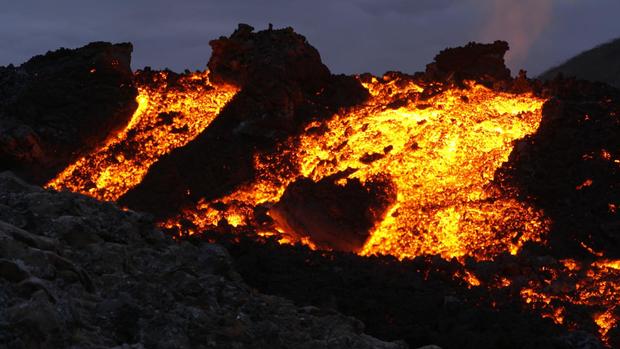
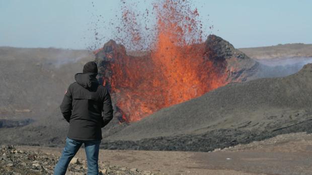
Horrible Today: (June 9, 2023) 2nd eruption of icelandic volcano unstoppable lava hell
spacer

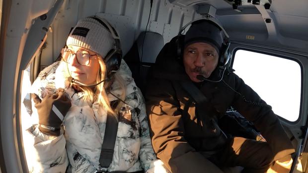
Bill Whitaker: Wow. This is remarkable.
Kristin Jonsdottir: Completely changed
Bill Whitaker: Completely changed
Bill Whitaker: How much lava is out here?
Kristin Jonsdottir: So the maximum thickness is about 100 meters and it is the thickest by the crater
Bill Whitaker: That’s a little more than 300 feet deep
Kristin Jonsdottir: Yes
Bill Whitaker: That’s incredible
Lava had filled up the valley like a bathtub. The hills where Icelanders came for a closer look were gone. So was its tongue-twisting icelandic name. Now, we had to learn a new one.
Kristin Jonsdottir: So the whole mass that you see behind here is called Fagradalsfjall.
Bill Whitaker: Fagradalsfjall
Kristin Jonsdottir: Very good, excellent
That means “Beautiful Valley Mountain” – a lot easier to pronounce. A new name for a new landscape. Jonsdottir, head of earth sciences at Iceland’s Meteorological Office, told us the 2021 eruptions were highly unusual. The quake storms that usually reach a crescendo before an eruption, instead went silent. The tremors stopped. Only then did the volcano explode.
Kristin Jonsdottir: So this was something we didn’t expect because before most eruptions, we see an escalation in the process. So we see more and bigger earthquakes the closer we–we come to an eruption.
Bill Whitaker: And what did you find this time?
Kristin Jonsdottir: Everything got quiet. And we thought, okay, maybe this is it. We’re not going to see an eruption this time. But we were wrong.
The magma bomb lasted six months. Then this past August, the volcano exploded again. This time scientists weren’t fooled. When the earthquakes stopped, they ran tests that showed the volcano wasn’t sleeping, rocks were still moving, gas escaping. Scientists called an audible – and warned the volcano would likely blow within 24 hours. They were right.
Today, the crater is still cooling. It’s quiet…for now.
Bill Whitaker: Look at that
Kristin Jonsdottir: Wow
Bill Whitaker: You remember when we flew around the plume, the fountain?
Kristin Jonsdottir: I remember. I didn’t feel as safe at that point.
In 2021 we had to veer away from the crater; it was too dangerous to get any closer.
Kristin Jonsdottir: This feels much safer.
Bill Whitaker: So do you think the eruption here is completely over?
Kristin Jonsdottir: Right now, we are not seeing anything, but we also know that this can happen quite quickly. The warning time we have is not necessarily gonna be many weeks, but maybe just a couple of days.
The lava field is like a record of the eruption. So, we set off at the crack of dawn – that’s an hour before noon—when the winter sun rises this far north. Soon we ran out of road. Then we ran out of steam. Our trucks had 42-inch tires but that was no match for snow that was as fine as sugar. Finally, we arrived to find a vast sea of volcanic rock just six months old. Geophysicist Freysteinn Sigmundsson from the University of Iceland gave us a tour.
Bill Whitaker: It is freezing out here, but this – this is warm, huh?
Freysteinn Sigmundsson: Yeah, feel it. This is the heat of the lava.
Bill Whitaker: Look at that
Freysteinn Sigmundsson told us if we dug just 10 feet below where we were standing, we’d find molten rock still at a scorching 1,800 degrees.
Freysteinn Sigmundsson: The heat is still coming out, and it will be for for a number of years.
Bill Whitaker: But even with this the temperatures here, it’s gonna take years for this to cool down?
Freysteinn Sigmundsson: Yes, yes, it—it will.
Bill Whitaker: It’s that hot?
Freysteinn Sigmundsson: It is that hot and thick.
Bill Whitaker: Incredible.
Sigmundsson told us these eruptions had spewed out the largest mix of lavas ever recorded. They cooled in different shapes. Some were as smooth as sidewalk, gnarled like roots, or stretched taut like rope.
Freysteinn Sigmundsson: Yeah, we call it lava cables. I would say this is maybe one of the best places on planet Earth to see these lava cables here.
Freysteinn Sigmundsson told us he now wants to find out if their most recent finding – a seismic decline before an eruption – might apply to similar volcanoes in Japan, Russia, or the United States. It’s urgent to do so, he told us, as warmer temperatures melt the glaciers that sit like a pressurized lid on many of the world’s most volatile volcanoes.
Bill Whitaker: So the retreating glaciers have an effect on the volcanoes?
Freysteinn Sigmundsson: Yes. Retreating glaciers can increase the possibility of eruptions.
Bill Whitaker: How so?
Freysteinn Sigmundsson: The glaciers, they are pushing down on—on the earth. There’s a force. So, if–if the glaciers are moving, it changes the force. Already the retreat of glaciers in Iceland, they are causing a lot more of new magma being formed under Iceland than normally.
With this new magma came new discoveries. In 2021, Ed Marshall, a Texas- trained geophysicist, showed us the lava wall when it was a mere 30 feet high. We watched as he scooped the molten lava, flash cooling it in water. This trip, we met Marshall in his lab at the University of Iceland to see what he had found.
Ed Marshall: We have an instrument called an ICPOES
Bill Whitaker: And that stands for?
Ed Marshall: It’s an Inductively Coupled Plasma Optical Emissions Spectrometer
Bill Whitaker: OK.
The impossibly named machine is able to measure with pinpoint accuracy the chemical composition of the rock. But Marshall wasn’t expecting what they found next: crystals.
Bill Whitaker: So what did you learn from these?
Ed Marshall: Well, we learned that they’re coming from nine miles deep below the volcano.
Bill Whitaker: Nine miles down?
Ed Marshall: Mhm it’s actually coming from a part of the Earth that we don’t normally get to sample: the boundary between the crust and mantle.
The magma had come straight up like an express elevator from deep in the mantle, opening a rare window into the earth’s deep plumbing. Geophysicist Ed Marshall showed us samples of the different lavas he’s collected.
Ed Marshall: So here we have a different kind of lava, called a pahoehoe lava.
Bill Whitaker: It’s much smoother
Ed Marshall: Yeah
When the lavas were still red hot they flowed at different speeds, some oozed out of the volcano, others exploded, moving as fast as 10 miles an hour.
Ed Marshall: It’s important to figure it out because they have different hazard potential. You know, if you’re worried about your town being covered by lava –
Bill Whitaker: You’re more worried about this one
Ed Marshall: Exactly.
Like so many other volcanologists who’d rushed to the eruption site in 2021, this self-described lab rat told us he was awed by the sheer power on display.
Ed Marshall: You know you have work to do but there are times when you just sit there and stare at the volcano. It’s just so much grander than you, it’s kind of this almost divine kind of presence.
Every volcano, as we learned, has its own personality. If Fagradalsfjall had elements of the divine, others were not as beatific. Take Grimsvotn, routinely described as cranky. Overdue for an eruption, Grimsvotn is hidden beneath a glacier making it almost impossible to monitor. So, seismologist Kristin Jonsdottir, and her European partners, tried something new – burying a coil of fiber optic cables in the ice cap.
Kristin Jonsdottir: So the cable we used was only four millimeters thick — and so thin they’re actually thinner than a human hair. Yeah, it’s a bit funny, you know, it’s like you’re trenching a very, 13-kilometer long hair along a volcano.
They devised a make-shift trenching sled to bury the cable to try to pick up volcanic tremors. It worked. Where regular seismometers barely registered a pulse, the fiber optic cable showed Grimsvotn was grumbling irritably inside its icy tomb. Jonsdottir told us it could be a game-changer.
Bill Whitaker: And you found how many more earthquakes?
Kristin Jonsdottir: 100 times more
Bill Whitaker: Found with this fiber?
Kristin Jonsdottir: Yes
Bill Whitaker: Did you find something in the pattern here that you could say ‘ah, if we see this, this indicates that an eruption is going to happen?’
Kristin Jonsdottir: So the potential here is really to be able to understand the volcanoes and the plumbing system you know just being able to see this high-definition picture that we were not able to see before.
Bill Whitaker: And this is just standard cable? The cable that we use for bringing television into our homes?
Kristin Jonsdottir: Exactly.
But Iceland is one of the few places in the world to actively watch its volcanoes. The lack of monitoring elsewhere can sometimes spell disaster, like the 2018 bang out of the blue in Indonesia that killed 400 people. Cornell geophysicist Matthew Pritchard told us they’ve got to do a better job.
Matthew Pritchard: So there are about 600 that have erupted in historic times, the last 500 years. And of those, only about 35% have continuous monitoring at them.
Bill Whitaker: What’s the problem?
Matthew Pritchard: Well, its expense, it’s maintaining these instruments. Again, if once a volcano stops erupting you know, should we continue to monitor, or is it gone to sleep for another couple hundred years? So, it’s all a question of priorities. It’s a question of resources.
But Pritchard told us there’s a solution on hand – spying on volcanoes from space. He’s spearheading an effort to establish a satellite network that will continuously monitor the world’s most restless volcanoes. Take Mauna Loa in Hawaii. This past November, it tore open the earth after 38 years of slumber. On the ground, magma forced its way through deep layers of rock until it cracked the earth’s surface. From space, it looked like this.
Matthew Pritchard: So each one of these contours here means 25 centimeters of ground motion. So on this side of the rift, it moved this way about 25 centimeters and then this side, in the opposite direction. And so, this is evidence of the magma coming up through the system and pushing the ground to the side as it was – coming out to erupt.
Bill Whitaker: And all of this captured by satellite?
Matthew Pritchard: Yes.
Bill Whitaker: The satellite can detect what level of movement on the surface of the Earth?
Matthew Pritchard: Best case scenario, a few millimeters.
Bill Whitaker: A few millimeters?
Matthew Pritchard: That’s right.
Bill Whitaker: From space?
Matthew Pritchard: That’s right.
Cornell’s Pritchard told us the new gold standard would be to combine ground sensors with satellite images to help detect eruptions earlier. Next year, a new satellite will be launched that will use radar waves capable of penetrating dense jungle, or snow, and seeing deeper underground than ever before. But as technology turbocharges the ability of volcanologists to forecast eruptions, we were reminded that the earth has been at this far longer than scientists have been collecting data. and that, one told us, keeps you humble.
Produced by Heather Abbott. Associate Producer, LaCrai Mitchell. Broadcast Associate, Natalie Breitkopf. Edited by Craig Crawford.
spacer

The Madness of Cooling A Cooling Planet

spacerr
We are into our third spring month, and it is still snowing in the northern hemisphere, yet the madmen ruling the planet will not let the media inform the people that the climate experts were wrong about man-made global warming. Earth is facing a deep freeze, and solar scientists are warning us that this cooling, which has accelerated dramatically this year, will continue for several decades.
We will only care about climate change when we start to go hungry because of the cold weather. The endless winter is again shortening the growing season. The extension of winter this late into the spring will drive already soaring food prices into the stratosphere. It is May 10, and it is still snowing, and another vast cold front moves as far south as Florida.
The trillions spent on the pandemic could have all gone into vertical farming and other technologies to mitigate crop losses, thus saving millions of more lives in the hungry future that is coming our way. The common sense that the longer you ignore a problem, the more it will grow applies to a cooling planet and the damage it will do to our food supply.
Though there are many madmen in the world, there is only one mad enough to cool a cooling planet. Bill Gates is probably the most dangerous man on Earth, and there seems to be little anyone can do about it. He is a target that no one can hit, but Tucker Carlson certainly took a shot at him and what he wants to do to the Earth. I think Tucker is right. Gates has a God complex worse than any Guru that has walked the planet. What Tucker does not say that his plan to cool the Earth is a global suicidal project because the Earth is already cooling on its own.
spacer
Bill Gates backs project to “dim the sun”, Tucker Carlson reacts
In a TED talk, Gates comes right out with a formula that is best resolved if there are no people, no one using carbon, no one with a carbon footprint. In reality, Bill Gates lost his marbles over CO2, making it into an evil gas when it is one of the essential life-giving gases on the planet.
Our life and health depend on high enough levels of CO2 in the blood and tissues. Carbon dioxide is a nutrient and a product of respiration and energy production in the cells, and its lack or deficiency is a starting point for disturbances in the body. Plants certainly love CO2. CO2 deficiencies equate with bicarbonate deficiencies, which relate to acid, low cell voltage, and low oxygen conditions.

World temperatures have generally been declining for about ten years while CO2 is rising rapidly,” writes famous weatherman Piers Corbyn, an astrophysicist.
“Carbon dioxide does not drive climate,” says Piers flatly. “The idea CO2 controls climate, and that man’s CO2 particularly controls climate, is delusional nonsense. There is no evidence for this in real data. Temperature changes in the oceans, in the long run, drive carbon dioxide levels, so they tend to move together.”
German Study Shows Added CO2 Has Led To 14% More Vegetation Over Past 100 Years!
 Gates, in his almighty vision, plans to dim the sun. If Bill Gates got his way in terms of climate, the only people left alive would be living in self-supporting underground shelters. Perhaps on or near the Equator, people would still survive above ground, but no one knows how profound the devastation would be if they blocked the sunlight on a cooling planet. Netflix even has a series called Tomorrows Express about a vast train of Earth survivors that goes round and round the globe. Everyone else is dead from the cold.
Micheal Shellenberger, the author of Apocalypse Never, the guest on the Tucker Carlson show above, says that Gates is well-intentioned. I earnestly beg to differ with him.
I do not know why Gates thinks we need to spend billions on cooling the atmosphere when we have plenty of volcanos doing that for us. Just look at the satellite images of the ash plume from St. Vincent as it spreads over the Atlantic and reaches Africa.

The sunsets in a sky dusted with ash over Màrdalsjškull, 20 km east from Iceland’s Eyjafjoell volcano, on May 5, 2010
The U.N. says the world is ‘on the verge of the abyss’ that if we do not do something, we are finished and will fry in the frying pan. I think it is interesting that this late in the climate game that they would risk their long-term reputation on such a gigantic lie.
Bill Gates Does No Know When To Shut Up

RT News reported that social media users are recoiling at Bill Gates’ call for a global disease alert system, questioning why a tech billionaire with no medical expertise or elected office is plotting what they fear could become a platform for tyranny.
The Microsoft co-founder, who ranks as the world’s third-richest person, took to Twitter to make his pitch for a new system that he said would help prevent future pandemics. This would include “mega testing diagnostic platforms” that could test 20 percent of the population every week, Gates said in a video promoting his plans. He added that future treatments, such as monoclonal antibodies, and vaccines would be developed far faster in response to future disease outbreaks.
Nick Hudson, the co-founder of PANDA (Pandemics – Data and Analytics), comes to the devastating conclusion that every single element of the Covid narrative has been false. “The narrative says that there’s a deadly virus spreading across the planet, that nobody’s immune to it, and there’s no cure. Even asymptomatic people can spread it and are major drivers of the epidemic of disease. And unless we lock down and wear our masks, until vaccines arrive and everybody gets vaccinated, we’re all going to die. And anybody who challenges this narrative is a lunatic, a menace, a danger to society, hence the suppression.”
Along with Dr. Fauci, Bill Gates is at the head of the mainstream narrative, and both he and his now ex-wife are all for censorship. His money gets him everything, even the right to put down the leading lights in infectious diseases and epidemiology, Nobel Laureates. But his money does not make him right.
Conclusion
Margaret Thatcher expressed the fatal flaw of consensus thinking beautifully: She wrote, “Consensus seems to be the process of abandoning all beliefs, principles, values, and policies in search of something in which no one believes, but to which no one objects.”
The Truth Machine, a book co-written by Michael Casey, a senior advisor at MIT Media Lab’s Digital Currency Initiative, and Paul Vigna, a reporter at the Wall Street Journal, makes it clear that the basis of all civilizational activity, whether it be economic or social, is trust. Bill Gates deserves absolutely none of our trust. Neither does the press or the vast majority of our politicians.
If one is interested in some climate science, watch this interesting video.
spacer
How Ice Ages Happen: The Milankovitch Cycles
CONCLUSION:
The TRUTH is that GOD created the World in PERFECT BALANCE. Everything He created contains within itself the ability to HEAL. All things were created to work together. Whether you think the world is heating up or cooling down…there is NO NEED TO FEAR! GOD IS IN CONTROL, evidenced by the fact that everything is playing out EXACTLY as it was declared to us in HIS WORD!!
TURN YOUR HEART TO HIM AND KEEP LOOKING UP! THE LORD IS DRAWING NEAR!
spacer