WAVE ON WAVE – Communication via Light

Communication what a complex, multi-faceted Word. It is so vital to our existence and so core to our relationships.

Communication simply put is a verbal or written exchange.  I talk, you listen.  You talk, I listen.  Both parties are intently involved in the process.

Originally the only way to communicate was to be face to face with someone.  There you could use eye contact, facial expressions, sounds and gestures to exchange feelings, and information.   The limitation with this form of communication was that it is only functional face to face.  God gave us language, which enables us to leave messages for those who are not present and to send written messages to those far away.  The written word has beauty and form.  It comes from the hand of the writer, so that energy flows through to the receiver.

There is some kind of power in the written word.  The actual physical act of writing causes our brains and our emotions to process the words as we write.  The thoughts and emotions that are formed flow onto the paper.  It is a very powerful form of communication.

In our modern, technological society, though we are able to communicate across further distances than ever before and more rapidly.  The quality, spirit and essence of real communication has been lost.

It seems funny to me that the thing they create to overcome the language barrier set up by GOD, has created its own kind of Babel.  Yes, words and images are going forth at breakneck speeds.  “Knowledge” is being revealed on a daily basis.  Decisions are being made, transactions completed, contracts being signed and interactions generated.  However, the heart, soul and spiritual depth of real communication seems to elude us.

The world we live in is getting smaller, yet we are becoming more and more lost, confused and isolated.  The world becomes more terrifying every day.  We know so much but understand so little.

WHAT HAPPENED??

Since the first government was formed, all governments have been focused on control.  Many methods have been applied over the thousands of years.  FEAR is always the main tool for control.  Fear of death, fear of sickness, fear of loss, fear of starving, fear of isolation, etc…   Governments have been using our own minds against us all along.  There is NOTHING NEW UNDER THE SUN.  I am pretty convinced that even the “amazing technology” we have today is not new.  I have seen enough evidence to believe that the Ancients had it all.  Which should not surprise anyone who knows that the Fallen Angels provided mankind with the knowledge they had. Fallen Angels are still working in the world today.

Ecclesiastes 1:9 

9 What has been will be again, what has been done will be done again; there is nothing new under the sun.
10 Is there anything of which one can say, “Look! This is something new”? It was here already, long ago; it was here before our time.
11 No one remembers the former generations, and even those yet to come will not be remembered by those who follow them.
Our own government is no different, they are all the same.

government (n.)

late 14c., governement, “act of governing or ruling;” 1550s, “system by which a thing is governed” (especially a state), from Old French governement control, direction, administration” (Modern French gouvernement), from governer “to steer, be at the helm of; govern, rule, command, direct,” from Latin gubernare “to direct, rule, guide, govern,” originally “to steer, to pilot”(see govern). The meaning “the governing power” in a given place is from 1702. Compare governance.

also from late 14c.
– ment  Etymology 1[edit]

Inherited from Old Catalan ment, from Latin mentem (mind), from Proto-Indo-European *méntis (thought).

Noun

ment f (plural ments)

  1. the mind
  2. the spirit
Related terms[edit]

The word Government actually means mind control. It is etymologically originated from the ancient Latin language. It Splits into two words:1) (guvernare) meaning “to control” and 2) (mens or mentis) meaning “mind”. SO GOVERNMENT MEANS “TO CONTROL THE MIND” It was always about slavery, then they realised it was easier to control us if we believed we were free so they tricked us and we fell for it. “If voting made a difference they wouldn’t let you do it” ; Mark Twain.       Source

spacer

Waves, Rays and Energy Beams what are they really Up To?

Satan’s Latest Weapon in the Battle for Your Mind – Part 4 – ElectroMagnetic Manipulation

LIGHT is LIFE – But They Are Using it to KILL US!

DIRECTED ENERGY WEAPONS, FREQUENCIES and YOU!

spacer

The government has been working very hard to dumb us down.  People think that we are so much smarter today.  But the truth is that those who have gone before us were much smarter.  If you read some writings from the Revolutionary war, you will have no doubt that they had a much greater command of language and much better understanding of life.

I was shocked when I learned that they had stopped teaching cursive writing in school. Now they do not even teach writing, as it is “out of date”.  In fact, they do not even teach reading, history or math.   Most of our young adults could not make change if their life depended on it.  They cannot work simple Math because they depend on their devices for that.  I doubt many young people ever read a book.  Especially not the Word of God.  And HISTORY has been so dumbed down and rewritten they don’t have a clue as to who they are, where they came from or what has occurred in the past.  The focus in today’s schools is today’s society.  The hive mind, inclusivity, all manner of perversion, and communism/socialism.  Drilled into their heads night and day.  Most of their time in school is spent teaching them how to pass the governments tests so the schools can get their money.  They actually teach them how to guess successfully and how to cheat, rather than learning the right answers.  Thanks to no child left behind, kids don’t even do their homework, because they know there will be no consequence.  No one is allowed to fail.
spacer

Writing by hand may increase brain connectivity more than typing, readings of student brains suggest

After recording the brain activity of university students, researchers in Norway determined that writing by hand may improve learning and memory.
Study participant wearing a device on head.

A participant in the Norway study.Courtesy NTNU

Typing may be faster than writing by hand, but it’s less stimulating for the brain, according to research published Friday in the journal Frontiers in Psychology.

After recording the brain activity of 36 university students, researchers at the Norwegian University of Science and Technology determined that handwriting might improve learning and memory.

At the start of the experiment, the students were told to either write words in cursive using a digital pen on a touchscreen, or to type the same words using a keyboard. When a word such as “forest” or “hedgehog” appeared on a screen in front of them, they had 25 seconds to write or type it over and over.

Meanwhile, a cap of sensors on their head measured their brain waves. The cap’s 256 electrodes attached to the scalp and recorded the electrical signals of the students’ brains, including where brain cells were active and how parts of the brain communicated with each other.

Our main finding was that handwriting activates almost the whole brain as compared to typewriting, which hardly activates the brain as such. The brain is not challenged very much when it’s pressing keys on a keyboard as opposed to when it’s forming those letters by hand,” said Audrey van der Meer, the study’s co-author and a neuropsychology professor at NTNU.

In particular, the study found that writing by hand required communication between the brain’s visual, sensory and motor cortices. People who wrote with the digital pen had to visualize letters, then use their fine motor skills to control their movement when writing.

When you have to form letters by hand, an ‘A’ will look completely different than a ‘B’ and requires a completely different movement pattern,” van der Meer said.

By contrast, when typing, the keys look mostly the same, regardless of the letter. As a result, the study found, typing required less brain activity in the visual and motor cortices.

Because only small parts of the brain are active during typewriting, there is no need for the brain to communicate between different areas,” van der Meer said.

Van der Meer’s previous research in children and young adults similarly found that people’s brains are more active while writing by hand than while typing. 2017 study from Indiana University also indicated that writing by hand could link visual and motor skills, which might help kids better recognize letters.

But so far, there’s mixed evidence as to whether taking notes on paper versus a laptop can help people remember and understand information better in the classroom or raise their performance on tests.

It’s also hard to know whether or how the brain activity in the new study might translate into real-life improvements in learning or memory, said Ramesh Balasubramaniam, a neuroscientist at the University of California, Merced, who wasn’t involved in the research.

Balasubramaniam said older adults might also see cognitive benefits from handwriting, “but I think the largest benefits are when the brain is still developing, because it kind of coincides with other major learning processes that are happening.

In the United States, the Common Core set of academic standards, adopted by most states, calls for kids to learn handwriting in kindergarten and first grade. It also sets typing milestones for fourth, fifth and sixth graders.

Kids are currently being taught handwriting. They will always be taught handwriting. How much they actually use handwriting is going to be a mixture of their own personal preferences and then the expectations of the classrooms that they’re in,” said Morgan Polikoff, an associate professor of education at USC Rossier School of Education.

Writing by hand can be more beneficial for some children than others, he added.

Some kids maybe have fine motor issues, so handwriting will be a challenge for them,” Polikoff said. On the other hand, “there’s some evidence that handwriting, especially cursive handwriting, works especially well for students with dyslexia.”

The U.S. has seen some political pressure to require cursive in schools. California, for example, passed a law last year mandating that public school teachers give some cursive instruction from first through sixth grade. Polikoff estimated that roughly 20 states have some sort of cursive requirement.

But scientists don’t know if cursive offers any additional cognitive benefits over writing in print.

Polikoff said some people support teaching cursive simply because historical documents were written that way, people traditionally sign their names in cursive or just that “it’s a lovely dying art.”

On the other hand, van der Meer said she’s often “accused of wanting to go back to the Stone Age” by advocating for students to write by hand in schools. Both handwriting and typing should have a place in the classroom, she said.

We live in a digital world and the digital world is here to stay,” van der Meer said. “If you have to write a long essay or a long text, then obviously it’s much better to use a computer.”
spacer

The governments of the world have plenty of available resources to ensure that the masses are controlled and compliant.  In this post we will look at some of those resources.  Remembering as we go that they conceal everything from public scrutiny.  THEY LIE to you, and you believe them, because it is more comfortable than looking at the truth.

spacer
If you have not seen the following related post, check it out.

spacer

Millions Could Be Washed Away

spacer

spacer

Radio Waves

Radio waves are a type of electromagnetic radiation. A radio wave has a much longer wavelength than visible light. Humans use radio waves extensively for communications.

Black and white radio tower with clouds in Harrisonburg, VA on James Madison University's campus.
This radio tower has both rectangular and circular antennas to transmit and receive radio frequency energy.

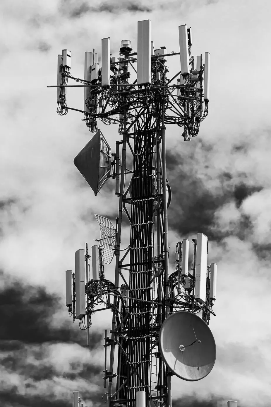
Photo by Christina Telep on Unsplash

The wavelengths of radio waves range from a few millimeters (tenths of inches) to hundreds of kilometers (hundreds of miles). Visible light, for comparison, has wavelengths in the 400 to 700 nanometer range, about 5,000 times shorter than the shortest wavelength radio waves. Radio waves oscillate at frequencies between a few kilohertz (kHz or thousands of hertz) and a few terahertz (THz or 1012 hertz). “Far infrared” radiation borders radio waves along the electromagnetic spectrum and has slightly higher energy and shorter wavelengths than radio waves.

Microwaves are short wavelength radio waves which we use for cooking and for communication. Microwaves have wavelengths between a few millimeters and tens of centimeters (tenths of inches to tens of inches).

Various frequencies of radio waves are used for television and FM and AM radio broadcasts, military communications, mobile phones, ham radio, wireless computer networks, and numerous other communications applications.

Most radio waves pass freely through Earth’s atmosphere. However, some frequencies can be reflected or absorbed by the charged particles in the ionosphere.

© 2018 UCAR with portions adapted from Windows to the Universe (© 2005 NESTA)

spacer

Asked 
Viewed 528 times
I am just wondering if radio waves are naturally produced. If so how?
  • Switch on your AM radio set (if you still have one in this digital age, otherwise ask your father), tune it to where there is no broadcast signal and listen if there is a thunderstorm somewhere in the distance.

    – user137289

    Oct 23, 2019 at 17:49

radio waves of various wavelengths are produced by processes on earth (lightning bolts), in the sun (interactions between charged particle movement and magnetic fields), in some gas giant planets like jupiter (lightning bolts again), and in the cores of active galaxies (synchrotron radiation and other modes).

Naturally-occurring radio waves furnish the basis of radioastronomy and there are radio telescopes all around the world that are used to map the cosmos in radio frequencies. A search on these terms will return lots of information on this topic.

answered Oct 23, 2019 at 17:43
Lightnings produce low frequency radio waves.

From Wikipedia: Whistler (radio):

A whistler is a very low frequency or VLF electromagnetic (radio) wave generated by lightning. Frequencies of terrestrial whistlers are 1 kHz to 30 kHz, with a maximum amplitude usually at 3 kHz to 5 kHz. […] They are produced by lightning strikes (mostly intracloud and return-path) where the impulse travels along the Earth’s magnetic field lines from one hemisphere to the other. […]

spacer

spacer

THE GROUND WAVE EMERGENCY NETWORK 

Electromagnetic Control

It is known the toxic soup of electo-magnetic waves already in place through power lines, cell towers, WiFi, radio, television and a host of other broadcasting devices has a seriously deleterious effect on human health and mental well being.


When I saw the map and I could not help but see the following:


Scripture: John 3:8, Revelation 12:9, Isaiah 14:12
Date: 03/15/2006

The Nation’s system that the military is in the process of constructing as we speak. It operates in the very-low-frequency (VLF) range, with transmissions between 150 and 175 kHz. This range was selected because its signals travel by means of waves that have a tendency to hug the ground rather than by radiating into the atmosphere. This signal drops off sharply with distancea single GWEN stations transmits in a 360 circle to a distance of 250 to 300 miles. The entire GWEN system consists of approximately 300 such stations spread across the United States, each with a tower 300-500 feet high. The stations are from 200 to 250 miles apart, so that a signal can go from coast to coast from one station to another. When the system is completed around 1993, the entire civilian population of the United States will be exposed to the GWEN Transmissions. Read Appendix 4 and then re-read this section.

I. APPLICATION OF MILITARY FREQUENCY WEAPONRY
According to a 1982 Air Force review of biotechnology, ELF has a number of potential military uses, including “dealing with terrorist groups, crowd control, controlling breaches of security at military installations, and antipersonnel techniques in tactical warfare.” The same report states:
“Electromagnetic systems would be used to produce mild to severe physiological disruption or perceptual dis- tortion or disorientation. They are silent, and counter- measures to them may be difficult to develop.”
Between 1980 and 1984 I was in England, and I got to see some illustrations of how some of this technology actually works. During this period, there were a lot of protests, sit-ins and demonstrations by Greenpeace and many other groups against the deployment of Cruise missiles, especially at Greenham Common, which was south of where I was located. In 1983 and 1984 there was a very large presence of military police at the base when the Cruise missiles arrived. Around mid-1984 this presence diminished considerably, and some of the protesters who were outside the base started claiming that they were being irradiated from the base because of physical problems they were unable to link to any other source. This was reported in Electronics Today magazine in 1985. The symptoms ranged from skin burns to headaches, drowsiness, menstrual bleeding at abnormal times, bouts of temporary paralysis, faulty speech coordination, and in one case circulatory failure severe enough to require hospitalization. Such a complex series of symptoms fits well with severe EM field exposure. The Ministry Of Defence (MOD) denied that any harmful electromagnetic signal was being used against the women, but did not deny that an electromagnetic signal may be in use which, if below lOmW/cm2, would not, under UK guidelines, be officially acknowledged as harmful. In other words, they lied.

2. Cases of Deliberate Experimentation on Individuals for Military Purposes

In one study over 100 Washington and Oregon state prisoners (recall the discussion of Phase II drug testing in Chapter 5) between 1963 and 1971 had their testicles dosed with radiation to discover what doses would sterilize them. The project was funded by the Atomic Energy Commission at a cost of $1.5 million.

From 1945 to 1947, 18 hospital patients, one of them only five years old, were injected with plutonium to measure how much the body would retain. The injections were represented as “experimental treatments” for the patients’ illnesses. This appalling scheme was reviewed in the British Medical Journal in 1987, where it said that the “redeeming feature of the test was that the results were made available to other countries for their use.”

II. ADVANCED MIND CONTROL APPLICATIONS
Cross-Referencing
By now you have acquired quite a bit of background knowledg e – it is knowledge that you will need to draw upon to properly understand and evaluate the information in this second section of Chapter7.

The Psvchology Behind Mind Control and Psychic Warfare

Body identification gives rise to a host of sociological phenomena, the least of which is the mechanistic view that consciousness is a product of the brain, and secondarily that the mind is centered in the brain. Dr. Jose Delgado was one of the chief proponents of this viewpoint. Delgado was the author of the book “Physical Control of the Mind: Toward a Psychocivilized Society”. For Delgado, the mind existed only in the brain; to postulate its existence as an independent entity was to him sheer nonsense. He rejected the concept of free will, and proposed that the mind was a functional entity produced by the electrical operations of the brain, and as such should be manipulated and controlled in order to control the behavior of the population. This was a view that seems to be shared by proponents of the New World Order. Delgado, since the mid-1970’s, was the director of the Spanish neurophysio- logical laboratory Centro Ramony Cajal. As time went on, his interests shifted from direct
stimulation of the brain to the broader area of the biological effects of electromagnetic fields, an area that has been eagerly embraced by the military and political system as a means to achieve their goal of absolute control of the population.
There are several psychological schools of thought that have been adopted by government psycho-scientists and the military to justify mind control. All of them relate to the idea of psychic energy as originating in the human psyche, typified by the work of Carl Jung. The energy originating in the human psyche consists of thoughts, feelings, emotions, and neuro-physiological stimuli and responses. It consists of a physical component that can be measured and an etheric hyper- spacial component that can only be measured by specialized equipment. These schools of thought are as follows:
Suppression of Vital Data in Physics
For thousands of years, many discoveries have been suppressed from the populations of the planet in order to keep them in bondage. The burning of the libraries of Alexandria is one example of how information can be suppressed. Another example would be the common technique of suppression of scientific information by alteration of the information itself. Perhaps the most blatant and far reaching alteration of data was the alteration of Maxwell’s equations. James Clerk Maxwell was a mathematical genius who lived in the late l9th century. His original work, which is available to covert scientific departments in the government, had the potential to radically alter the entire course of our civilization.
It is certainly clear to most of you by now that the human population can easily (be) manipulated by electronic means using various methods Developed through the military industrial complex. What may not be clear to you is that many of the EM effects can be initiated from outside of what is normally seen as the electromagnetic spectrum. Just as a magnetic field in a wire is at right angles to the current flow, other fields and waveforms exist that are an integral part of the electromagnetic spectrum, yet exist at a certain number of right-angle rotations (orthogonal rotations) away from the electromagnetic field components we are normally accustomed to. If these hyperspacial components, which are not subject to the usual electromagnetic constraints of time and space, are generated and manipulated, they can in turn generate EM effects that have the capability to influence human biology and consciousness.
Let’s take a brief look at how and by whom the equations of Maxwell were changed, in order to make subsequent open scientific development that would have influenced civilization in a positive way, impossible:

The Hertzian Conspiracy

In late 1864, James Clerk Maxwell published his epic material on electromagnetic waves. His material dealt not only with electrical and magnetic waves, but also the relativistic/ etherial psycho-active component of these waves (representing electromagnetics of the second order and above). The equations also included transformations that enabled the change from inertial frames of reference to non-inertial frames of reference. Maxwell’s original equations were written in Quaternion notation, a complex mathematical system available at that time before Vector Analysis was introduced by Oliver Heaviside. Today’s generalized equivalent of Quaternions is Tensors.

In short, Maxwell’s original work gave the necessary information for gravitational propulsion and psychoactive devices. Someone somewhere recognized this, for shortly after his death, the mathematician Oliver Heaviside, the chemist Willard Gibbs, and physicist Heinrich Hertz decided to “edit” or “interpret” Maxwells famous equations which were, in the original form, the foundations of electromagnetics and Unified Field Theory (UFT). This “unholy trio, especially Heaviside, disregarded the Quaternions or Scalar components of Maxwells original equations, because they represented potentials and not fields. He thought potentials were akin to “mysticism”, because “everybody knows that fields contain mass, and mass cannot be created from apparently nothing, which is what potentials are, both literally and mathematically; they are an accumulation or reservoir of energy. Furthermore, not only did they throw away the gravitational component with the Quatern- ion/Scalar, but also postulated that gravitation and electro- magnetism were mutually exclusive, not interdependent. That was the death blow to subsequent efforts by scientists to realize a functioning unified field theory. Because of this one act, electromagnetism was reduced from its original five dimensions to only four: X, Y, Z, and time. The element of G was removed.
Because of this deliberate act, twenty-two other errors exist today in electromagnetic theory. The very concepts of force, mass and charge are ill-defined, and the so-called “static” electrical charge has been discovered by Quantum mechanics not to be static at all, but to move rotationally by virtue of the quantum mechanical spin. Finally, adding insult to injury, the so-called “imaginary components” of Maxwells original equations as well as the mutilated version of the equations have also been discarded or ignored. With this last error, the door to hyperspacial domains was forever closed, for the present mathematics and physics of electromagnetic theory do not allow for hyperspacial domains (domains out- side of three dimensions), superluminal signals (signals that exceed the speed of light or are infinite in speed), and a unified field theory.
The edited version of Maxwells work, which every physicist and engineer has had to contend with, discards electrogravitation, and avoids the unification of gravitation and electromagnetics. It also prevents the direct engineering of gravitation, space-time, time flow rates, free energy devices, and quantum changes, which is viewed by the altered equations that are vector-based as only a statistical change. The quaternion approach captures the ability to utilize electromagnetics and produce local curvature of spacetime. Heaviside wrote a subset of Maxwell’s equations where this capability is excluded.
Dr. Henry Monteith has independently discovered that Maxwell’s original quaternion theory was a unified field theory. Einstein assumed, because he only had access to the altered equations, that curving spacetime could only be achieved by the weak gravitational force due to mass, that the local frame would always be a Lorentz frame, which would mean that all operations would be constrained to conservation laws of physics.”
In the 1960’s the Hertz (Hz) replaced Cycles Per Second. Since, then everyone thinks that all electromagnetic waves are hertzian. Only the upper portion of the spectrum before Infra- red contains Hertzian waves. ELF and ULF are not; waves in biosystems and natural phenomena are not Hertzian in nature.

spacer

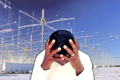
Gwen Towers: What Are They Being Used For?

GWEN Towers:  Ground Wave Emergency Network

GWEN Tower Mind Control the Populace @ ToxicNow.com.jpg

Quote by el schism,

“Apparently these are militarized communication antenna/towers …with hundreds that have seemingly just popped up across the U.S. in the past few decades; and they say they’re there to help prevent EMP or nuclear attack ? But I believe that they’re being used for more sinister means which correlate back to HAARP, where it’s somehow connected and/or, redirected into Smart Meters leading to your Smart Appliances in your home,while..unbeknownst to most..the feeble,I mean people and their ENERGY, are… being manipulated systematically and electronically by a corporate handler or entity…while managing the populace via electromagnetic stimulation/manipulation using the power grid,whereas implementation of their agenda by modulating our natural frequencies and blasting us with these artificial ones. WiFi  is one type of technology that has many disturbing aspects regarding the silent war ” 

Quoted from ActivistPost.com,

‘  “The potential for attuned frequencies, and extremely low frequency (ELF) waves in particular, to be used to electronically stimulate areas of the brain and alter mood has been documented in scientific research for decades now. Moreover, microwaves have allegedly been put to use in covert warfare since the early days of the Cold War.”  ‘

http://www.activistpost.com/2015/07/what-is-this-gwen-tower-really-for.html

Or from Educate-Yourself.org,

‘ According to a 1982 Air Force review of biotechnology, ELF has a number of potential military uses, including “dealing with terrorist groups, crowd control, controlling breaches of security at military installations, and antipersonnel techniques in tactical warfare.” The same report states:

“Electromagnetic systems would be used to produce mild to severe physiological disruption or perceptual dis- tortion or disorientation. They are silent, and counter- measures to them may be difficult to develop.” ‘

http://educate-yourself.org/dc/gwentowersbybyronweeks.shtml

MK-ULTRA @ ToxicNow.com.jpg

DIGITALIZED SLAVERY !

You are a Slave !

“If you want to find the secrets of the universe, think in terms of energy, frequency,and vibration.” Nikola Tesla.

ELF Waves Manipulate Your Thoughts @ ToxicNow.com.jpg

http://educate-yourself.org/cn/The-Weaponization-of-WiFi-09Oct26.shtml#top

Original Article:

Read More:GWEN Towers

Read More:5G Network The Same Frequency As Governmental ‘Crowd Control’ Microwave Weapons

Read More:Proven: Electromagnetic Frequencies Can Cause Harm And Serious Changes To Our Behavior- Is This Why So Many Seem To Be Losing Their Minds?

Read More:Firefighters Living Next To 5G Towers End Up With Brain Abnormalities After Being Exposed To Electromagnetic Radiation

spacer

6 months, 2 weeks ago

Wednesday, March 13, 2013

The Ground-Wave Emergency
Network (GWEN) System

{Editor’s Note: GWEN towers are popping up everywhere in America; rural, hilltops, mountain areas, suburbs, and cities. The cover story is that they’re supposed to be used for cell phone communications, but as this article reveals, Big Brother has something far more insidious in mind. ..Ken Adachi]

Forward by Byron Weeks
Written by Val Valerian
http://educate-yourself.org/dc/gwentowersbybyronweeks.shtml

The Ground-Wave Emergency Network (GWEN) is a com

spacer

Electromagnetic Control

It is known the toxic soup of electo-magnetic waves already in place through power lines, cell towers, WiFi, radio, television and a host of other broadcasting devices has a seriously deleterious effect on human health and mental well being.

RULE THE AIR

HAARP and its various localized outposts and GWEN towers (Ground Wave Emergency Network) has the known capability to affect human thought.


Another even more sinister capability using other inaudible ELF and UHF (extra low and ultra high frequency) electromagnetic signals is also in place since the 1990’s. This secret program nicknamed the sounds of silence operates within the frequencies the brain operates on, and the PTBs have been piggy-backing inaudible, subliminal programming to manipulate humanity for decades.

No wonder so many are entranced by the media and the country appears to be so upset, confused, fearful and divided.

The Department of Defense even tested this Silent Sound Spread Spectrum (SSSS) technology during the first Iraq war, causing unwary battle-tested Iraqi soldiers to act like submissive children running to American troops for protection.

It’s also in use in the private sector and goes by the name of Silent Subliminal Presentation System and is used as an advanced marketing technique, among other things.

It is believed this technology is one of the PTBs main tools being used for the subjugation of the American people.

spacer

An Existence of the Still Hidden CIA Program to Manipulate the Human Brain and Organism With Remote Electromagnetic Means

23 Pages Posted: 29 Nov 2018

Kenji Miyamoto

Independent

Date Written: November 11, 2018

Abstract

この論文の日本語版は、:https://ssrn.com/abstract=3308226.

There are letters disclosed under the STARGATE declassification, which indicated that the CIA had covert programs to manipulate the brain function interacted with the external electromagnetic stimuli, which is still hidden to the public eyes. The CIA has had an intention to read and activate the human being from the outside and paid attention to the related studies and developments since MKULTRA Subproject 119 in the early 1960s. They naturally supported the earlier experiments on the remote electromagnetic sensing conducted by SRI, Stanford Research Institute, though halting their subsidies within several years. The problem was SRI’s focus on the remote viewing, which was not necessarily the primary goal for the agency that would like to deploy the electromagnetic technologies into their information gathering to interrogate or manipulate their subjects. It is more or less the fact that the brain is synchronized to the external electromagnetic stimuli and the issue was to what extent the intelligence community has developed these methodologies. The CIA already acquired the basic technological foundation to manipulate the human brain electromagnetically in the 1970s, which has progressed to the critical level from then to now, considering the tremendous technological development of the overall society.

spacer

PROJECT MKIULTRA, THE CIA’S PROGRAM OF RESEARCH IN BEHAVIOR MODIFICATION

Senate Select Committee on Intelligence (.gov)

https://www.intelligence.senate.gov › hearings
PDF / Aug 3, 1977 — CIA had initiated 144 subprojects related to the control of human behavior.
spacer

Nervous system manipulation by electromagnetic fields from monitors

Abstract
Physiological effects have been observed in a human subject in response to stimulation of the skin with weak electromagnetic fields that are pulsed with certain frequencies near ½ Hz or 2.4 Hz, such as to excite a sensory resonance. Many computer monitors and TV tubes, when displaying pulsed images, emit pulsed electromagnetic fields of sufficient amplitudes to cause such excitation. It is therefore possible to manipulate the nervous system of a subject by pulsing images displayed on a nearby computer monitor or TV set. For the latter, the image pulsing may be imbedded in the program material, or it may be overlaid by modulating a video stream, either as an RF signal or as a video signal. The image displayed on a computer monitor may be pulsed effectively by a simple computer program. For certain monitors, pulsed electromagnetic fields capable of exciting sensory resonances in nearby subjects may be generated even as the displayed images are pulsed with subliminal intensity.
Images (10)
Classifications
 A61N2/00 Magnetotherapy
spacer
spacer

Ms. Soleilmavis Liu Sponsor Activist of Peacepink Yantai, Shandong Province, China

Recent years, the words “mind control abuse and torture” and “target individual” appears frequently online. Thousands of people in groups or individually cries attention to the abuses and tortures with electromagnetic mind control technologies through internet and all other channels. The scale of the ongoing crimes is large, and hidden. People are asking for the worldwide attention and an international investigation of enormous human rights violations that are silently taking place worldwide at this moment.
Abstract: One of the twenty-first century’s greatest violations of human rights is the proliferation of mind control technologies and their accompanying abuse and torture. Thousands of innocent victims across the globe have become activists for their freedom.
Electromagnetic mind control technologies are weapons which use electromagnetic waves to hijacka person’s brain and nervous system and subvert an individual’s sense of control over their own thinking, behavior, emotions or decision making. This article is a brief introduction to mind control technologies, the grave situation of hidden mind control abuses and tortures, and victims, including Soleilmavis Liu, whose work is to expose mind control technologies and their torturous abuses, and to urge governments worldwide to investigate and halt these egregious violations of human rights.
Brief introduction of mind control technologies Mind control technologies are weapons which use electronic microchip implants, nanotechnologies, microwaves and/or electromagnetic waves to subvert an individual’s sense of control over their own thinking, behavior, emotions or decision making by attacking the brain and nervous system. The development of these methods and technologies has a long history.
1.Nazi Wonder Drug
2 Nazi researchers used concentration camp inmates to test a cocaine-based “wonder drug” they hoped would enhance the performance of German troops. Hamburg-based criminologist Wolf Kemper believed that D-IX pills were Hitler’s last secret development. The so-called Experiment D-IX started in November of the year 1944 in Sachsenhausen concentration camp. The results of all those tests inspired their initiators to supply D-IX drug to the entire Nazi Army. However, they failed to launch the mass production of the substance. The allies’ victories at both fronts in winter and spring of in 1945 resulted in the collapse of the Nazi regime. The absurd dream of the wonder drug was crushed.
[1] According to the “Want to Know” information site, “After the end of World War II, German scientists were held in a variety of detainment camps by the allies. In 1946, President Truman authorized Project Paperclip to exploit German scientists for American research, and to deny these intellectual resources to the Soviet Union.” Some reports bluntly pointed out that they were “ardent Nazis.” They were considered so vital to the “Cold War” effort that they would be brought into the US and Canada. Some of these experts had participated in murderous medical experiments on human subjects at concentration camps. A 1999 report to the Senate and the House said “between 1945 and 1955; 765 scientists, engineers, and technicians were brought to the US under Paperclip and similar programs.” (Bluebird Report)
2. Mk-ultra, America’s Central Intelligence Agency mind control project.
The Central Intelligence Agency’s Fact Book states the NSC (National Security Council) and the CIA were established under the provisions of the National Security Act of 1947. In December 1947, the NSC held its first meeting. James Forrestal, the Secretary of Defense, pushed for the CIA to begin a “secret war” against the Soviets. Forrestal’s initiative led to the execution of psychological warfare operations (psy-ops) in Europe. CIA personnel were not opposed to working with Nazi doctors who had proven to be proficient in breaking the mind and rebuilding it. In some cases, military bases were used to hide these covert activities. It was decided that the communist threat was an issue that took priority over constitutional rights.
One of the areas to be investigated by the CIA was Mind Control. The CIA’s human behavior control program was chiefly motivated by perceived Soviet, Chinese, and North Korean use of mind control techniques. Under the protection of “national security,” many other branches of the government also took part in the study of this area. The CIA originated its first program in 1950 under the name BLUEBIRD, which in 1951, after Canada and Britain had been included, was changed to ARTICHOKE. MKULTRA officially began in 1953. Technically it was closed in 1964, but some of its programs remained active under MKSEARCH well into the seventies. In 1973, tipped off about forthcoming investigations, CIA Director Richard Helms ordered the destruction of any MKULTRA records. (MC 10, 17)
There is an overwhelming body of evidence that confirms the existence of Mk-ultra. More than 250 people who claim they were the victims of “brainwashing” by America’s Central Intelligence Agency were set to win a multimillion dollar legal battle for compensation. Nine already had each received $67,000 (£33,500) compensation from the spy agency, which had admitted to settingup an operation codenamed MK-Ultra during the Cold War. [Mike Parker, CIA’s Bourne Identity Plot (Mkultra), Express.co.uk, July 8, 2007] [2] 3
3. Implantable electronic chip mind control
Many researchers, using nanotechnologies had developed implantable electronic chips that established new nerve connections in parts of the brain that controlled movement or even altered emotion and thought. Researchers at the University of Washington (UW) had been working on an implantable electronic chip that might help establish new nerve connections in the part of the brain that controlled movement. Their study, to be published in the November 2, 2006, edition of Nature, showed such a device could induce brain changes in monkeys lasting more than a week (Leila Gray, Tiny Electronic Chip, Interacting with the Brain, Modifies Pathways for Controlling Movement, University of Washington News, October 24, 2006).
[3] On March 18, 2008, the Central Intelligence Agency responded in writing to a Larson Media Freedom of Information Act request. The document disclosed that the CIA’s use of biomedical intellectual property developed at the Alfred Mann Foundation, Second Sight LLC, Advanced Bionics, and under Naval Space Warfare (SPAWAR) contract #N6600106C8005, was “currently and properly classified pursuant to an executive order in the interest of national security,” and applied to the CIA Director’s “statutory obligation to protect from disclosure, intelligence sources and methods.” The technology, developed under the DARPA programs of Tony Tether, Col. Geoffrey Ling and N.I.H programs of William Heetderks, had been protected as a Defense “Special Access Program1” (SAP), which was the official terminology for a “black project.” The research had resulted in implantable devices that were millimeter and sub-millimeter in size, could be surreptitiously implanted (and had been fabricated in a manner that the devices could not be detected or localized by clinical medical or radiology techniques), and provided a shocking amount of surveillance capability regarding a subject’s activities, which might include visual and auditory biofeedback data. Additionally, the devices were capable of delivering testosterone or any other biological agent.
4. Voice to Skull Technologies
Artificial microwave voice-to-skull transmission was successfully demonstrated by researcher Dr. Joseph Sharp in 1973, announced at a seminar at the University of Utah in 1974, and in the journal “American Psychologist” in the March 1975 issue, the article was titled “Microwaves and Behavior” by Dr. Don Justesen (1975).
[4] In 2002, the US Air Force Research Laboratory patented precisely such a device: “a nonlethal weapon which includes (1) a neuro-electromagnetic device, which broadcast sound into the skull of persons or animals by way of pulse-modulated microwave radiation; and (2) a silent sound device, which can transmit ultrasound (above human hearing) into the skull of mammals.” NOTE: The sound modulation might be voice or audio subliminal messages. One application of voice-to-skull uses was an electronic scarecrow to frighten birds in the vicinity of airports. [5]
5. Mind reading technologies
A team of world-leading neuroscientists has developed a powerful technique that allowed them to look deep inside a person’s brain, and to read their intentions before they act.
The research broke controversial new ground in scientists’ ability to probe people’s minds and eavesdrop on their thoughts, ethically to be condemned in its technology and applications.
4 “Using the scanner, we could look around the brain for this information and read out something that from the outside, there is no way you possibly could tell is in there. It is like shining a torch around, looking for writing on a wall,” said John Dylan Haynes at the Max Planck Institute for Human Cognitive and Brain Sciences in Germany in 2007, who led the study with colleagues at University College London and Oxford University.
In 2011, neuroscientists at the University of California Berkeley put electrodes inside the skulls of brain surgery patients to monitor information from their temporal lobe, which was involved in the processing of speech and images. As the patient listened to someone speaking, a computer program analysed how the brain processed and reproduced the words they had heard.
The scientists believed the technique could also be used to read and report what they were thinking of saying next.
In the journal Plos Biology, they wrote that it took attempts at mind reading to “a whole new level.”
Harvard’s Buckner won the Alzheimer’s award for reading our minds in 2011. Researchers had shown a capability to read a subject’s mind by remotely measuring their brain activity. This technique could even extract information from individuals, who were unaware of themselves.
[6] Those mind reading technologies use EEC with decoding of neurological signals remotely with or without an implant through satellite or through TV Mobile transmission towers. The following data was from NASA’s Jet Propulsion Lab, “The sensitivity of our deep-space tracking antennas located around the world is truly amazing. The antennas must capture Voyager information from a signal so weak that the power striking the antenna is only 10 exponent -16 watts (1 part in 10 quadrillion). A modern-day electronic digital watch operates at a power level 20 billion times greater than this feeble level.”
Scientists believed the weak radio emission of a cubic centimeter of brain matter was within the detectable limits of the satellite. It was technically possible for a satellite to detect your thoughts, emotions and perceptions, and pass that information to a computer for interpretation. [7]

spacer

Check out the following related posts:
spacer

spaceer

New Type of Electromagnetic Wave Discovered

Sep 4, 2019 by News Staff

An international team of scientists from the United Kingdom and the United States has discovered a previously unknown type of electromagnetic wave: a Dyakonov-Voigt surface wave.

Mackay et al found theoretically a new type of electromagnetic surface wave. Image credit: Arek Socha.

University of Edinburgh’s Dr. Tom Mackay and his colleagues from Pennsylvania State University made the discovery by analyzing how light interacts with certain naturally occurring or man-made crystals.

The researchers found that Dyakonov-Voigt surface waves are produced at a specific regionknown as an interfacewhere the crystals meet another material, such as oil or water.

Named after two leading scientists, these waves can be produced only using certain types of crystal whose optical properties depend on the direction in which light passes through them.

The scientists identified the waves’ unique properties using mathematical models that incorporated equations developed by renowned mathematician and physicist James Clerk Maxwell.

They also found that Dyakonov-Voigt surface waves diminish as they move away from the interface – a process called decay – and travel only in a single direction.

Other types of surface waves decay more quickly and travel in multiple directions.

These phenomena could have a range of useful applications, such as improving biosensors used to screen blood samples or developing fiber optic circuits that transfer data more efficiently.

“Dyakonov-Voigt surface waves represent a step forward in our understanding of how light interacts with complex materials, and offer opportunities for a range of technological advancements,” Dr. Mackay said.

The findings were published online August 28, 2019 in the Proceedings of the Royal Society A.

Tom G. Mackay et al. 2019. Dyakonov-Voigt surface waves. Proc. R. Soc. A 475 (2228); doi: 10.1098/rspa.2019.0317

spacer

LIGHT COMMUNICATION

Light Fidelity (LiFi)

LiFi is the revolutionary technology which enables transmission of data through light. LiFi can be defined as a fully networked optical wireless technology that leverages the spectrum of light instead of radio waves to exchange data. With LiFi, the possibilities are endless and the opportunities tremendous. The applications of LiFi ranges from using it at home or an office environment to streaming high-quality content during flights.

Spectrum of light, being 1000 times wider than the Radio Frequency can achieve significantly faster speed than Wi-Fi. The fact that light cannot trespass through the physical environment makes LiFi a secure bearer of data.

Anywhere solid-state lights (e.g. LED lights) are installed to provide illumination, there can also be high-speed wireless data communications.

spacer

AN/URC-117 Ground Wave Emergency Network

From Wikipedia, the free encyclopedia
Typical GWEN relay node

GWEN site locations

A 1998 U.S. Department of Transportation environmental impact survey that proposed repurposing a number of existing GWEN sites for use by the Nationwide Differential Global Positioning System listed the locations of 29 GWEN sites:[6]

spacer

The next article you will find below, came from the Federal Highway Administration webpage.  I immediately noticed the symbol on their logo.  Primarily because it i a symbol for the Devil, but also because not too long ago I had created a post that was related to Japan.   Check out that post Here:

You can find many more versions of the symbol by clicking the link below:

666 the number of the BEAST/The Devil/ Satan

spacer

spacer

They were already beginning to upgrade from the GWEN system to the NDGPS system, starting in 1994

by James A. Arnold

The recent conversion of two Ground Wave Emergency Network (GWEN) sites in Annapolis and Hagerstown, Md., to Nationwide Differential Global Positioning System (NDGPS) broadcast stations is the latest chapter in the emerging NDGPS.

Whether mapping the natural resources of the largest state or determining the precise boundaries of a family farm, the practical applications of NDGPS are expanding exponentially. (Two previous Public Roads articles —”A More Precise Sense of Where We Are,” Vol. 63, No. 4, January/February 2000, pages 7-13, and “New Applications Make NDGPS More Pervasive,” Vol. 64, No. 4, January/February 2001, pages 39-43 — describe the emerging NDGPS and its burgeoning number of civilian uses.)

In a nutshell, this nationwide system of 300-foot- (91-meter-) high broadcast towers is being created to improve the accuracy of the positioning information obtained via radio signals emitted by the Global Positioning System (GPS) satellites traveling in orbit around the Earth.

In 1994, the departments of Transportation, Commerce, and Defense, which were looking for ways to improve the information provided by GPS, recommended the expansion of the Coast Guard’s differential global positioning system (DGPS) system. They also noted that the U.S. Air Force, which operated GWEN, planned to decommission the network and its 53 transmitters across the country. In a subsequent field test, it was demonstrated that these transmitters, which operated on frequencies near the Coast Guard DGPS radio-beacon frequencies, could be successfully used to provide navigational information for surface transportation applications. The Department of Transportation (DOT), which was designated in 1996 as the lead agency for all federal civil GPS matters, determined that conversion of the GWEN transmitters would save the Air Force $6 million in decommissioning costs, while decreasing NDGPS deployment costs by $10 million.


Workmen are getting ready to use a crane to pull and replace equipment shelters. Notice the thin tower in the background. (Photo credit: Melissa Winn)

The process of converting existing GWEN sites to NDGPS sites is relatively simple, compared to the engineering feat of developing the system. The state of Maryland owns the land on which the Annapolis and Hagerstown GWEN sites are located. The Air Force leased the land from Maryland, so the lease had to be transferred to DOT. In addition, the leased property needed to be resurveyed and expanded slightly to accommodate additional equipment. The Coast Guard worked with Maryland’s Department of Public Works to meet all the requirements. Although governmental approvals for the Annapolis site took about eight months due to unanticipated delays, all approvals for the Hagerstown site were secured within about four weeks from start to finish. The average cost of a conversion is about $300,000 to $400,000 for the survey, equipment, and construction of the site.

Miscellaneous tasks that occur as time allows include maintenance on the backup diesel generator, weed control, etc.

When all is ready, the equipment is put through its final check and, if all is fine, begins broadcasting DGPS corrections.

An interagency group of technical people, the NDGPS Policy and Implementation Team, recommends policy for the implementation of the NDGPS system, including establishing priorities for converting GWEN sites to NDGPS.

The practical applications of NDGPS include grand applications and simple ones. For example, the state of Alaska plans to survey the entire state to map out natural resources and roads accurately. To accomplish this by traditional survey methods would cost about $100 million. Alaska transportation officials are convinced that an aerial survey with NDGPS will be more accurate than a land survey and will probably be much less costly.

To survey Alaska — a state with more than 570,000 square miles (almost 1.5 million square kilometers) of land — with NDGPS presents significant challenges: setting up 14 NDGPS sites, grappling with severe weather, getting to remote sites to set up the equipment, providing power to the sites, and coping with permafrost ground conditions in constructing the sites. However, if the funds are available to tackle the task, the result will be an extremely accurate picture of the natural and man-made landscape.

South Carolina has been particularly creative in its use of NDGPS. It is making road surveys more accurate to enhance 911 emergency response times and is using data obtained from NDGPS to update its tax maps.

The service has immediate practical application to the U.S. Department of Agriculture. Various conservation programs provide money to farmers for taking their fields out of crop production and putting them into trees or warm season grasses to reduce runoff into local streams and waterways. Quite often, survey markers have become lost and must be resurveyed. The traditional methods are expensive and can take time. With the NDGPS and a plat of the property, it is relatively easy to relocate the markers and determine the area that is covered under the program. We worked with the Natural Resource Conservation Service on a site in Maryland to demonstrate how easy this process was. Using an NDGPS receiver and having one survey point clearly visible, it was easy to generate a bearing and distance to find the remaining survey markers.

DOT currently has 25 operational NDGPS sites with an additional 55 planned before the end of 2004. In addition, the Coast Guard and the U.S. Army Corps of Engineers already have 55 maritime NDGPS sites, creating a seamless network over most of the country.

Many of the sites are located in rural areas, resulting in fewer neighborhood complaints, little vandalism, and little or no incursion into environmentally sensitive areas. DOT prefers to lease sites from the owners, many of whom are private citizens, so that the properties will stay on the tax rolls when DOT no longer needs them.

spacer

An Overview of Emergency Communication Networks

School of Communication and Information Engineering, Xi’an University of Science and Technology, Xi’an 710054, China
2
James Watt School of Engineering, University of Glasgow, Glasgow G12 8QQ, UK
3
Shanxi Fenxi Mining Group Co., Ltd., Jiexiu 032000, China
*
Author to whom correspondence should be addressed.
Remote Sens. 202315(6), 1595; https://doi.org/10.3390/rs15061595
Submission received: 10 December 2022 / Revised: 25 February 2023 / Accepted: 11 March 2023 / Published: 15 March 2023

Abstract

In recent years, major natural disasters and public safety accidents have frequently occurred worldwide. In order to deal with various disasters and accidents using rapidly deployable, reliable, efficient, and stable emergency communication networks, all countries in the world are strengthening and improving emergency communication network construction and related technology research. Motivated by these situations, in this paper, we provide a state-of-the-art survey of the current situation and development of emergency communication networks. In this detailed investigation, our primary focus is the extensive discussion of emergency communication network technology, including satellite networks, ad hoc networks, cellular networks, and wireless private networks. Then, we explore and analyze the networks currently applied in emergency rescue, such as the 370M narrowband private network, broadband cluster network, and 5G constellation plan. We propose a broadband-narrowband integrated emergency communication network to provide an effective solution for visual dispatch of emergency rescue services. The main findings derived from the comprehensive survey on the emergency communication network are then summarized, and possible research challenges are noted. Lastly, we complete this survey by shedding new light on future directions for the emergency communication network. In the future, the emergency network will develop in the direction of intelligence, integration, popularization, and lower cost, and space-air-ground-sea integrated networks. This survey provides a reference basis for the construction of networks to mitigate major natural disasters and public safety accidents.

1. Introduction

In the past few years, China and the world have witnessed an endless stream of disasters, such as earthquakes [1], hurricanes [2], and tsunamis [3]. Various natural and man-made disasters have caused huge losses of life and property, such as the 7.3-magnitude earthquake in Haiti, which caused at least 2248 deaths, with 329 people missing and 12,268 injured [4]. The United States has been hit hard by hurricanes which have triggered storm surges, floods, and other disasters. These disasters caused infrastructure damage and large-scale power outages, with economic losses of more than USD 95 billion [5]. From 1894 to 2021, the Uttarakhand Himalaya witnessed at least 16 major disasters. In 2021, glaciers in the Himalaya Mountains broke, causing a series of floods, mudslides, avalanches, and other disasters, which destroyed many bridges, dams, power stations, tunnels, and villages in Chamoli, North Akande, India, leaving 174 people unaccounted for and 32 dead [6]. If adequate communications support can be provided in the aftermath of a disaster, we believe that casualties and property damage can be reduced. The occurrence of major natural disasters and public safety accidents can even damage the existing communication networks, resulting in communication interruptions and preventing the disaster area from contacting the outside world [7]. Therefore, communication networks are very important during a disaster, because rescue and recovery largely depend on the communication channel provided. However, once a disaster occurs, the traditional communication network is fragile; at this time, a temporary communication system, namely an emergency communication network, should be built as soon as possible.
Before a disaster, the emergency communication network can combine the data obtained from different systems to provide a technical platform for early warning, and disaster reduction and prediction, so as to improve the ability to monitor, manage, and control accidents and disasters. After a disaster, the emergency communication network can quickly and reliably restore communication in the disaster area, assist users, be used to rescue workers, support disaster relief headquarters, and realize on-site personnel scheduling, on-site data transmission, and other functions, to promote emergency rescue work. This can provide valuable time and first-hand information for the rescue, so as to save more lives. With the frequent occurrence of natural disasters and the tightening of the international security situation, countries all over the world are strengthening and improving the construction of emergency communication systems and related technology research, and striving to deploy a more reliable and stable emergency communication network.
Emergency communication [8,9,10] refers to the communication means and methods needed for the extensive use of various communication resources to support rescues, including emergency rescues, and the necessary communication in the case of natural or manufactured emergencies. Because of the characteristics of disasters, making effective use of limited resources to provide the best communication services is a key problem. Unlike the traditional communication network, the emergency communication network is a complex network, and enables the implementation of emergency rescue activities and provides the primary conditions for the realization of emergency rescue functions. Its network structure has a significant impact on rescue efficiency. In different emergency situations, the demand for emergency communication is different, and the technical means used are different. Emergency communication mainly has the following characteristics: uncertainty of time and place; uncertainty of capacity demand; high degree of timeliness of the emergency communication; complexity of the environment; uncertainty of the degree of damage to the communication network itself; and diversification of information.
In the case of damage to public communication network facilities, and a sudden decrease in performance and increase in traffic volume, it is necessary to use a combination of unconventional and multi-communication means to restore communication capability. The important characteristics of emergency communication networks [11] are shown below:
  • Ability to work during both a disaster situation and at times of normality;
  • Dynamic expansion of the network to provide more coverage;
  • Accurately transmit disaster information and provide comprehensive services;
  • Have high reliability, high redundancy, high safety, and high anti-interference capabilities.
An emergency communication system comprises the integration and application of various communication technologies and approaches in an emergency. Therefore, the emergency communication system should make full use of mature communication technologies and network equipment, and integrate them into an extensible and reliable secure communication network. Generally, the emergency communication network uses the existing fixed wire network, the mobile cellular network [12], the Internet, and other public communication networks. Private communication networks, such as trunking communication networks [13], satellite communication networks [14,15], and short-wave communication networks [16,17,18,19], will also be used. In addition, public media networks are also used, such as radio, television, and newspapers, as well as on-site monitoring and rescue networks, such as sensor networks [20] and ad hoc networks [21,22,23,24].
An emergency communication network is a heterogeneous network involving a variety of communication technologies, and its composition is diverse and dynamic. In recent years, through the study of public events and natural disasters, it has been found that the emergency communication platform needs to use the existing public networks or private networks to communicate [25,26,27], and the communication between rescue units at all levels needs to be interconnected. In order to solve the intercommunication problem of various emergency communication platforms, China proposed an integrated communication system based on the Internet protocol for the construction of a post-disaster emergency rescue communication platform [28,29,30]. Some researchers have proposed an interconnected communication solution that integrates satellite communication, 4G, and mesh technologies [31,32]. At present, the emergency wireless private network is also evolving into the Professional Digital Trunking (PDT) narrowband digital cluster and B-TrunC broadband cluster private network. In addition, multi-system converged communication technologies such as fixed-mobile integration, narrowband convergence, and public-private network complementarity have also been proposed. In view of the characteristics of the 5G communication network, such as high rate, high reliability, low delay, and low power consumption, as well as the rapid development of networking technology [33], the integration of wireless ad hoc networking technology and 5G communication technology has gradually entered the field of emergency communication [34,35]. The future emergency network will develop in the direction of integration, popularization, lower cost, mobile Internet integration, and space-air-ground-sea integrated networks [36,37]. The new generation of emergency communication systems should integrate a variety of communication technologies, and ensure timely, efficient, and safe emergency communication services for rescue and disaster relief, major activities, and other work.
Several survey articles in the literature consider issues related to the emergency communication network. Junbo Wang et al. [38] investigated the existing emergency communication networks and big data analysis from the perspective of content and space. F. Pervez et al. [39] conducted a detailed investigation of wireless emergency response systems. K. Ali et al. [40] reviewed various potential emerging communication technologies, such as Internet of Things (IoT), Device-to-Device (D2D) communication, Vehicle Network, Cloud and Fog Computing, Unmanned Aerial Vehicles (UAVs), and Wireless Sensor Networks (WSNs) in disaster situations. Lei Du et al. [41] systematically summarized the disaster emergency management network. Sanjoy Debnath et al. [42] outlined various existing technologies and the latest progress in the field of emergency communication technology. By investigating mobile ad hoc networks, Anjum et al. [43] provided the classification of communication strategies for mobile ad hoc networks in disasters and emergencies. Abhishek Sharma et al. [44] investigated the communication and network technology of UAVs. Vasani Yash Kishorbhai et al. [45] conducted a detailed investigation of Always-On Networks (AONs) and outlined AONs for emergency communication.
Whenever natural or man-made disasters occur, the main communication infrastructure is usually overloaded and suffers partial or total failure. Therefore, it is crucial to create a reliable emergency network to ensure adequate coverage. At present, there are many proposals relating to emergency communication technology, and countries all over the world are also strengthening and improving the construction of emergency communication systems and their research into related technologies. Based on this situation, this paper summarizes the issues related to emergency communication networks and widely discusses the various technologies used in emergency communication networks. The key issues addressed are as follows:
  • What is the key technology of emergency communication networks?
  • What is the importance of emergency communication networks?
  • What are the main advantages of emergency communication networks compared with traditional networks?
  • What are the limitations of emergency communication networks?
  • What progress has been made in the research into emergency communication network?
This paper presents extensive research into emergency communication technology, including satellite networks, ad hoc networks, cellular networks, and wireless private networks, and analyzes the networks currently used in emergency rescue and the future development direction of emergency communication networks.

2. Materials and Methods

A systematic literature review was conducted by following a well-defined process to retrieve articles most relevant to this research’s scope. Our goal was to study the emergency communication network following the five main stages of the systematic mapping process, which was proposed by Yli-Huumo J [46]. The first stage was analysis of the key research problems and determining the relevant research direction by identifying the key research problems. The second stage was article retrieval; by narrowing the scope of the search engines, all the literature related to the research topic on the online resources was searched. These search engines included China National Knowledge Infrastructure (CNKI), Springer Link, Web of Science, Elsevier ScienceDirect, and IEEE Xplore, which were used for the extraction of high impact factor papers. The keywords and strings related to the research topic for a semantic search were used to retrieve the articles most closely related to the research problem. For this purpose, several groups of keywords were formulated, namely emergency communication network, wireless communication, satellite network, cellular network, broadband cluster network, and ad hoc network. The third stage was screening of all relevant papers according to the title, selection of the literature related to the research direction, and exclusion of the literature with low content quality. The fourth stage was content analysis after reading the retrieved articles. By reading abstracts and keywords to determine their relevance to the current research topic, articles irrelevant to the research direction were deleted. The last stage was classification and collection of all the required information, and classification of the retrieved articles.

3. Review of Emergency Communication Networks

3.1. Network Classification

Emergency communication networks provide timely and effective communication support for all kinds of emergencies, and are an essential part of the comprehensive emergency support system. For any country, the establishment of effective emergency communication based on the disaster communication backbone is an important component of disaster relief. Emergency communication networks are divided into different categories according to different standards. The commonly used classification standards are as follows:
  • According to the transmission medium, networks can be divided into wired communication networks and wireless communication networks.
Wired communication networks use wired transmission media in the form of communication. The common forms of communication are fixed telephone communication, telephone line/network cable access to the Internet, and optical fiber communication. Wireless communication networks use wireless transmission media. Common communication forms include microwave communication, mobile communication, and satellite communication.
  • According to the attributes, networks can be divided into public networks and private networks.
A public network is a network operated and managed by operators, and connects each private network and user terminal through a public user network interface. A private network refers to a network within a unit or department. At present, private networks mainly use ethernet, Asynchronous Transfer Mode (ATM), and various wireless technologies.
  • According to geographical classification, networks can be divided into local area networks (LANs), metropolitan area network (MANs), and wide area network (WANs).
A LAN is a communication network having a distribution ranging from hundreds of meters to several kilometers. The transmission coverage area of a MAN is mainly within cities, with a distribution area ranging from hundreds to dozens of kilometers. The transmission coverage area of a WAN includes provinces, countries, and even the world, and ranges from hundreds to tens of thousands of kilometers.
This section analyzes the existing emergency communication network technologies that are mainly used at present: satellite communication [47,48,49], wireless ad hoc networks [50,51], cellular communication [26,52], and wireless private networks [53,54,55].

3.1.1. Satellite Networks

Satellite communication technology is a method of communication between two or more Earth stations using artificial Earth satellites as relay stations to forward radio waves. Satellite communication systems are usually classified according to the satellite orbit altitude, and can be divided into geosynchronous Earth orbit (GEO) satellites, medium Earth orbit (MEO) satellites, and low Earth orbit (LEO) satellites. The characteristics of different satellite communication systems are shown in Table 1.
Table 1. Characteristics of satellite communication system.
GEO satellites cover a wide range, with a single satellite covering up to 42% of the Earth’s area. GEO satellite mobile communication systems include the North American satellite mobile communication system (MSAT) and the International Maritime Satellite (Inmarsat) system. At present, GEO satellites are being developed towards the direction of high throughput, which can improve the utilization rate of the satellite frequency and data throughput by utilizing the rich spectrum resources of the Ka band and frequency reuse technology. MEO satellites cover a much smaller area than GEO satellites, and are mainly used to provide satellite Internet access services with high bandwidth, low cost, and low delay. MEO satellite mobile communication systems mainly include Inmarsat-P, Odyssey, MAGSS-14, and BeiDou positioning system. LEO satellites have low cost and small coverage per satellite. The current development trend of the LEO satellite is for miniaturization, low cost, and more intensive networking. Miniaturization and lightweight design can reduce the manufacturing and transmission costs, provide greater system throughput through intensive networking, and dynamically allocate the power and bandwidth to each beam using beam forming and beam shaping functions, so as to maximize the performance and reduce the interference in high orbit satellites.
The satellite communication system is mainly composed of space, ground, and user segments, as shown in Figure 1. Space segment: with communication satellites as the main body, used for receiving and forwarding signals from satellite communication Earth stations, to achieve communication between Earth stations or between Earth stations and spacecraft. Ground segment: including satellite transponder, gateway station, Satellite Control Center (SCC), and Tracking, Telemetry, and Command station (TT&C), to realize communication between users. User segment: mainly composed of various terminal user devices, including Very Small Antenna Terminal (VSAT) stations, handheld terminals, and mobile terminals mounted on cars, ships, and planes, as well as various applications and services based on satellite communication.
Figure 1. Satellite network communication system (PLMN: public land mobile network, PSTN: public switched telephone network).
With the development of satellite communication technology, Earth observation satellite remote sensing technology has been extended. This technology uses the visible light, infrared, and microwave sensors built on satellites to detect and identify the Earth’s resources and environmental information by collecting the electromagnetic radiation data of the Earth’s surface and near-Earth space. At present, this technology has been widely used in many fields, such as land natural resources surveys, marine ecological environment protection, and meteorological disaster prediction. NISAR is a “dual-frequency” synthetic aperture radar imaging satellite built by the National Aeronautics and Space Administration (NASA) and Indian Space Research Organization (ISRO). Its primary purpose is to spot potential natural disasters, help monitor groundwater supply, track ice sheet melting rates associated with sea level rise, and observe changes in the distribution of vegetation around the world. With the rapid increase in the number of remote sensing satellite platforms, snow monitoring using remote sensing satellites has been widely used. Tsai et al. [56] used spaceborne SAR to detect the snow cover area so as to better understand global snow cover dynamics. Haiwei Qiao et al. [57] proposed a snow cover recognition method based on FY-4A AGRI geostationary satellite data, which can accurately and effectively identify snow cover phenomena. Muhuri et al. [58] used satellite sensors to monitor the snow coverage of the Himalayas; these sensors enable timely detection of snow cover and snow melt, and prediction of the occurrence of avalanches, floods, and other natural disasters.
Satellite communication has the advantages of not being limited by ground conditions and having a wide range of communication coverage, large capacity, high reliability, long transmission distance, independent communication ability, and strong resistance to damage, which makes it very suitable for emergency communications. Ran et al. [59] thoroughly analyzed the usefulness of satellite communications after a disaster. Iapichino et al. [60] proposed a satellite-based hybrid network, in which the ground network and satellite network were mixed on a mesh wireless communication protocol platform. Xiaofan Xu et al. [61] proposed a functional architecture and network architecture of the fusion of satellite communication and ground mobile communication based on the 5G core network. Pecorella et al. [62] described in detail an emergency network based on satellite communication, which uses two-way satellite links for reliable communication. M.Cason et al. [63] proposed a network architecture based on the integration of satellite and the Long-Term Evolution (LTE) network, which provides LTE to disaster areas through the satellite return trip and is applicable to various scenarios. Despite the huge advantages of satellite communication, there are limitations to its use. Satellite communication networks require a large investment, have a relatively low transmission rate, limited capacity, and high use cost, and are only suitable for communication in extreme emergencies.

3.1.2. Ad Hoc Networks

In 1991, IEEE formally put forward the term “ad hoc network” [64]. Ad hoc network technology adopts a “peer-to-peer structure” mobile communication mode without a base station. Compared with other network forms, an ad hoc network is a special mobile communication network that can be quickly networked without the prerequisite of relevant infrastructure presetting. Ad hoc networks are characterized by high destructibility, self-healing, and self-organization, and are especially suitable for communication during temporary or sudden emergency events. On an ad hoc basis, a variety of networks have been extended: Wireless Mesh Network (WMN) [65,66], Wireless Ad Hoc Network (MANET) [54], Vehicular Ad Hoc Network (VANET) [67], Fly Ad Hoc Network (FANET) [68,69], and Sea Ad Hoc Network (SANET). Each network is described below.
  • Wireless Mesh Network (WMN)
WMN [70] is a new network product based on the development of wireless networks and the extension of the ad hoc network. Its network architecture is shown in Figure 2. The main advantages of WMN are:
Figure 2. Structure diagram of WMN.
  • WMN is a multi-hop network that automatically selects the best path to avoid communication failure due to obstacles, so as to provide service transmission capability for users who are not within line-of-sight range.
  • WMN has flexible and diverse networking modes, supports dynamic topology networking, provides effective networking capabilities for application scenarios with high mobility requirements, ensures the quality of connectivity among users, and expands network coverage.
  • WMN is capable of self-organizing, self-healing, and self-balancing, with strong network reliability.
WMN is basically similar to MANET in terms of connectivity and operation, except for the design and application scenarios of routing protocols. Suzuki et al. [71] proposed SKYMESH, a Wi-Fi-based mesh network that can provide Internet to disaster-affected areas. Kanchanasu et al. [72] used MANET, WMN, and World Interoperability for Microwave Access (WiMAX) to form a mesh network and expand the service area through satellite communication links. Ray et al. [73] adopted the WMN solution in post-disaster communication to reduce losses. At present, most WMN networking technologies use Coded Orthogonal Frequency Division Multiplexing (COFDM) modulation and characteristic beam technology, which can solve the problem of channel selective fading and channel flatness fading in a multi-path environment. After adopting a Multiple-Input Multiple-Output (MIMO) antenna, high-order modulation, and other technologies, the transmission rate can reach nearly 100 Mbps.
As a new form of wireless self-organizing network, WMN can not only effectively combine with emergency communication modes such as satellites and short-wave, but also be used as the extension of mobile communication networks such as 4G and metropolitan area networks such as Wireless Personal Area Networks (WPANs) to provide more extensive wireless access coverage and comprehensively improve the quality of emergency communication. WMN is mainly used in mine emergency rescue. In recent years, it has also been more widely used in terms of fire protection [74,75] and earthquake and other disasters.
2.
Mobile Ad Hoc Network (MANET)

MANET is a new type of broadband WMN based on ad hoc networking mode. Its structure is shown in Figure 3. MANET makes use of the routing and forwarding function of mobile terminals to communicate without infrastructure, thus compensating for the lack of network communication infrastructure available. The features of MANET are:

Figure 3. Structure diagram of MANET.
  • MANET is a distributed, multi-hop relay wireless broadband system without a center, and provides dynamic routing, strong damage resistance, and good scalability. Its network topology changes dynamically, and it internally uses its own routing protocol to complete wireless communication among nodes through wireless multi-hop forwarding.
  • MANET has the advantages of having a low deployment and maintenance cost, large coverage, high rate, strong network robustness and adaptability, and link self-sensing and self-healing. It can not only exist as an independent wireless self-organizing network, but also serve as an effective supplement and expansion of an existing heterogeneous network system.
  • MANET can be widely used in military communication private networks, public security private networks, emergency communication private networks, regional broadband private networks, and wireless monitoring private networks.
Due to its significant advantages, MANET is widely used in emergency communications in order to provide effective communications during natural disasters. For example, Chen et al. [76] developed a hybrid MANET topology with the advantages of fast deployment, simple configuration, and convenient interoperability. The proposed solution can provide network access for post-earthquake emergency rescue services to meet the communication requirements of rescue work. Z.lu et al. [77] designed and implemented a system named TeamPhone, which consists of two components, namely, a message system and a self-rescue system. The message system integrates cellular networks, ad hoc networks, and a self-rescue systems group, and locates the smart phones of trapped survivors. The TeamPhone system can send emergency messages and provide their location information to assist rescue operations. Kim et al. [78] designed disaster communication network management software combining MANET and a wireless local area network (WLAN). MANET can be widely used in environments where wired networks cannot be supported or where communication is temporarily required. The problems faced by MANET include:
  • Wireless transmission bandwidth is limited, and signal fading and noise interference exist;
  • Poor security and the wireless link makes the network vulnerable to link layer attacks;
  • Without centralized nodes, it is difficult to connect with external systems;
  • Limitations of mobile terminals: mobile terminals in MANET have the advantages of dexterity and good mobility, but are limited by their power supply, small memory, and low CPU performance.
3.
Vehicular Ad Hoc Network (VANET)
VANET is a new mobile ad hoc network created by applying the principles of MANET to vehicles. VANET is composed of self-organizing vehicles as mobile nodes, and the communication between nodes can be divided into vehicle-to-vehicle (V2V), vehicle-to-roadside (V2R), and vehicle-to-infrastructure (V2I). Its network structure is shown in Figure 4. VANET is a wireless communication technology that can be deployed quickly, which simplifies data exchange between vehicles and provides a variety of data services [79]. VANET is expected to enter the application field of disaster communication due to its features of connecting emergency vehicles and road navigation.
Figure 4. Structure diagram of VANET.
VANET has its own unique characteristics compared to other types of networks, which include: predictable mobility; provision of safe driving and enhancement of passenger comfort and traffic efficiency; lack of power limitation; variable network density; rapid changes in network topology; unlimited network size; and high computing power.
In recent years, as automotive technology has advanced, VANET has played an important role in saving drivers’ lives and property by disseminating critical incident information. The important purpose of VANET architecture is to provide efficient and effective emergency and warning alerts for vehicles, so that vehicles can make appropriate decisions without delay to safeguard passenger safety [80]. Milton Joe et al. [81] proposed a real-time emergency warning model, based on Android applications, which provided efficient and safe driving for vehicles while establishing a reliable VANET. High-speed movement of vehicle nodes and rapid changes in network topology in VANET result in severe challenges to the design of the network architecture and related protocols. From a technical perspective, the main challenges of VANET are as follows:
  • Signal attenuation: objects placed between two communication vehicles as obstacles are one of the challenges that affect VANET efficiency;
  • Bandwidth limitation: VANET has no central coordinator to control the communication between nodes;
  • Connectivity: due to the high mobility and rapid change in the topology, fragmentation often occurs in the network;
  • Small effective diameter: due to the small effective network diameter of VANET, the communication connectivity between nodes is weak.
4.
Fly Ad Hoc Network (FANET)

FANET is a self-organizing wireless network that enables communication between flying nodes, such as UAVs, without a fixed network infrastructure, making it low cost, flexible, and easy to deploy. FANET can be regarded as an extended paradigm of MANET, realizing communication between UAVs and between UAVs and control stations. FANET not only has the inherent characteristics of a wireless ad hoc network, such as multiple hops, self-organization, and centrality, but also has some functions related to UAVs, such as the rapid change in network topology caused by high-speed moving nodes, sparsity of network nodes and network heterogeneity, network node peers, and data relay capability. UAVs have potential advantages in wireless communications because they can transfer data from the air to one or more ground stations [82], so they can be widely used in disaster areas where communications are completely shut down due to an unexpected disaster. As shown in Figure 5a, there are four types of links between UAVs and different radio facilities (e.g., FANET base station, cellular base station, and satellite) in the ad hoc network.

Figure 5. (a) Four link modes; (b) structure diagram of FANET.
FANET can be composed of a control center, sensing system, satellite communication system, and UAV swarm, as shown in Figure 5b. The control center can be an air or ground command center to send control messages to the UAV swarm. The sensor system encompasses the ground and air, mainly by the radar system, which is responsible for collecting status information from the ground or UAV. The control center uses a mobile ad hoc network to issue instructions to the UAV swarm, and after the drone bees perform corresponding tasks, the working status and movement information is fed back to the control center through the sensor system. FANET can be used in a variety of environments, ranging from civilian to military, because of its robustness, adaptability, low operating cost, and ease of construction [83]. These applications include precise geographic positioning, search and rescue missions [84], intelligent transportation systems, target detection, disaster tracking and monitoring, and forest fire prevention.
5.
Sea Ad Hoc Network (SANET)

SANET is a wireless multi-hop network composed of nodes (e.g., ships, offshore buoys, and beacons). As shown in Figure 6, connections can be established between these nodes, or with coastal base stations and satellites [85,86]. SANET has characteristics that are similar to those of other wireless networks: composition made up of mobile nodes; high processing capacity; no energy restrictions; and high data storage capacity. However, there are some differences in many areas, such as power consumption, topology, speed, and deployment changes.

Figure 6. Structure diagram of SANET.
SANET can be used for maritime communications, navigation, and emergency response. The challenges of SANET include:
  • Quality of Service (QoS): maintaining the best forwarding quality of service is important because it involves certain requirements, latency, throughput, and packet error rates associated with the application.
  • Security: confidentiality and integrity are important for information transmission.
  • Scalability: the most important step in achieving effective ship communication is to ensure a stable routing mechanism on SANET. Due to the variation in ship mobility and network topology, the routing path is often interrupted, so it is difficult to ensure its stability.
  • Routing protocol: has large end-to-end latency and reduced packet delivery rate.
6.
Comparison with other ad hoc networks
Ad hoc networks are also known as infrastructure-free networks, non-central networks, multi-hop networks, and self-organizing wireless networks. Ad hoc networks have no fixed infrastructure, and their nodes can be vehicles, mobile devices, aircraft, and ships, which can dynamically maintain contact with other nodes in any way. Ad hoc networks include MANET, VANET, FANET, and SANET. VANET is a subset of MANET, FANET is a subset of VANET, and SANET is a popular type of self-organizing network. Table 2 summarizes the differences between different ad hoc wireless networks. An ad hoc network is an ad hoc wireless network composed of communication nodes that do not depend on the infrastructure, in which each node can act as a host and router. Ad hoc networks have been gradually applied to many key scenarios, such as emergency communication, rescue and disaster relief, and expanding the coverage of existing cellular networks, due to their fast network speed and robustness. Therefore, ad hoc networks are an important part of next-generation wireless communication network systems.
Table 2. Comparison of ad hoc networks.

3.1.3. Cellular Networks

Cellular mobile communication adopts cellular wireless networking mode to connect terminals and network devices through wireless channels, so as to realize mutual communication between users. After developing the 1G, 2G, 3G, and 4G technologies, cellular mobile communication technology has entered the 5G era, and the development vision of 6G was proposed at the same time [87,88,89,90]. The development trend from 1G to 6G is shown in Figure 7. Modern mobile communication technology can be mainly divided into low frequency, medium frequency, high frequency, VHF, and UHF frequency bands. In these bands, technicians can connect terminal devices in the mobile communication network, using mobile station technology, base station technology, and mobile switching technology to meet people’s mobile communication needs. In emergency communication networks, the most significant advantage of mobile communication technology is the large communication distance, wide coverage area, and low cost. However, in the case of major natural disasters and public safety accidents, the public communication network may be interrupted and unavailable, and seriously affect the rescue effect.

Figure 7. Development trend from 1G to 6G.
With the advent of MIMO technology and D2D communication, 5G is widely used in disaster management. 5G networks will integrate a variety of promising technologies, such as software-defined networks (SDN), software-defined wireless sensor networks (SD-WSN), coordinated multi-point processing (CoMP), MIMO, network function virtualization (NFV), and centralized radio access networks (CRANs) [91]. D2D communication in cellular networks supports direct communication between near-end mobile devices without the need for base stations (BSs) and core networks, and can be used to extend network coverage and enable infrastructure free connectivity. Therefore, D2D communication has become an indispensable candidate technology for next-generation wireless networks and an effective alternative to cellular communication during a disaster.
Because of their effectiveness, hybrid networks consisting of existing cellular networks and D2D networks are popular in disaster recovery. Ruengsatra et al. [92] proposed a hybrid network based on D2D and a ground infrastructure system. Fodor et al. [93] proposed a cluster-centered D2D network structure, which is based on cellular and ad hoc networks, and uses D2D communication as the LTE underlying network to obtain hop gain. KamranAli et al. [11] integrated clustering technology with D2D communication into a cellular network so that communication services could be maintained if parts of the cellular infrastructure become dysfunctional. As part of the auxiliary network of emergency communication, UAVs meet the urgent needs of public security services. Xiaohui Zhou et al. [94] discussed the use of UAVs to broadcast an emergency alarm through a D2D-assisted multi-hop network, and established a multi-hop multi-cast D2D auxiliary network to broadcast emergency information to victims. Thomas et al. [95] designed a framework called Finding Isolated Nodes Using D2D for Emergency Response (FINDER) to locate and reconnect isolated mobile nodes (MNs) in disaster areas, so as to avoid damage to assets and loss of life.
Currently, 5G wireless communication networks are being deployed worldwide. However, in 2030 and beyond, 5G will not be able to meet all future requirements, and 6G wireless communication networks are expected to provide global coverage. Compared with 5G networks, 6G wireless communication networks are expected to provide higher spectrum/energy/cost efficiency, higher data rate, lower delay, and sub-centimeter geographic positioning accuracy.

3.1.4. Wireless Private Networks

In the case of natural disasters and public security and other emergencies, due to the interruption of public communication networks or the inability to use public communication networks because of security reasons, it is often necessary to restore or supplement on-site communication in a short time using private networks. According to the technology used, emergency private wireless networks can be divided into five stages, namely, analogue cluster/conventional, narrowband digital cluster/conventional, 3G cluster, 4G broadband cluster, and 5G evolution. With digital wireless communication technology, digital cluster and conventional digital technology have been developed rapidly. PDT in China, Tetra and Digital Mobile Radio (DMR) in Europe, and P25 technology in the United States represent the narrowband digital cluster. As public network communication is evolving from 4G to 5G, digital cluster private networks are also gradually evolving in the direction of broadband multimedia [96]. 5G applications in the emergency industry will use 5G and artificial intelligence (AI) as the main approach and vigorously develop related applications.
Wireless private networks, represented by digital trunking wireless communication systems, have the characteristics of high confidentiality, high reliability, and low service cost. They are mainly used in specific fields such as public security, fire protection, rescue services, and the petrochemical industry. Private network mobile communication systems include interphones, non-central digital systems, and trunking communication systems. An interphone is a two-way communication tool that is suitable for real-time communication, emergency dispatching, and collective cooperation. If natural disasters destroy the public network infrastructure, thereby preventing communication, the role of interphones will be more obvious. A trunked mobile system is a special dispatching communication system that is part of the advanced development stage of the private radio dispatching network. The system can dynamically, automatically, quickly, and optimally distribute the limited channels to all users of the system, so as to make maximum use of the channel frequency resources of the whole system. To date, an 800 MHz wireless trunking mobile communication system has been gradually established in various cities in China. Trunked mobile communication networks can be divided into two types: Public Access Mobile Radio (PAMR) networks and Private Mobile Radio (PMR) networks. To date, the commonly used standards in digital private communication include DMR, Digital Private Mobile Radio (DPMR), and PDT. The DMR standard adopts Time Division Multiple Access (TDMA) technology, supports single call, full call, group call, and selective call modes, and also supports direct mode communication without a base station. DPMA is a narrowband (6.25 KHz) Frequency Division Multiple Access (FDMA) technology that can provide various forms of voice/data applications. The PDT standard adopts TDMA multiple access mode and is based on the Chinese public security market. It not only supports low-cost single base station system communication, but can also achieve efficient regional coverage. While satisfying basic business requirements, it also adds innovative functions such as simulcast and dynamic frequency resource management. In earthquakes, wind disasters, fires, and other emergency events, the private communication network can quickly access the rescue dispatching platform, to realize flexible networking, efficient command and dispatching, high-quality voice and data transmission, and other functions.
LTE is a long-term evolution technology based on 3GPP. LTE networking has the following advantages: it has a fast wireless network communication rate and high throughput, which can provide strong support for extensive services; with a slight delay, it can meet most application scenarios having high real-time requirements; and the LTE base station can be conveniently deployed and used to supplement the existing wireless communication infrastructure [97]. LTE is mainly applied in private networks, such as for emergency communication, smart construction sites, and forest fire prevention. In critical areas, the 4G-LTE broadband cluster is used for signal coverage, and the high bandwidth of the LTE system is used to realize video and high-speed data interaction and other services.
In recent years, 4G-LTE and 5G technologies have been increasingly used in search and rescue work in disaster areas. Chandrasekharan et al. [98] designed an Aerial Base Station (AeNB) based on an LTE advanced network that could communicate with tethered balloons providing LTE payloads. The representative technology of the 4G broadband cluster is the B-TrunC standard, which has the characteristics of flexible bandwidth, high spectral efficiency, low delay, and high reliability, and meets the requirements of critical voice communication, positioning, multimedia information, real-time video, large bandwidth data, and multimedia command and scheduling. Al-hilfi et al. [99] proposed a communication system that integrates WiMAX and Wi-Fi, which can restore communication services in emergencies such as floods and other disaster scenarios.
With the development of the private network industry, especially in the field of public security, the evolution of private network communication based on LTE technology has become a general trend. However, for a long time in the future, private network broadband clusters will be influenced and limited by spectrum policy, technical standard maturity, network security and reliability, user cost, and many other factors. Therefore, the popularization of broadband cluster technology cannot be achieved overnight. It is necessary to integrate broadband and narrowband technology according to the actual situation, and finally transition to PDT + LTE mode. The PDT cluster private network provides emergency voice services, while the LTE public network provides data services. The PDT narrowband private network is the most economical and efficient way for private network users to evolve to broadband to supplement image, video, and high-speed data transmission capabilities through the LTE public network.

3.1.5. Comparison of Different Networks

As shown in Table 3, each emergency communication network technology has its advantages and disadvantages. Satellite communication systems have the advantages of wide frequency band, large communication capacity, low bit error rate, flexible networking, high communication quality, and wide coverage. However, the capacity of satellite communication is limited, the cost is high, and there are communication blind spots. Ad hoc networks have the advantages of flexible networking modes, wide network coverage, self-organization, self-healing, self-balancing, high network reliability, and high scalability. However, ad hoc networks also have disadvantages, such as poor security, limited bandwidth capacity, poor network scalability, and short lifetime. Cellular mobile communication technology has an unlimited communication distance, wide coverage area, and low cost, but its network is unstable and vulnerable to interference. Wireless private network communication technology has high reliability and high security, but its cost is high and communication capacity is small. As a result, in the field of emergency communications, various networks should be used together as complements and cooperate to better accomplish more complex communication tasks.
Table 3. Advantages and disadvantages of different network technologies.

3.2. Summary of Network Development Status

The emergency communication network is a heterogeneous network involving multiple communication technologies. According to the time, place, and damage degree of the infrastructure network, its network composition is uncertain, diverse, and dynamic. Traditional emergency communication is mainly based on satellite communication, cluster communication, and ad hoc networks. With the emergence of broadband, wireless, heterogeneous, and other new technologies, emergency communication has led to faster, more convenient, and more robust solutions. In this section, the applications of 370M narrowband private networks, mobile satellite communication networks, hybrid networks, and 5G communication networks are introduced.

3.2.1. 370M Narrowband Private Networks

The 370M narrowband private network was the first narrowband wireless communication network used for emergency command in China. When major disasters occur, there are often “three noes”, of no power, no network, and no road. In this case, the narrowband private wireless network significantly improves the capability of ensuring communication. China adopted the domestic PDT standard with independent intellectual property rights to build a 370M emergency command wireless communication network, as well as a public network cluster and emergency communication equipment at the rescue site, to meet the demand of daily wireless command scheduling and sudden emergency communication, and finally connect the 370M PDT communication system of the national emergency management department to the Internet. The PDT communication system is deployed as a combination of fixed and mobile networks, with mobile base stations as the main part and fixed base stations as the auxiliary for digital cluster networking. It can be applied in fire protection, earthquake, and other fields to provide communication support for emergency rescue.

According to communication scenarios and regions, emergency management communication mainly includes two layers: the 370M PDT digital cluster system and the field emergency communication system. The overall network structure is shown in Figure 8. The 370M PDT digital cluster system includes a PDT + LTE broadband-narrowband fusion core network, a fixed base station, a mobile base station, an integrated command and dispatching center, a site emergency communication system, and terminal equipment. The characteristics of the whole communication system are: mobile is the main network and fixed is the auxiliary network; the mobile vehicle-mounted PDT cluster station is closely combined with the fixed PDT broadcast network; the PDT private network, LTE private network, and public network clusters are interconnected and provide unified scheduling. Functionally, the system realizes the integration from traditional voice communication to voice, data, and multimedia. Technically, it realizes the integration of broadband, narrowband, Internet of Things, wired, and wireless communication. The network structure also realizes the integration of satellite networks, public networks, and private networks. At present, China’s emergency management departments are building 370M PDT emergency private network clusters in an orderly manner, but there are also some challenges, mainly including:

Figure 8. Network structure of 370M narrowband private network.
  • Interconnecting the 370M PDT wireless cluster private network with the existing analog cluster.
  • Connecting the 370M PDT wireless cluster private network to the completed emergency command and dispatching network.

3.2.2. Mobile Satellite Networks

The International Telecommunications Union (ITU) divides satellite communication services into three categories: fixed-satellite service (FSS), mobile satellite service (MSS), and broadcasting satellite service (BSS). The traditional emergency satellite communication is mainly an FSS system, which uses a C/Ku high orbit satellite to construct the VSAT satellite communication system. However, in recent years, the MSS system has played an increasingly important role in major natural disasters, especially within 72 h of the disaster. When the ground network cannot be used, the rescue organization needs to use the MSS system to understand the real-time messages in the disaster area, so as to organize effective rescue activities.
At present, most communication satellites in the world are mainly GEO satellites, which have wide coverage and a relatively stable location. However, with the increasingly crowded orbital space and the development of cellular communication, multiple access, spot beam, and other small satellite technologies, LEO satellites have gradually been application in space-based communication systems; these satellites have short transmission delay, small path loss, and more effective frequency reuse. A number of countries have successively launched large-scale LEO satellite systems. The main foreign satellite communication systems are shown in Table 4, and the main domestic satellite communication systems are shown in Table 5.
Table 4. Representative foreign satellite communication systems.
Table 5. Representative domestic satellite communication system.
Inmarsat was the first global mobile service satellite communication system in the world. The user link uses the L-band to provide low speed digital voice, data communication, facsimile, and telegraphy services. Inmarsat’s first to fourth generation satellite user links all adopted the L-band, while the Inmarsat fifth-generation satellites use the Ka-band, based on DVB-S2 technology, and support broadband services having uplink of 5 Mbit/s and downlink of 50 Mbit/s [100].
Iridium utilizes on-board processing, on-board switching, and interplanetary link technologies, and uses TDMA multiple access for direct communication between handheld terminals and satellites, providing users with voice, data, paging, fax, and other services. “Iridium NEXT” mainly aims at IP broadband networking and the scalability and upgrading of load capacity, which will enable it to meet the complex needs of future spatial information applications.
Starlink adopts a new connection protocol that is more lightweight than IPv6 and supports P2P. It is a decentralized network similar to blockchain. Satellites can accurately understand the longitude and latitude of each user’s physical location and reasonably distribute their data links. Starlink’s second generation system will employ inter-satellite laser links to provide seamless network management and service continuity. Starlink users access the Internet by converting the satellite signal into a Wi-Fi signal through a Wi-Fi router.
The Oneweb system has set up more than 50 gateway stations around the world, and its user link adopts the Ku-band. The user terminal can be used as a local Internet access point, and users can access the Internet through 3G, LTE, Wi-Fi, or satellite links.
The BeiDou satellite system is an active satellite positioning and communication system independently developed by China. It is the third satellite navigation system covering the world after the Global Positioning System (GPS) of the United States and the Global Navigation Satellite System (GLONASS) of Russia. BeiDou satellites can not only provide rapid positioning and timing services for ground users worldwide, but also enable short digital message communication, which is one of the means of ensuring communication in an emergency.
The Hongyan global satellite constellation communication system is planned to be composed of 300 low orbit small satellites and a global data service processing center, with all-time two-way communication capability under complex terrain conditions. It will provide users with global real-time data communication and comprehensive information services. The Hongyan constellation will integrate a number of satellite application functions. Its satellite data acquisition function can realize large-scale regional information collection and meet the needs of monitoring data information transmission in the fields of oceanography, meteorology, transportation, environmental protection, geology, and disaster prevention and reduction. According to the existing information, it is expected that the system will include a communication network of 60 artificial satellites by 2023. By 2025, the second phase will be completed, and a mobile satellite communication and network access system having space-air-ground-sea integration will be built.
The Hongyun project is a “star chain plan” independently developed by China. It is expected that 156 satellites will be launched into orbit 1000 km above the ground. The project is committed to building a satellite-borne broadband global mobile Internet that can provide integrated services for communication, navigation, and remote sensing for all types of users around the world. Because of its extremely low communication delay, extremely high frequency reuse rate, and real global coverage, the Hongyun project can meet the needs of China, underdeveloped Internet areas, and large-scale user units to share broadband Internet access. At the same time, it can also meet the application requirements of high real-time information interaction, such as in emergency communication, sensor data acquisition, industrial Internet of Things, and remote control of unmanned equipment.
The Tiantong-1 satellite mobile communication system is a satellite mobile communication system independently developed and constructed by China. It is also an important part of China’s space information infrastructure, and solves the problem of seamless signal coverage in a particularly complex environment. The Tiantong-1 01, Tiantong-1 02, and Tiantong-1 03 satellites were successfully launched in 2016, 2020, and 2021 respectively. After the Tiantong-1 03 satellite was launched into orbit, it was networked in orbit to the Tiantong-1 01 and Tiantong-1 02 satellites. The Tiantong-1 satellite mobile communication system will achieve regional coverage in the Asia-Pacific region. It has the advantages of strong reliability, strong real-time performance, strong confidentiality, wide coverage, and long communication distance. It can provide stable and reliable voice, short message, video, and other mobile communication services, and improve the service level of satellite communication and emergency communication support capacity. The Tiantong-1 satellite system is a narrowband mobile satellite communication system. In case of natural disasters, the emergency communication capability of Tiantong-1 can play a significant role.

The BeiDou, Tiantong, broadband satellite, and ground mobile communication systems can meet the transmission requirements for low delay, large capacity, and high rate of emergency communication. The network architecture is shown in Figure 9. After a disaster, the emergency command vehicle arrives at the disaster site, and realizes data communication and relay communication with the rear emergency command center through satellite communication, ground fixed cable communication, and ground mobile communication networks. If the vehicle cannot reach the site, rescuers will carry various emergency mobile communication terminals to the disaster site, and realize point-to-point communication with the emergency command vehicle through BeiDou handheld terminals, Beidou vehicle positioning terminals, short-wave radios, and Tiantong handhelds. The transmission route of emergency mobile communication is from the frontline personnel to the emergency communication vehicle, and then to the rear command center. If no public network exists, Ku broadband satellite communication is used to realize image transmission. Tiantong handheld terminals are used to realize voice transmission and BeiDou short messages are used to realize text transmission of command and dispatch information.

Figure 9. Network structure of mobile satellite communication.
To summarize, Inmarsat, Iridium, and China’s Tiantong-1 mobile satellite communication systems use 2G or 3G technology systems similar to land mobile communication systems. They also adopt FDMA/TDMA and CDMA multiple access mode, and support low-speed data and voice services. Only satellites deployed in recent years, such as Inmarsat fifth generation satellites, have begun to support broadband Internet services. Emerging LEO satellite broadband Internet constellations such as Starlink need to be equipped with special routers to convert satellite signals into Wi-Fi, microwave, and other wireless networks to realize Internet access by user terminals. The development trend of mobile satellite communication in the future will mainly include four aspects: increasing satellite antenna aperture and satellite power; multi-beam antennas will be widely used and the number of beams will increase; broadband business, IP services, and data transmission rates will be continuously improved; and the trend of integration with ground mobile communication network will increase. In the future, satellite and ground communication networks will no longer be isolated, but an integrated communication network of heaven and Earth will exist. The integration of the 5G mobile communication network and satellite communication network [101] will also become a new development direction, and the world will enter a new era of broadband Internet. In May 2020, Galaxy Aerospace launched the first 5G satellite, the “yinhe-1” broadband communication satellite. Furthermore, VestaSpace, an Indian small satellite manufacturer, unveiled plans for its own satellite 5G constellation. In addition, 3GPP, ITU, and other organizations are also updating the standard version of 5G and satellite communication. These trends and changes will provide some technical accumulation and reference for the heterogeneous network ManyNet and 6G communication networks that integrate satellite communications in the future.

3.2.3. Hybrid Networks

Emergency communication networks are typical complex networks, involving a variety of communication technologies. Their network composition is diverse and changes dynamically. As a new type of self-organizing wireless network, WMN can not only effectively combine with emergency communication methods such as satellites and short-wave, but can also be used as an extension of mobile communication networks and metropolitan area networks to provide more extensive wireless access coverage and comprehensively improve the quality of emergency communication.
At present, WMN has been applied in fire control, water conservancy and flood control, electric power rescue, railway rescue, maritime law enforcement, marine surveillance and assessment, forest fire prevention, and other fields. China Earthquake Administration [102] proposed a seismic emergency field communication system based on satellite and WMN technology. It realized the interconnection between WMN and the rear command center through a multi-hop mesh network, a satellite communication vehicle, and a rear ground fixed communication base station in the disaster area. For a coal mine emergency communication system, Guan Chao [103] proposed an underground disaster relief communication system based on WMN. The system uses the wireless mesh backbone network constructed from several mesh access points, routers, and gateways as the network architecture, and uses the underground communication function system and ground command center to realize coal mine emergency disaster relief, to meet the needs of a modern mine. Mesh and LTE hybrid networking is widely used in emergency communication because of its advantages such as flexible networking, network robustness, high wireless network bandwidth, support for non-line-of-sight communication, and large network scale. Lei Liu et al. [104] proposed a hybrid networking scheme comprising mesh and LTE networks to address current wireless network capacity shortages, spectrum resource shortages, and application requirements in a particular environment. China Telecom uses a WMN terminal mounted on a low-altitude tethering platform to relay and form a point-to-point wireless back-chain network with multi-point relay and without line-of-sight. Under 5G with high bandwidth and low delay, WMN has more technical advantages, improving the synthesis, application, and systematization. The unique advantages of the ad hoc network enable it to occupy a position in the field of emergency communication. In the future, ad hoc networks will have an ideal space for improvement in miniaturization and portability. In the application of emergency communication, the integration of mesh networks with other private network communication and satellite communication systems will also be the focus of future development. Future development will also include the integration of 5G with satellite networks [105,106,107,108], 5G with UAV integration [109,110,111], and the space-ground convergence network [112,113,114,115].
At the moment, the private network projects in the emergency communication industry are gradually shifting from narrowband digital clusters to LTE broadband clusters, and broadband-narrowband integration has also become a significant development direction. A narrowband cluster system is used for comprehensive coverage to achieve voice communication in a wide area, and the 4G-LTE broadband cluster is used to increase range in critical areas. The high bandwidth of the LTE system is utilized to realize video and high-speed data services. 4G private network communication can provide full wireless coverage in a mine, and realize the high-bandwidth wireless integration of voice, data, and video networks, providing a wireless platform for the digitization of coal mines. In view of the earthquake fieldwork, China Earthquake Administration proposed alleviating the problem of temporary communication terminals by building a 4G emergency command and dispatch system in severely affected areas, and realizing the functions of on-site personnel scheduling, real-time video transmission, and on-site data transmission by building a broadband emergency cluster private network system [116].
Narrowband networks represented by PDT and TETRA have the characteristics of low carrier frequency, good wireless transmission, strong single-station coverage ability, and high system reliability. In contrast, the broadband TrunC network based on the B-TrunC standard can provide multimedia cluster scheduling capability, including video for private network users. The broadband-narrowband fusion network architecture can integrate these complementary characteristics, and provide a more reliable task assurance in the mission-critical cluster command and emergency rescue dispatch by utilizing the multiple reliability of the multi-mode fusion network. As a result of the upgrading of broadband cluster private network technology, IoT technology and high reliability and low delay technology based on 5G characteristics will gradually enter the application field of the private network, which will lead to a brighter future for the development of broadband-narrowband converged cluster private networks.

3.2.4. 5G Networks

5G network technology [117] includes network slicing technology, ultra-dense heterogeneous network technology, and multi-access edge computing technology. In emergency rescue work, the network slicing technology can be used to realize the interconnection of various devices, thus comprehensively improving the efficiency of emergency rescue command and promoting the development of rescue work [118]. With the support of 5G network technology, all regions need to speed up the construction of emergency rescue communication equipment, especially that used for the network control center, satellite ground station, and converged communication platform. At the same time, it is also necessary to use emergency communication equipment to expand network coverage and promote the development of emergency rescue work.
Guofa Wang et al. [119] discussed the application prospect of 5G technology in coal mine intellectualization and analyzed the feasibility and necessity of intelligent application of 5G in a coal mine. Zhenlong Huo et al. [118] studied the composition and networking mode of a 5G wireless communication system for mining, and proposed the application scenario of 5G technology in coal mines. Sheng Wang et al. [120] studied a new super-intensive networking technology for emergency communication based on the 5G network as the traditional networking technology, and using data positioning technology to control network data so as to reduce the distance of the base station in the process of network construction. In view of the current 4G situation of “one network and one station” in coal mines, Qingyong Meng [121] proposed the network architecture of 4G and 5G integration in coal mines based on NSA. The network not only has the functions of continuous 4G base station coverage and wireless high-speed transmission across the whole mine, but also makes full use of the advantages of the 5G network to realize the intelligent application of 5G in underground coal mines and promote the construction of intelligent mines. Dingjiang Wei et al. [122] proposed an action plan for search and rescue using a multi-rotor UAV under a 5G communication network based on the sea surface coverage model of the 5G network. The efficiency of maritime search and rescue was greatly improved using a network communication model and a UAV-related load. Saleha. Alghamdi. [123] designed an efficient C-V2X network with 5G communication. In recent years, ZTE has also made significant progress in the research and development of ultra-high-definition network cameras for the search and rescue of lost people, 5G video conferencing terminals, and 5G integrated command platforms. In Europe, the European Commission and the European ICT industry are currently fostering 5G research and innovation across different vertical integrations through their joint 5G infrastructure.
In view of the problems faced by existing emergency communication systems, such as low rate, high delay, insufficient bandwidth, and poor interoperability, ZHONG Jianfeng et al. [124] proposed a technical route of integrating a 5G and UAV emergency communication system. Xu Bingyu et al. [125] proposed a technical route of integrating a 5G mobile communication network and a satellite communication network. In the future, the coverage of communication networks will not be limited by the surface, and the world will enter a new era of broadband Internet. SANSA proposed dynamic spectrum sharing and ground ad hoc network research for satellite and 5G network fusion. The SATis5 project was proposed in March 2017 and launched in August 2018, and is a platform designed to demonstrate, evaluate, and verify 5G + integrated satellite communication networks. In 2020, VestaSpace, an Indian company, released a satellite constellation with 5G network and IoT functions. The 5G + satellite integrated communication network will integrate the space-air-ground-sea 5G networks, provide a ubiquitous communication network with high-speed data, low delay, and low power consumption, and realize man-machine and things interconnection.
To summarize, the emergency wireless private network is evolving toward the PDT narrowband digital cluster and B-TrunC broadband cluster private networks. Currently, it is mainly based on the 370M narrowband private network, and it is developing towards multi-system convergence communication technologies such as fixed-mobile integration, broadband-narrowband integration, and public-private complementarity. In remote or extreme areas of sea, air, and ground, especially during the rescue and relief of major natural disasters, the mobile satellite communication system will be a more reliable choice. Mobile satellite communication systems can provide users with regional and even global communication services by using mobile communication satellites in high and low orbits. In view of the characteristics of high speed, high reliability, low delay, and low power consumption of 5G communication networks, and the rapid development of ad hoc network technology, the integration of ad hoc network technology, 5G communication technology, satellite communication technology, and private network technology will also be the focus of future development.

3.3. Case Study: Broadband-Narrowband Emergency Communication Command System

At present, the narrowband trunking communication system represented by PDT mainly provides voice services. Its path loss is small and it has a wide coverage, but its transmission band is narrow, and it cannot meet the demand of complex scenarios scheduling command. The broadband cluster system represented by LTE supports different multimedia services and has the advantages of high speed, large bandwidth, and resource sharing, but its coverage is limited. Therefore, the combination of high speed and large bandwidth of the broadband cluster and narrowband voice can realize resource sharing, helping users to realize multimedia command and scheduling, integrating voice, data, and video.
Aiming at the problems of the short transmission distance of existing emergency communication equipment and complex system deployment, a portable broadband-narrowband integrated emergency communication command system applied to the emergency rescue scene is proposed. The system adopts a PDT + LTE solution, and soft switch technology based on SIP realizes the unified management of broadband-narrowband cluster users, mixed calls, multimedia cluster scheduling, and other integrated services. The system topology is shown in Figure 10. The portable broadband-narrowband integration emergency command system is deployed in the forward headquarters. Adoption of the multi-link aggregation mode of the public network and LTE private network enables multimedia cluster services such as voice, video, and data.
Figure 10. System topology of broadband-narrowband integrated emergency communication.
The core equipment of the portable broadband-narrowband emergency communication command system is the switching control platform and the narrowband relay base station. The switching control platform uses a unified switching center to control the broadband and narrowband cluster access system, and provide data and signaling channels, and is responsible for the exchange, control, and transmission of data, with mobility management functions. The narrowband relay base station covers narrowband terminal signals to realize the return of voice signals and transmit the signals to the switching control platform for the next step of broadband and narrowband service integration. In view of potential network disconnection and power failure in the emergency rescue scene, the system adopts a portable LTE base station to realize the network coverage of the rescue scene and build a visual integrated command and dispatch system. The portable LTE base station integrates the base station, the core network, and the scheduling system, and has the characteristics of integration, piggyback, and rapid deployment.
In practical application, considering the networking cost and the demand for fast network layout, a more reasonable network coverage scheme can be designed by calculating the coverage scope of the LTE private network.

The high-frequency propagation curve was analyzed using the cost-231hata model. The link parameters of the base station were set, the maximum path loss allowed for the uplink and downlink was calculated, and the uplink and downlink coverage radius was obtained. The link maximum path loss (MAPL) is shown in the following:

MAPL=EIRP+GtalLtalMtalRsMAPL=EIRP+Gtal−Ltal−Mtal−Rs

where EIRP is the effective omnidirectional radiation power at the transmitting end; GtalGtal is the sum of the transmitting antenna gain and receiving antenna gain; LtalLtal is the sum of human body loss, feeder loss, and penetration loss; MtalMtal is the sum of interference margin and shadow margin; Rs is the minimum receiving sensitivity.

The link coverage radius is shown in the following:

L=46.3+33.9lgf13.82lghaa(hm)+(44.96.55lgha)lgr+CmL=46.3+33.9lgf−13.82lgha−a(hm)+(44.9−6.55lgha)lgr+Cm

where f is the frequency of the electromagnetic wave; haha is the antenna height of the base station; hmhm is the height of the base station; r is the coverage radius of the base station; Cm is the correction factor; a(hm) is the height correction factor of the base station antenna. The specific parameter settings are shown in Table 6.

Table 6. System parameter settings.
The LTE edge rate was calculated by Formulas (1) and (2). The maximum uplink loss is 125.11 dB and the maximum downlink loss is 116.13 dB, that is, the uplink coverage radius is 2.58 km and the downlink coverage radius is 4.76 km. Therefore, in order to expand the coverage area of the system, the system will adopt the “LTE + Mesh” networking scheme. This uses the portable LTE base station to realize network coverage of the rescue site, and the backpack mesh base station to transmit signals back to the front finger and rescue site. The network topology is shown in Figure 11.
Figure 11. System topology of the “LTE + Mesh” network.
In response to the needs of emergency rescue communication services, the portable broadband-narrowband integrated emergency command system was set up in Dongcun, Ziwu Town, Chang’an District, Xi’an for practical testing, and the business transmission contents, such as voice dispatch, video dispatch, short message, and picture data packets, were tested. The test results show that the maximum distance of broadband-narrowband integrated communication of portable devices is about 18.78 km. The video communication distance of the LTE private network base station is about 3.56 km, and 16 channels of video can be pulled up at the same time. According to the network bandwidth limitation, the voice communication distance of the LTE private network base station is about 7.82 km. The maximum communication distance of point-to-point networking using a piggyback mesh base station is about 11.23 km.
The system can be applied to a variety of scenarios, such as forest fire rescue, urban fire rescue, and emergency production accident rescue. Taking forest fire prevention as an example, the main rescue challenge is the signal coverage of the rescue site and the data transmission between the front and rear. Therefore, the portable broadband-narrowband integration emergency communication system can be used to realize voice, video, conference, and other services between the rescue site and the command center.

3.4. Future Development Directions

With the rapid development of network technology and information technology, future emergency networks will develop in the direction of intelligence, integration, popularization, and low cost. This will mainly introduce network intelligence and integration, and lead to the development trend of space-air-ground-sea integration networks.

3.4.1. Intelligent Networks and Integrated Networks

With the rapid development of network technology and information technology, the IoT, cloud computing, and big data have penetrated the daily applications of humans. People can use Radio Frequency Identification (RFID), sensors, monitoring, and other equipment to sense, measure, and capture potential areas of natural disasters. This allows advance deployment and quick decision making, and reduces losses caused by disasters. For example, in May 2018, when floods occurred in Maryland, the US Department of Homeland Security used automatic sensors to provide an early warning and reduce losses. In November 2018, when a forest fire broke out in California, Silvia Terra, a San Francisco based company, used AI technology to map the forest, including the density and type of trees, to identify the areas with the highest fire risk and make a plan. In response to the COVID-19 outbreak in 2019, the communication network industry made outstanding contributions to the prevention and control of the epidemic. At present, the most mature and large-scale schemes are the communication big data travel card provided by operators, the health codes based on big data analysis, and the Exposure Notifications System issued by Apple/Google Corporation.
The 6G network can be referred to as the “AI + ground communication + satellite network”. Using AI technology to build 6G networks will be an inevitable choice, and using intelligent dynamic spectrum-sharing technology between ground communication and satellite communication can improve spectrum efficiency. At the same time, intelligent seamless switching technology and intelligent interference elimination technology are being used to realize real space-air-ground-sea intelligent communication.

3.4.2. Space-Air-Ground-Sea Integration Networks

Due to limitations in the radio spectrum, service geographic coverage, and operating costs, 5G ground communication networks alone cannot provide high-quality and reliable services at any time and in any place. This is especially the case in remote areas such as oceans, forests, and deserts [114]. In order to provide truly ubiquitous wireless communication services on a global scale, it is necessary to develop an integrated space-air-ground-sea network to achieve global connectivity. The rapid development of wireless, broadband, fusion, and three-dimensional network technology provides the construction foundation for the integration of the space-air-ground-sea network with information sharing, interconnection, and unified command. Integrated use of big data, cloud computing, AI, satellite communications, multimedia communications, mobile communications, and other advanced technologies, and integration of space-based, air-based, ground-based, and sea-based platforms, can be used to construct the space-air-ground-sea integrated emergency communication network architecture. This architecture can realize the overall emergency resource planning and collaborative services of multiple platforms. The network architecture is shown in Figure 12. The integrated space-air-ground-sea network is based on a ground network, extended by air-based and sea-based networks, and connected and supplemented by a space-based network; thus, it covers the natural space including space, the sky, the ground, and the ocean [126,127]. The air-based network consists of satellites, which can be divided into GEO, MEO, and LEO satellites. The space-based network is composed of aerial platforms such as near-space airships, airplanes, UAVs, and hot-air balloons. The ground-based network is mainly composed of LANs and cellular mobile networks, including all wired and wireless network facilities on the ground. Currently, this mainly relies on 5G network technology. The sea-based network consists of coastal base stations, surface ships, buoys, etc.

Figure 12. System topology of the space-air-ground-sea integrated emergency communication network.
  • Air-based network
The air-based network is a satellite network that is composed of multiple satellites in different orbits with different types and levels of performance, which form a constellation covering the whole world. It provides information interaction for users, aircraft, and various communication platforms on the ground and in the air through inter-satellite and satellite-Earth links. The network can be divided into GEO, MEO, and LEO satellite systems. GEO satellites have a large single satellite coverage capability, but high deployment cost and long propagation delay. In contrast, LEO satellites, having small single satellite coverage but low cost and small propagation delay, have gradually become the object of consideration. Giant constellation systems composed of LEO satellites are the focus of current research, and include Starlink and OneWeb. China also has plans for the launch of corresponding constellations, such as “Hongyun” and “Hongyan”, which are introduced in Section 3.2.2.
2.
Space-based network
Space-based networks can be divided into low-space networks and high-space networks. Low-space networks are mainly composed of UAVs, and also involve tethering UAVs, low-altitude balloons, tethered balloons, etc. High-space networks consist of balloons, airships, and gliders. Space-based communication approaches can significantly expand the communication distance, extend the coverage of the ground network, and complete the forwarding and exchange of information in the air.
The altitude of a low-space network is no more than 10 km, which is not suitable for disasters such as storms or hurricanes. UAV technology involves a flying base station that can be used to access disaster-affected areas, efficiently obtain the required data, and understand the disaster situation. With the characteristics of easy deployment and efficient capture of high-resolution images, UAV technology is an effective solution for emergency communication, disaster reduction, management, and recovery. The UAV sends the collected data to the disaster area to enable appropriate decisions to be made and necessary actions to be taken in real time. Deruyck et al. [128] studied the feasibility of a UAV-assisted emergency network in a large-scale disaster. Dhivya et al. [129] proposed a four-axis aircraft for emergency medical care. Perera et al. [130] collected real-time data by deploying wireless sensors on UAVs. Debnath et al. [42] designed and implemented an emergency network assisted by a UAV, which provides on-site monitoring, expands the existing Wi-Fi coverage through users’ smartphones, and assists in search and rescue operations. Due to the advantages of rapid and flexible deployment of UAVs, the cooperative communication of the UAV cluster is an important part of the space-air-ground-sea integrated network. UAV communications can reduce the burden on ground networks and improve service capacity in congested areas with high dynamic data traffic loads. In addition, satellites/UAVs with remote sensing technology can support reliable acquisition of monitoring data and assist in effective resource management and planning decisions for ground networks [131]. The search for victims will be improved by adjusting the position of drones to adapt to actual disaster situations and exploring new areas to search for and rescue more victims.
High-space networks, also known as “high-altitude airships”, “stratospheric platforms”, or “atmospheric satellites”, have a wide coverage area, good channel characteristics, convenient deployment, and other advantages. High-space networks are deployed at an altitude of 17–22 km, including balloons, airships, and gliders.
3.
Ground-based network
Ground-based networks mainly refer to ground fixed networks, ground mobile communication networks, and various types of terminals. Cellular mobile networks, vehicle networks, etc., are introduced in detail in Section 3.1.
4.
Sea-based network
Sea-based networks use ships and buoys as platforms to quickly establish communication support and carry out rescue missions in the case of maritime emergencies or natural disasters. In the space-air-ground-sea integrated emergency communication system, the communication support ship carries a tethered UAV platform. This platform carries multiple relay communication loads to quickly reach the emergency sea area by taking advantage of the strong carrying capacity of the ship-borne system and the abilities to maneuver over long distances and remain for a long time. The system realizes the information communication between the rescue forces and the onshore command center, and lays a good technical foundation for joint cooperation in rescue work.
The integrated space-air-ground-sea network uses TCP/IP technology to realize the interconnection of the Internet, mobile communication networks, and space networks, and to realize the unification of various applications on a common platform [132]. The network usually takes IP as the information carrying mode, combines technologies such as long-distance efficient transmission, signal processing, inter-satellite routing, and mobility management, and constructs a set of high-speed information networks covering the whole area based on the principle of the maximum effective comprehensive utilization of information resources.
In the integrated space-air-ground-sea network, various networking technologies have advantages and disadvantages in terms of coverage, transmission delay, throughput, and reliability. Terrestrial cellular networks provide wide-area coverage with high data rates, but are extremely vulnerable to natural disasters (e.g., earthquakes, typhoons, and hail). In contrast, satellite communications can complement service access to ground networks in areas with limited or no ground network coverage, but the system capacity is limited. UAV communication can reduce the burden on ground networks and improve service capabilities in congested areas with high dynamic data traffic loads, providing high-capacity wide-area coverage; however, UAV battery capacity is limited and the network may face energy shortages.
With the development of various key technologies, the construction of a space-air-ground-sea integrated emergency communication network can be divided into several aspects:
  • Integrate ground system and non-ground system: design an open and secure gateway interface to realize network interconnection and gradually optimize the delay and transmission cost of non-ground networks.
  • Unified planning of satellites with different orbital heights to realize networking communication: adopt the architecture mode and key technology similar to that of the ground network, and improve the networking efficiency of the space-air-ground-sea integration.
  • Realize the reuse and sharing of space-air-ground-sea communication network equipment and computing processing capacity: through modularization of equipment, cloud computing and processing, and other technologies, the cost of emergency rescue can be further reduced and network technical support can be provided for emergency response.
The development of the space-air-ground-sea integrated network faces the following major challenges:
  • The network dynamic change speed is fast, the structure is complex, and the topology changes frequently;
  • The performance of different service facilities (e.g., satellites and base stations) varies greatly;
  • High construction cost and high trial-and-error cost.
The space-air-ground-sea integrated network can provide ubiquitous, collaborative, and efficient information support infrastructure for various network applications. In addition, the network can take full advantage of the different dimensional networks, such as air-based backbone networks, and space-based, ground-based, and sea-based access networks, overcome the barriers that exist between originally independent networks, and truly realize the integration of the networks. In this case, ensuring reliable and efficient data transmission of the network to meet people’s increasing requirements for the space-air-ground-sea integration network service has become an important goal and research focus. In the future, the space-air-ground-sea integration network will realize efficient cooperation through mutual integration; for example, through unified planning of satellites, space networking will be realized to fully utilize network advantages. Because of the development direction of the future 6G mobile communication system, the space-air-ground-sea integrated network can meet the needs of large-scale access and high-speed and low-delay data transmission of users in the whole domain.

4. Discussion

When natural disasters occur suddenly, the original public communication network facilities can be destroyed. In order to ensure the smooth development of emergency rescue work, it is necessary to quickly establish a temporary emergency communication network. Emergency communication refers to the means and methods of communication required for the comprehensive utilization of various communication resources to guarantee rescue, including emergency rescue, and the necessary communication when natural or man-made emergencies occur. Realizing the emergency rescue function is a basic condition, and its network structure will seriously affect the rescue efficiency. Emergency communication networks are characterized by uncertainty of time and place, unpredictability of communication demand, urgency of business, flexibility of application, rapidity of network construction, and brevity of the process. Emergency communication networks provide timely and effective communication support for all kinds of emergencies, and are an essential part of the comprehensive emergency support system.
Emergency communication networks are heterogeneous networks involving multiple communication technologies. According to the time, place, and damage degree of the infrastructure network, the network composition is uncertain, diverse, and dynamic. At present, emergency communication technologies mainly include satellite communication technology, wireless ad hoc network technology, cellular mobile communication technology, and wireless private network communication technology. Table 7 describes the features of various emergency communication technologies in terms of six aspects: characteristics, advantages, disadvantages, existing schemes, application scenarios, and development directions. The satellite communication system has the advantages of large communication capacity, low bit error rate, flexible networking, high communication quality, and wide coverage, and has the disadvantages of high cost, high latency, and communication blind spots. At present, the implemented schemes include VSAT, Inmarsat, Starlink, Tiantong-1, and BeiDou, which are mainly applied in the fields of personal positioning, marine ecological environment protection, and meteorological disaster prediction. In the future, these technologies will mainly develop in the direction of miniaturization, lower cost, and hybrid networks. The wireless ad hoc network has the advantages of flexible networking, wide network coverage, self-organization, self-healing, self-balancing, high network reliability, and high scalability, However, it experiences high delay and has limited bandwidth capacity. Existing technologies include WMN, MANET, VANET, FANET, and SANET, which are mainly used in mine emergency rescue, fire protection, earthquake, military communication, and marine surveillance scenarios. These technologies will move towards miniaturization, low attenuation, low bandwidth, portability, and hybrid networks. Cellular mobile communication has the advantages of unrestricted distance, wide coverage area, and low cost. At the same time, it is insufficient in terms of stability and anti-jamming capability. The technologies currently used include D2D, 5G, and 6G, which can be applied in the military, medical treatment, security, household, transportation, and construction fields. In the future, it will be necessary to improve their coverage and communication capacity through hybrid networks. Wireless private network communication technology has high reliability and high security, but also has a high cost and small communication capacity. The technologies currently used are mainly PDT, DMR, DPMR, P25, PMR, LTE, and TETRA, which are widely used in the public security, fire protection, rescue, petrochemical, and earthquake response fields. In the future, different technologies will need to unify standards and develop in the direction of fixed-mobile integration, broadband-narrowband integration, and public-private completion.
Table 7. The features of various emergency communication technologies.

To summarize, each emergency communication network technology has its own advantages and disadvantages. Therefore, in the field of emergency communication, various networks should be used together to complement each other’s advantages and cooperate with each other, so as to better complete more complex communication tasks. A typical collaborative network scenario is shown in Figure 13. The system integrates satellite communication systems, a cellular network, a wireless private network, and an ad hoc network to obtain resilient post-disaster communication services through collaboration with various systems. The accident scene and the rescue command center realize data, voice, and video services through the cellular network. When cellular communication is interrupted due to a major accident or disasters, the wireless private network can be used to continue communication. The system can expand the communication range by means of an ad hoc network. Due to the advantages of the rapid and flexible deployment of UAVs in complex environments, FANET can be used to provide wireless network access services for air platforms. The emergency network at the disaster site can be deployed by emergency communication vehicles; however, in the case of complex terrain environments, such as earthquakes and floods, satellite communication system is a better choice. In general, in the case of sudden large-scale natural disasters and public emergencies, a single communication network technology cannot guarantee communication needs, so the emergency communication network should integrate multiple communication technologies to ensure normal communication.

Figure 13. Collaborative network scenario.
In this paper, a broadband-narrowband integrated emergency communication system is proposed, which uses the PDT+LTE scheme to fuse information from the broadband-narrowband communication network into a unified scheduling platform. An LTE private network base station + piggyback mesh base station is adopted to expand the accident rescue area and ensure rescue communication. The system realizes instant message, audio, and video unified command and scheduling. Compared with traditional converged communication system equipment, it has the characteristics of integrating broadband and narrowband technology, portability, and a self-provided power supply. Through actual testing, it was found that the voice communication distance of the system is 15~20 km, and 16 video signals can be pulled at the same time, ensuring communication for the visual dispatch of emergency rescue services.
At present, all countries have recognized the importance of emergency communication networks, and further development has been made in relevant technologies. However, in the new situation, the emergency communication network still faces many problems to be solved:
  • Frequency resources: at present, there is a lack of national disaster communication dedicated spectrum. Effective spectrum management and dedicated disaster spectrum can minimize network congestion after disasters.
  • Bandwidth limitation: wireless transmission bandwidth is limited, and suffers from signal fading and noise interference.
  • Security: for information transmission, security services must be provided to enable reliable and secure communication through privacy, authentication, or access control. In an emergency, the deployed wireless communication network may be vulnerable to failures and security threats, resulting in incorrect data. Reliable, secure, and robust communications are therefore critical to successful emergency management operations.
  • Routing protocol: due to the different mobilities and topologies of different networks, routing paths are prone to interruption. In order to ensure the stability of networks, an efficient routing algorithm is needed.
  • Network mobility: the nodes of a hybrid network have special mobility. Furthermore, the network topology changes rapidly and ground terminals or ground sub-nets composed of multiple terminals are in constant motion. Therefore, network mobility has gradually become a key factor affecting network performance.
  • Access, switching, and fusion: the hybrid network is composed of multiple sub-nets, and different communication networks differ in terms of their nodes, links, functions, and other attributes. Therefore, an efficient and robust network structure is required to cope with the access, switching, and fusion among heterogeneous networks.
With the rapid development of network technology and information technology, the IoT, cloud computing, and big data have penetrated into the daily applications of humans. The emergency wireless private network is evolving toward the PDT narrowband digital cluster and B-TrunC broadband cluster private networks. The development of satellite mobile communication will be in the direction of large capacity, high power, high speed, and low cost. The integration of wireless ad hoc network technology, 5G communication technology, satellite communication technology, and other private network technology will also be the focus of future development. The construction of the space-air-ground-sea integrated emergency communication network has gradually entered the 21st century, and the rapid development of wireless, broadband, ubiquitous, fusion, and three-dimensional network technologies has enabled the construction of emergency communication platforms characterized by information sharing, interconnection, unified command, and coordination. This network has a layered heterogeneous architecture, which will realize multi-platform emergency resource planning and collaborative services, and is the main development trend in emergency networks.

5. Conclusions

In contrast to traditional communication networks, emergency communication networks are characterized by their fast communication speed, non-fixed communication location, and high flexibility; these advantages can effectively make up for the deficiency of the communication network. Establishing an emergency network is a prerequisite for the smooth implementation of rescue and recovery operations after geological disasters. This paper provides a comprehensive survey of emergency communication networks, highlighting their classifications, characteristics, applications, and development directions. The main findings of this review are summarized as follows:
  • The application of communication networks is introduced by citing different examples. Subsequently, the characteristics and importance of emergency communication network are discussed.
  • The classification of emergency communication networks under different standards is introduced. The paper then describes the advantages, disadvantages, and applications of different network technologies, such as satellite networks, WMN, MANET, VANET, FANET, SANET, cellular networks, and wireless private networks.
  • This paper summarizes a large number of emergency communication schemes currently in use, analyzes the challenges of these schemes, and proposes some possible directions.
  • A case study is introduced of a portable broadband-narrowband integrated emergency communication command system. The characteristics, topology structure, and application method of the case are introduced in detail, and the system was tested in the field. The test results show that the communication distance of the system is 15~20 km, which ensures communication for the visual dispatch of emergency rescue services.
  • The problems, challenges, and future research directions of the emergency communication network are discussed, and the development trend of space-air-ground-sea networks is clearly introduced.
Finally, emergency networks mainly consist of satellite networks, narrowband private networks, broadband private networks, and cellular networks, and the integration of various networking technologies. As public network communication progresses from 4G to 5G, digital cluster private networks are gradually evolving in the direction of broadband multimedia. Broadband private networks are driven by the demands of complex emergency communication scenarios, and have become the mainstream trend in communication construction in major countries around the world. In the field of emergency communication, various networks should be combined to form an integrated network with complementary advantages and mutual cooperation, so as to better complete more complex communication tasks. In the future, the emergency network will develop in the direction of intelligence, integration, popularization, low cost, and space-air-ground-sea integration. With the continuous development of economies and societies, the emergency communication network has been further improved and more new network technologies have emerged. This will further promote the rapid implementation of emergency rescue work.

Author Contributions

Conceptualization, Q.W., W.L., T.Z., L.W. and Q.L.; methodology, Z.Y., Q.A., M.I., S.A. and Y.S.; investigation, Q.W.; resources, L.W. and Q.L.; writing—original draft preparation, Q.W.; writing—review and editing, Q.W., W.L., Z.Y., Q.A., M.I., S.A., Y.S. and T.Z. All authors have read and agreed to the published version of the manuscript.

Funding

This research was funded by Shaanxi Province key industry innovation chain project (Grant No. 2020ZDLGY15-07) and China Scholarship Fund.

spacer